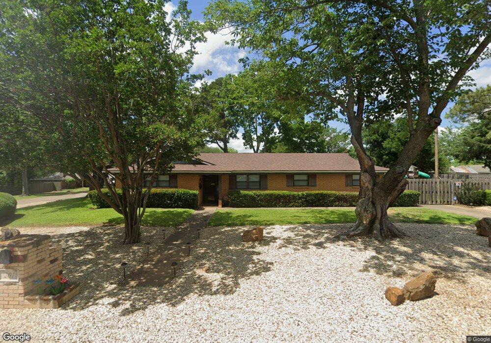
201 Lone Star St Joshua, TX 76058
Estimated Value: $268,000 - $304,000
3
Beds
2
Baths
1,756
Sq Ft
$161/Sq Ft
Est. Value
About This Home
This home is located at 201 Lone Star St, Joshua, TX 76058 and is currently estimated at $283,548, approximately $161 per square foot. 201 Lone Star St is a home located in Johnson County with nearby schools including A.G. Elder Elementary School, Joshua High School, and Joshua High School - 9th Grade Campus.
Ownership History
Date
Name
Owned For
Owner Type
Purchase Details
Closed on
Jan 16, 2009
Sold by
Pepka Victor L and Pepka Janice A
Bought by
Pierce Shari
Current Estimated Value
Home Financials for this Owner
Home Financials are based on the most recent Mortgage that was taken out on this home.
Original Mortgage
$124,325
Outstanding Balance
$78,542
Interest Rate
5.17%
Mortgage Type
FHA
Estimated Equity
$205,006
Create a Home Valuation Report for This Property
The Home Valuation Report is an in-depth analysis detailing your home's value as well as a comparison with similar homes in the area
Home Values in the Area
Average Home Value in this Area
Purchase History
| Date | Buyer | Sale Price | Title Company |
|---|---|---|---|
| Pierce Shari | -- | Fnt |
Source: Public Records
Mortgage History
| Date | Status | Borrower | Loan Amount |
|---|---|---|---|
| Open | Pierce Shari | $124,325 |
Source: Public Records
Tax History Compared to Growth
Tax History
| Year | Tax Paid | Tax Assessment Tax Assessment Total Assessment is a certain percentage of the fair market value that is determined by local assessors to be the total taxable value of land and additions on the property. | Land | Improvement |
|---|---|---|---|---|
| 2025 | $3,953 | $252,524 | $40,000 | $212,524 |
| 2024 | $5,413 | $222,416 | $0 | $0 |
| 2023 | $2,626 | $218,840 | $40,000 | $178,840 |
| 2022 | $3,948 | $167,743 | $40,000 | $127,743 |
| 2021 | $3,621 | $148,949 | $25,000 | $123,949 |
| 2020 | $3,561 | $148,949 | $25,000 | $123,949 |
| 2019 | $3,401 | $148,949 | $25,000 | $123,949 |
| 2018 | $3,178 | $107,483 | $25,000 | $82,483 |
| 2017 | $3,176 | $107,483 | $25,000 | $82,483 |
| 2016 | $3,592 | $121,559 | $15,000 | $106,559 |
| 2015 | $3,040 | $121,559 | $15,000 | $106,559 |
| 2014 | $3,040 | $121,559 | $15,000 | $106,559 |
Source: Public Records
Map
Nearby Homes
- 312 Comanche Walk
- 304 Comanche Walk
- 414 Dakota Dr
- 527 Lone Star St
- 200 Wayside St
- 520 Palo Duro Dr
- 108 Sally St
- 608 W Sheila Cir
- 107 E 10th St
- 613 W Sheila Cir
- 209 E 8th St
- 628 E Sheila Cir
- 205 Greenhill Dr
- 629 E Sheila Cir
- 102 Carlock St
- 401 Eddy Ave
- 500 N Main St
- 307 Gregory St
- 601 Eddy Ave
- 408 Eddy Ave
- 109 Murray St
- 200 Lone Star St
- 103 Lone Star St
- 104 Lone Star St
- 208 Thomas St
- 202 Lone Star St
- 108 Murray St
- 107 Murray St
- 102 Lone Star St
- 204 Lone Star St
- 106 Murray St
- 101 Lone Star St
- 215 Thomas St
- 105 Murray St
- 213 Thomas St
- 206 Lone Star St
- 204 Thomas St
- 211 Thomas St
- 104 Murray St
- 208 Lone Star St