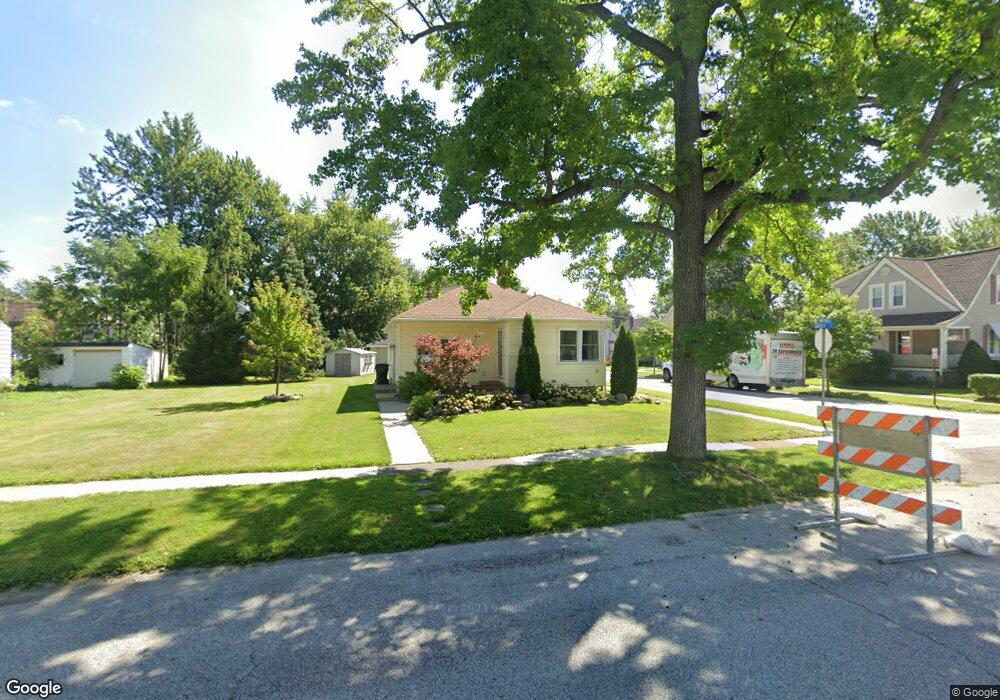
201 Longford Ave Elyria, OH 44035
Estimated Value: $122,048 - $153,000
2
Beds
1
Bath
1,016
Sq Ft
$138/Sq Ft
Est. Value
About This Home
This home is located at 201 Longford Ave, Elyria, OH 44035 and is currently estimated at $140,012, approximately $137 per square foot. 201 Longford Ave is a home located in Lorain County with nearby schools including Ely Elementary School, Northwood Middle School, and Elyria High School.
Ownership History
Date
Name
Owned For
Owner Type
Purchase Details
Closed on
Feb 25, 2000
Sold by
Dowdell Theodore P Trustee
Bought by
Hayes Wayne A and Hayes Joyce
Current Estimated Value
Home Financials for this Owner
Home Financials are based on the most recent Mortgage that was taken out on this home.
Original Mortgage
$73,395
Interest Rate
8.3%
Mortgage Type
FHA
Purchase Details
Closed on
Jun 17, 1998
Sold by
Dowdell Theodore P and Dowdell Bonnie J
Bought by
Dowdell Bonnie J and The Bonnie J Dowdell Trust
Create a Home Valuation Report for This Property
The Home Valuation Report is an in-depth analysis detailing your home's value as well as a comparison with similar homes in the area
Home Values in the Area
Average Home Value in this Area
Purchase History
| Date | Buyer | Sale Price | Title Company |
|---|---|---|---|
| Hayes Wayne A | $74,000 | Midland Title | |
| Dowdell Bonnie J | -- | -- |
Source: Public Records
Mortgage History
| Date | Status | Borrower | Loan Amount |
|---|---|---|---|
| Closed | Hayes Wayne A | $73,395 |
Source: Public Records
Tax History
| Year | Tax Paid | Tax Assessment Tax Assessment Total Assessment is a certain percentage of the fair market value that is determined by local assessors to be the total taxable value of land and additions on the property. | Land | Improvement |
|---|---|---|---|---|
| 2024 | $1,906 | $39,316 | $9,321 | $29,995 |
| 2023 | $1,696 | $30,230 | $6,629 | $23,601 |
| 2022 | $1,682 | $30,230 | $6,629 | $23,601 |
| 2021 | $1,686 | $30,230 | $6,630 | $23,600 |
| 2020 | $1,584 | $24,740 | $5,430 | $19,310 |
| 2019 | $1,542 | $24,740 | $5,430 | $19,310 |
| 2018 | $1,557 | $24,740 | $5,430 | $19,310 |
| 2017 | $1,569 | $24,090 | $5,470 | $18,620 |
| 2016 | $1,549 | $24,090 | $5,470 | $18,620 |
| 2015 | $1,454 | $24,090 | $5,470 | $18,620 |
| 2014 | $1,463 | $24,540 | $5,570 | $18,970 |
| 2013 | $1,451 | $24,540 | $5,570 | $18,970 |
Source: Public Records
Map
Nearby Homes
- 120 Longford Ave
- 127 Beebe Ave
- 147 Bellfield Ave
- 249 Roosevelt Ave
- 144 Roosevelt Ave
- 164 Woodbury St
- 235 Brandtson Ave
- 147 Hamilton St
- 463 Poplar St
- 137 Lafayette St
- 171 S Logan St
- 513 Gulf Rd
- 805 Clark St
- 409 Wesley Ave
- 442 Hilliard Rd
- 113 Coronado Ct
- 118 Brandemere Ct
- 362 Hamilton Cir
- 347 Ohio St
- 209 Clark St
- 207 Longford Ave
- 211 Longford Ave
- 217 Longford Ave
- 204 Marseilles Ave
- 143 Longford Ave
- 200 Marseilles Ave
- 208 Marseilles Ave
- 210 Marseilles Ave
- 139 Longford Ave
- 212 Marseilles Ave
- 144 Marseilles Ave
- 202 Longford Ave
- 208 Longford Ave
- 200 Longford Ave
- 223 Longford Ave
- 210 Longford Ave
- 216 Marseilles Ave
- 137 Longford Ave
- 214 Longford Ave
Your Personal Tour Guide
Ask me questions while you tour the home.