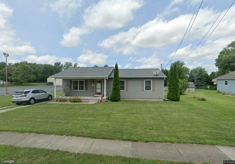
201 Maple St Bellevue, OH 44811
Estimated Value: $142,000 - $174,004
3
Beds
1
Bath
1,196
Sq Ft
$138/Sq Ft
Est. Value
About This Home
This home is located at 201 Maple St, Bellevue, OH 44811 and is currently estimated at $164,501, approximately $137 per square foot. 201 Maple St is a home with nearby schools including Bellevue Elementary School, Bellevue Middle School, and Bellevue High School.
Ownership History
Date
Name
Owned For
Owner Type
Purchase Details
Closed on
Dec 18, 2013
Sold by
Firelands Habitat For Humanity Inc
Bought by
Cruse Lauren
Current Estimated Value
Home Financials for this Owner
Home Financials are based on the most recent Mortgage that was taken out on this home.
Original Mortgage
$92,725
Outstanding Balance
$69,196
Interest Rate
4.17%
Mortgage Type
Seller Take Back
Estimated Equity
$95,305
Create a Home Valuation Report for This Property
The Home Valuation Report is an in-depth analysis detailing your home's value as well as a comparison with similar homes in the area
Home Values in the Area
Average Home Value in this Area
Purchase History
| Date | Buyer | Sale Price | Title Company |
|---|---|---|---|
| Cruse Lauren | $92,800 | Attorney |
Source: Public Records
Mortgage History
| Date | Status | Borrower | Loan Amount |
|---|---|---|---|
| Open | Cruse Lauren | $92,725 |
Source: Public Records
Tax History Compared to Growth
Tax History
| Year | Tax Paid | Tax Assessment Tax Assessment Total Assessment is a certain percentage of the fair market value that is determined by local assessors to be the total taxable value of land and additions on the property. | Land | Improvement |
|---|---|---|---|---|
| 2024 | $2,084 | $48,730 | $10,050 | $38,680 |
| 2023 | $2,084 | $38,680 | $7,980 | $30,700 |
| 2022 | $1,770 | $38,680 | $7,980 | $30,700 |
| 2021 | $1,784 | $38,680 | $7,980 | $30,700 |
| 2020 | $1,589 | $32,550 | $7,980 | $24,570 |
| 2019 | $1,570 | $32,550 | $7,980 | $24,570 |
| 2018 | $1,520 | $32,550 | $7,980 | $24,570 |
| 2017 | $1,462 | $30,310 | $7,980 | $22,330 |
| 2016 | $1,414 | $30,310 | $7,980 | $22,330 |
| 2015 | $1,425 | $30,310 | $7,980 | $22,330 |
| 2014 | $1,610 | $32,770 | $7,740 | $25,030 |
| 2013 | $390 | $7,740 | $7,740 | $0 |
Source: Public Records
Map
Nearby Homes
- 408 W Main St
- 126 Greenwood Heights
- 0 Oakwood Dr
- 155 Ashford Ave
- 0 County Road 308
- 311 N Sandusky St
- 111 Flat Rock Rd Unit 34
- 206 Southwest St
- 510 Kilbourne St
- 630 Gardner St
- 303 Moore Ave
- 808 Castalia St
- 124 Sunset Dr
- 308 E Center St
- 720 Kilbourne St
- 1085 W Main St
- 0 St Rt 4 - B
- 0 Hartland Dr
- 817 E Main St
- 881 Flat Rock Rd