Estimated Value: $744,386 - $793,000
5
Beds
4
Baths
2,841
Sq Ft
$273/Sq Ft
Est. Value
About This Home
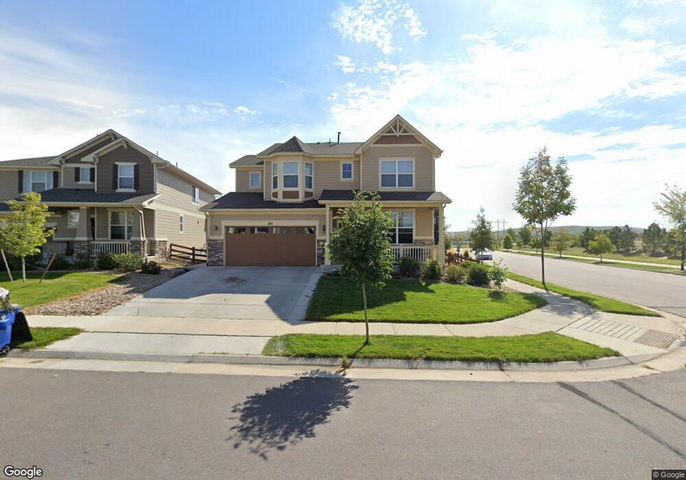
This home is located at 201 Maxwell Cir, Erie, CO 80516 and is currently estimated at $775,847, approximately $273 per square foot. 201 Maxwell Cir is a home with nearby schools including Red Hawk Elementary School, Erie Middle School, and Erie High School.
Ownership History
Date
Name
Owned For
Owner Type
Purchase Details
Closed on
Jul 16, 2013
Sold by
Meritage Homes Of Colorado
Bought by
Gerber Larry A and Gerber Patrice R
Current Estimated Value
Home Financials for this Owner
Home Financials are based on the most recent Mortgage that was taken out on this home.
Original Mortgage
$314,916
Outstanding Balance
$229,184
Interest Rate
3.94%
Mortgage Type
VA
Estimated Equity
$546,663
Create a Home Valuation Report for This Property
The Home Valuation Report is an in-depth analysis detailing your home's value as well as a comparison with similar homes in the area
Home Values in the Area
Average Home Value in this Area
Purchase History
| Date | Buyer | Sale Price | Title Company |
|---|---|---|---|
| Gerber Larry A | $368,240 | None Available |
Source: Public Records
Mortgage History
| Date | Status | Borrower | Loan Amount |
|---|---|---|---|
| Open | Gerber Larry A | $314,916 |
Source: Public Records
Tax History Compared to Growth
Tax History
| Year | Tax Paid | Tax Assessment Tax Assessment Total Assessment is a certain percentage of the fair market value that is determined by local assessors to be the total taxable value of land and additions on the property. | Land | Improvement |
|---|---|---|---|---|
| 2025 | $8,108 | $45,810 | $8,750 | $37,060 |
| 2024 | $8,108 | $45,810 | $8,750 | $37,060 |
| 2023 | $7,894 | $51,440 | $10,420 | $41,020 |
| 2022 | $6,122 | $37,110 | $7,160 | $29,950 |
| 2021 | $6,210 | $38,180 | $7,360 | $30,820 |
| 2020 | $6,032 | $37,270 | $5,430 | $31,840 |
| 2019 | $6,069 | $37,270 | $5,430 | $31,840 |
| 2018 | $5,643 | $34,770 | $4,540 | $30,230 |
| 2017 | $5,714 | $34,770 | $4,540 | $30,230 |
| 2016 | $4,999 | $32,190 | $4,780 | $27,410 |
| 2015 | $4,898 | $32,190 | $4,780 | $27,410 |
| 2014 | $4,129 | $10,820 | $10,820 | $0 |
Source: Public Records
Map
Nearby Homes
- 110 Ferris Ln
- 173 Ambrose St
- 132 Ambrose St
- 195 Briggs St
- 555 Gallegos Cir
- 111 Ambrose St
- 270 Holbrook St
- 420 Anderson St
- 410 Anderson St
- 0 High St Unit REC9712912
- 626 Gallegos St
- 365 Briggs St
- 0 Holbrook St
- 250 Holbrook St
- 370 Lawley Dr
- 122 Jackson Dr
- 448 Biscuit St
- 448 Biscuit St Unit 1-23
- 350 Montgomery Dr
- 93 Jackson Ln
- 199 Maxwell Cir
- 197 Maxwell Cir
- 170 Westwood Way
- 180 Westwood Way
- 160 Westwood Way
- 202 Maxwell Cir
- 200 Maxwell Cir
- 195 Maxwell Cir
- 150 Westwood Way
- 198 Maxwell Cir
- 140 Westwood Way
- 196 Maxwell Cir
- 193 Maxwell Cir
- 130 Westwood Way
- 171 Westwood Way
- 191 Maxwell Cir
- 181 Westwood Way
- 194 Maxwell Cir
- 161 Westwood Way
- 191 Westwood Way