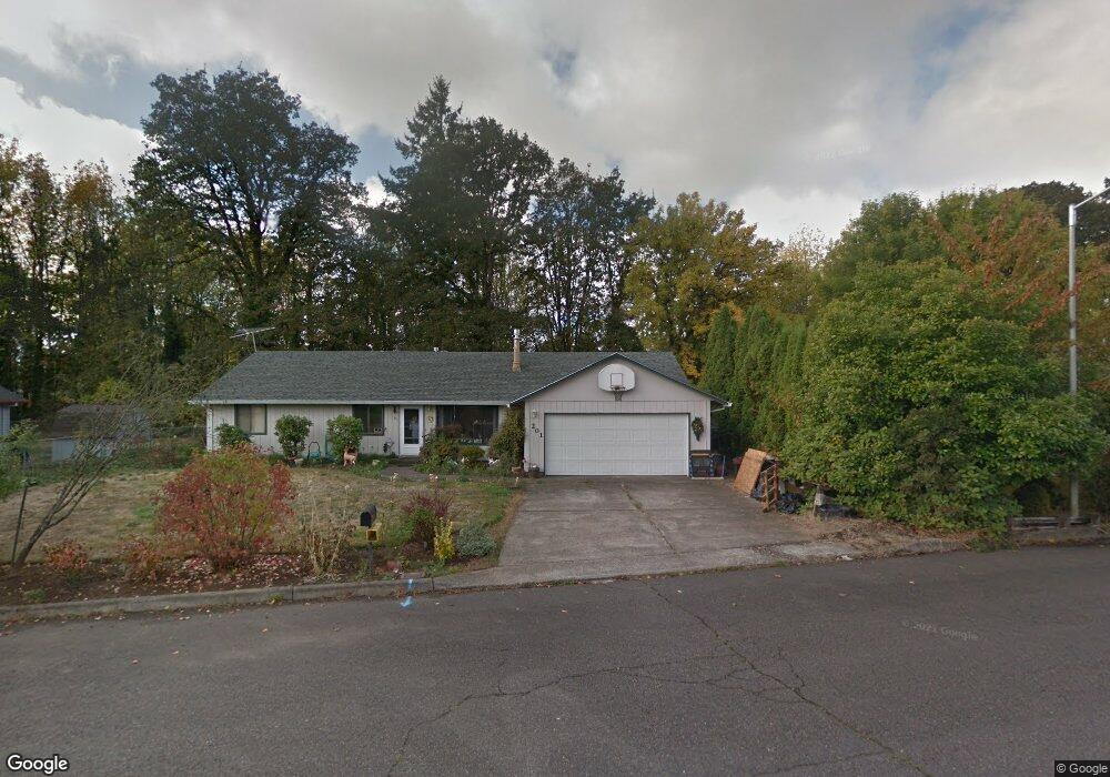
201 Mayfair Dr Unit 1 Saint Helens, OR 97051
Estimated Value: $331,000 - $432,000
3
Beds
2
Baths
1,552
Sq Ft
$254/Sq Ft
Est. Value
About This Home
This home is located at 201 Mayfair Dr Unit 1, Saint Helens, OR 97051 and is currently estimated at $393,689, approximately $253 per square foot. 201 Mayfair Dr Unit 1 is a home located in Columbia County with nearby schools including St. Helens High School and St. Helens Arthur Academy.
Ownership History
Date
Name
Owned For
Owner Type
Purchase Details
Closed on
Apr 22, 2024
Sold by
Harlan Michael A and Harlan Carmen L
Bought by
Brown Ryen Benjamin Jam and Mcguire-Brown Ravyn Nicole
Current Estimated Value
Home Financials for this Owner
Home Financials are based on the most recent Mortgage that was taken out on this home.
Original Mortgage
$339,500
Outstanding Balance
$334,291
Interest Rate
6.74%
Mortgage Type
New Conventional
Estimated Equity
$59,398
Purchase Details
Closed on
Mar 2, 2017
Sold by
Jenkerson Mary
Bought by
Harlan Michael A and Harlan Carmen L
Home Financials for this Owner
Home Financials are based on the most recent Mortgage that was taken out on this home.
Original Mortgage
$247,828
Interest Rate
4.25%
Mortgage Type
FHA
Purchase Details
Closed on
Jul 13, 2010
Sold by
Amyette Alice Irene
Bought by
Jenkerson Norman and Jenkerson Mary
Create a Home Valuation Report for This Property
The Home Valuation Report is an in-depth analysis detailing your home's value as well as a comparison with similar homes in the area
Home Values in the Area
Average Home Value in this Area
Purchase History
| Date | Buyer | Sale Price | Title Company |
|---|---|---|---|
| Brown Ryen Benjamin Jam | $350,000 | Ticor Title | |
| Harlan Michael A | $252,400 | Ticor Title Company Of Or | |
| Jenkerson Norman | -- | None Available |
Source: Public Records
Mortgage History
| Date | Status | Borrower | Loan Amount |
|---|---|---|---|
| Open | Brown Ryen Benjamin Jam | $339,500 | |
| Previous Owner | Harlan Michael A | $247,828 |
Source: Public Records
Tax History Compared to Growth
Tax History
| Year | Tax Paid | Tax Assessment Tax Assessment Total Assessment is a certain percentage of the fair market value that is determined by local assessors to be the total taxable value of land and additions on the property. | Land | Improvement |
|---|---|---|---|---|
| 2024 | $3,329 | $207,780 | $75,210 | $132,570 |
| 2023 | $3,278 | $201,730 | $71,200 | $130,530 |
| 2022 | $3,144 | $195,860 | $69,130 | $126,730 |
| 2021 | $2,871 | $190,160 | $72,770 | $117,390 |
| 2020 | $2,775 | $184,630 | $63,170 | $121,460 |
| 2019 | $2,731 | $179,260 | $60,720 | $118,540 |
| 2018 | $2,648 | $174,040 | $73,530 | $100,510 |
| 2017 | $2,573 | $168,980 | $71,390 | $97,590 |
| 2016 | $2,535 | $164,060 | $69,310 | $94,750 |
| 2015 | $2,387 | $159,290 | $59,940 | $99,350 |
| 2014 | $2,406 | $154,660 | $51,530 | $103,130 |
Source: Public Records
Map
Nearby Homes
- 221 Allendale Dr
- 103 Oakwood Dr
- 251 Allendale Dr
- 169 Macarthur St
- 255 Macarthur St
- 59893 Ethan Ln
- 169 N Vernonia Rd
- 35505 Iris Way
- 59941 Windy Ridge Dr
- 59945 Sunrise Dr
- 59284 Cherrywood Dr
- 0 Seal Ln Unit 24455005
- 35946 Pittsburg Rd
- 114 Pine St
- 35092 Pittsburg Rd
- 175 Kindre St
- 35130 Roberts Ln
- 35530 Portland View Dr
- 35551 Portland View Dr
- 35601 Valley View Dr
- 201 Mayfair Dr
- 211 Mayfair Dr
- 151 Mayfair Dr
- 221 Mayfair Dr
- 200 Sherwood Dr
- 175 Sherwood Dr
- 141 Mayfair Dr
- 210 Mayfair Dr
- 231 Mayfair Dr
- 140 Mayfair Dr
- 194 Sherwood Dr
- 151 Oakwood Dr
- 131 Mayfair Dr
- 141 Oakwood Dr
- 220 Mayfair Dr
- 240 Mayfair Dr
- 230 Mayfair Dr
- 34200 Sherwood Dr
- 130 Ivy Ln
- 250 Mayfair Dr