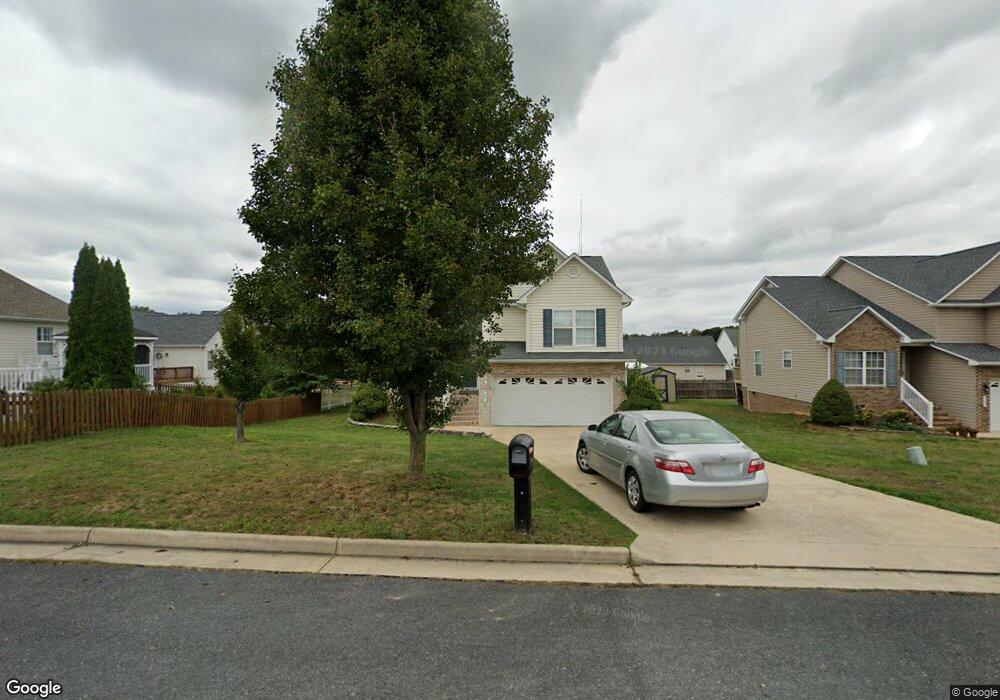
201 Mayfield Ln Waynesboro, VA 22980
Estimated Value: $343,000 - $372,501
3
Beds
3
Baths
1,750
Sq Ft
$203/Sq Ft
Est. Value
About This Home
This home is located at 201 Mayfield Ln, Waynesboro, VA 22980 and is currently estimated at $354,875, approximately $202 per square foot. 201 Mayfield Ln is a home located in Waynesboro City with nearby schools including William Perry Elementary School, Kate Collins Middle School, and Waynesboro High School.
Ownership History
Date
Name
Owned For
Owner Type
Purchase Details
Closed on
Aug 2, 2013
Sold by
Secretary Of Veteran Affairs
Bought by
Allen Coty
Current Estimated Value
Home Financials for this Owner
Home Financials are based on the most recent Mortgage that was taken out on this home.
Original Mortgage
$160,000
Outstanding Balance
$116,866
Interest Rate
3.95%
Mortgage Type
New Conventional
Estimated Equity
$238,009
Purchase Details
Closed on
Mar 1, 2013
Sold by
Glasser And Glasser Plc Sub Tr and Smith Tony R
Bought by
Secretary Of Veterans Affairs
Create a Home Valuation Report for This Property
The Home Valuation Report is an in-depth analysis detailing your home's value as well as a comparison with similar homes in the area
Home Values in the Area
Average Home Value in this Area
Purchase History
| Date | Buyer | Sale Price | Title Company |
|---|---|---|---|
| Allen Coty | $157,000 | -- | |
| Secretary Of Veterans Affairs | $148,059 | -- |
Source: Public Records
Mortgage History
| Date | Status | Borrower | Loan Amount |
|---|---|---|---|
| Open | Secretary Of Veterans Affairs | $160,000 |
Source: Public Records
Tax History Compared to Growth
Tax History
| Year | Tax Paid | Tax Assessment Tax Assessment Total Assessment is a certain percentage of the fair market value that is determined by local assessors to be the total taxable value of land and additions on the property. | Land | Improvement |
|---|---|---|---|---|
| 2025 | $2,691 | $328,200 | $58,500 | $269,700 |
| 2024 | $2,360 | $306,500 | $55,000 | $251,500 |
| 2023 | $2,360 | $306,500 | $55,000 | $251,500 |
| 2022 | $2,091 | $232,300 | $45,000 | $187,300 |
| 2021 | $2,091 | $232,300 | $45,000 | $187,300 |
| 2020 | $1,827 | $203,000 | $45,000 | $158,000 |
| 2019 | $1,827 | $203,000 | $45,000 | $158,000 |
| 2018 | $1,634 | $181,500 | $45,000 | $136,500 |
| 2017 | $1,579 | $181,500 | $45,000 | $136,500 |
| 2016 | $1,339 | $167,400 | $41,000 | $126,400 |
| 2015 | $1,339 | $167,400 | $41,000 | $126,400 |
| 2014 | -- | $169,000 | $41,000 | $128,000 |
| 2013 | -- | $0 | $0 | $0 |
Source: Public Records
Map
Nearby Homes
- 340 Kingsport Rd
- 200 Bedford Rd
- 1905 Monroe St
- 177 Tomasville Dr
- 7 White Birch Rd
- 112 Kings Ct
- 9 White Birch Rd
- 1073 Pendleton Dr
- 5 White Birch Rd
- 2404 Village Dr
- 656 Edwardian Ln
- 504 Rosewood Ct
- 113 Ana Marie Blvd
- 233 Camden Dr
- 241 Camden Dr
- 237 Camden Dr
- 108 Ana Marie Blvd
- 505 Pelham Dr
- 208 Claybrook Dr
- 1637 Mulberry St
- 205 Mayfield Ln
- 2401 Monroe St
- 200 Inglecress Rd
- 209 Mayfield Ln
- 204 Inglecress Rd
- 2405 Monroe St
- 2409 Monroe St
- 2413 Monroe St
- 2329 Monroe St
- 200 Mayfield Ln
- 208 Inglecress Rd
- 204 Mayfield Ln
- 213 Mayfield Ln
- 208 Mayfield Ln
- 212 Inglecress Rd
- 2325 Monroe St
- 2408 Monroe St
- 217 Mayfield Ln
- 216 Inglecress Rd
- 2404 Monroe St