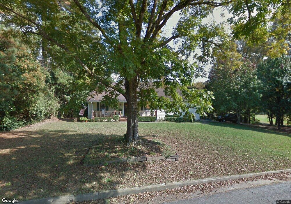
201 Mcelroy St Bowdon, GA 30108
Estimated Value: $206,000 - $276,000
3
Beds
2
Baths
1,610
Sq Ft
$147/Sq Ft
Est. Value
About This Home
This home is located at 201 Mcelroy St, Bowdon, GA 30108 and is currently estimated at $237,056, approximately $147 per square foot. 201 Mcelroy St is a home located in Carroll County with nearby schools including Bowdon Elementary School, Bowdon Middle School, and Bowdon High School.
Ownership History
Date
Name
Owned For
Owner Type
Purchase Details
Closed on
Nov 19, 2007
Sold by
Not Provided
Bought by
Davidson Thomas and Davidson Francis
Current Estimated Value
Purchase Details
Closed on
Mar 30, 2001
Sold by
Mclendon Charles M
Bought by
Davidson Thomas and Davidson Fr
Purchase Details
Closed on
Mar 1, 2001
Sold by
Mclendon
Bought by
Davidson Thomas and Davidson Fr
Purchase Details
Closed on
Mar 17, 1994
Sold by
Rogers Danny
Bought by
Mclendon
Purchase Details
Closed on
Mar 26, 1991
Bought by
Rogers Danny
Create a Home Valuation Report for This Property
The Home Valuation Report is an in-depth analysis detailing your home's value as well as a comparison with similar homes in the area
Home Values in the Area
Average Home Value in this Area
Purchase History
| Date | Buyer | Sale Price | Title Company |
|---|---|---|---|
| Davidson Thomas | -- | -- | |
| Davidson Thomas | $82,400 | -- | |
| Davidson Thomas | $82,400 | -- | |
| Mclendon | $58,000 | -- | |
| Rogers Danny | $3,500 | -- |
Source: Public Records
Tax History
| Year | Tax Paid | Tax Assessment Tax Assessment Total Assessment is a certain percentage of the fair market value that is determined by local assessors to be the total taxable value of land and additions on the property. | Land | Improvement |
|---|---|---|---|---|
| 2025 | $584 | $74,242 | $7,339 | $66,903 |
| 2024 | $595 | $74,242 | $7,339 | $66,903 |
| 2023 | $595 | $68,149 | $7,339 | $60,810 |
| 2022 | $580 | $60,358 | $4,900 | $55,458 |
| 2021 | $533 | $51,115 | $3,629 | $47,486 |
| 2020 | $499 | $45,507 | $3,629 | $41,878 |
| 2019 | $487 | $42,082 | $3,629 | $38,453 |
| 2018 | $461 | $36,482 | $3,629 | $32,853 |
| 2017 | $463 | $36,482 | $3,629 | $32,853 |
| 2016 | $515 | $36,482 | $3,629 | $32,853 |
| 2015 | $480 | $32,210 | $5,059 | $27,151 |
| 2014 | $484 | $32,210 | $5,059 | $27,151 |
Source: Public Records
Map
Nearby Homes
- 310 W College St
- 313 Ellenwood Dr
- 101 Winding Road - Lot 1a & 1b & Lot 2
- 110 Bevis Cir
- 414 Wedowee St
- 0 Hwy 100 Unit LotWP001 24911780
- 0 Hwy 100 Unit 10541558
- 627 Wedowee St
- 255 Eason St Unit 10
- 255 Eason St
- 263 Eason St Unit 12
- 263 Eason St
- 309 Angela Ave
- 309 Angela Ave Unit 6
- 301 Angela Ave Unit 8
- 301 Angela Ave
- 267 Eason St
- 267 Eason St Unit 13
- 0 Magnolia St Unit 7657311
- 0 Magnolia St Unit 10614572
- 197 McElroy Mountain Dr
- 197 Mcelroy St
- 215 McElroy Mountain Dr
- 215 Mcelroy St
- 401 Mitchell Ave
- 124 Mcelroy St
- 119 Mcelroy St
- 213 Mcelroy St
- 118 Mcelroy St
- 414 Mitchell Ave
- 117 Oak St
- 115 Oak St
- 111 Oak St
- 335 W College St
- 107 McElroy Mountain Dr
- 107 Mcelroy St
- 109 Oak St
- 106 McElroy Mountain Dr
- 260 Watts Rd
- 281 McElroy Mountain Dr
Your Personal Tour Guide
Ask me questions while you tour the home.