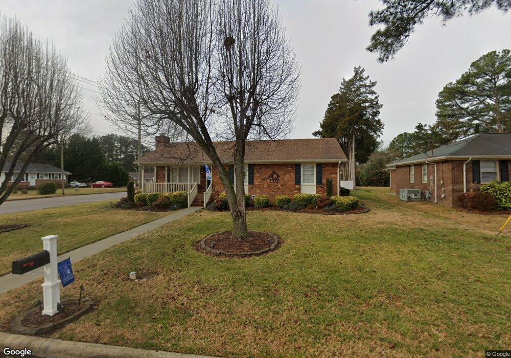
201 Moreland Dr Oxford, NC 27565
Estimated Value: $190,000 - $236,000
3
Beds
2
Baths
1,302
Sq Ft
$171/Sq Ft
Est. Value
About This Home
This home is located at 201 Moreland Dr, Oxford, NC 27565 and is currently estimated at $222,629, approximately $170 per square foot. 201 Moreland Dr is a home located in Granville County with nearby schools including West Oxford Elementary School, Northern Granville Middle School, and J.F. Webb High School.
Ownership History
Date
Name
Owned For
Owner Type
Purchase Details
Closed on
Feb 26, 2020
Sold by
Cox Nancy J
Bought by
Cox Charles Michael
Current Estimated Value
Home Financials for this Owner
Home Financials are based on the most recent Mortgage that was taken out on this home.
Original Mortgage
$100,000
Outstanding Balance
$88,731
Interest Rate
3.6%
Mortgage Type
New Conventional
Estimated Equity
$133,898
Purchase Details
Closed on
Nov 1, 2006
Sold by
Nelms Samuel Douglas and Harper Lisa
Bought by
Cox Nancy J
Create a Home Valuation Report for This Property
The Home Valuation Report is an in-depth analysis detailing your home's value as well as a comparison with similar homes in the area
Home Values in the Area
Average Home Value in this Area
Purchase History
| Date | Buyer | Sale Price | Title Company |
|---|---|---|---|
| Cox Charles Michael | $110,000 | None Available | |
| Cox Nancy J | $109,000 | -- |
Source: Public Records
Mortgage History
| Date | Status | Borrower | Loan Amount |
|---|---|---|---|
| Open | Cox Charles Michael | $100,000 |
Source: Public Records
Tax History Compared to Growth
Tax History
| Year | Tax Paid | Tax Assessment Tax Assessment Total Assessment is a certain percentage of the fair market value that is determined by local assessors to be the total taxable value of land and additions on the property. | Land | Improvement |
|---|---|---|---|---|
| 2025 | $1,611 | $135,646 | $37,000 | $98,646 |
| 2024 | $1,611 | $135,646 | $37,000 | $98,646 |
| 2023 | $1,609 | $99,758 | $25,000 | $74,758 |
| 2022 | $1,501 | $99,758 | $25,000 | $74,758 |
| 2021 | $1,496 | $99,758 | $25,000 | $74,758 |
| 2020 | $1,496 | $99,758 | $25,000 | $74,758 |
| 2019 | $1,496 | $99,758 | $25,000 | $74,758 |
| 2018 | $1,496 | $99,758 | $25,000 | $74,758 |
| 2016 | $1,581 | $102,708 | $25,000 | $77,708 |
| 2015 | $1,525 | $102,708 | $25,000 | $77,708 |
| 2014 | $1,525 | $102,708 | $25,000 | $77,708 |
| 2013 | -- | $102,708 | $25,000 | $77,708 |
Source: Public Records
Map
Nearby Homes
- 201 Mooreland Dr
- 203 Moreland Dr
- 200 Mooreland Dr Unit b
- 205 Mooreland Dr
- 205 Moreland Dr
- 803 Sunset Ave
- 801 Sunset Ave
- 200 Moreland Dr Unit 200A
- 200 Moreland Dr Unit b
- 404 N Country Club Dr
- 402 N Country Club Dr
- 805-807 Sunset Ave
- 404 N Country Club Dr
- 207 Moreland Dr
- 207 Mooreland Dr
- 114 Moreland Dr
- 202 Moreland Dr
- 310 N Country Club Dr
- 406 N Country Club Dr
- 702 Sunset Ave