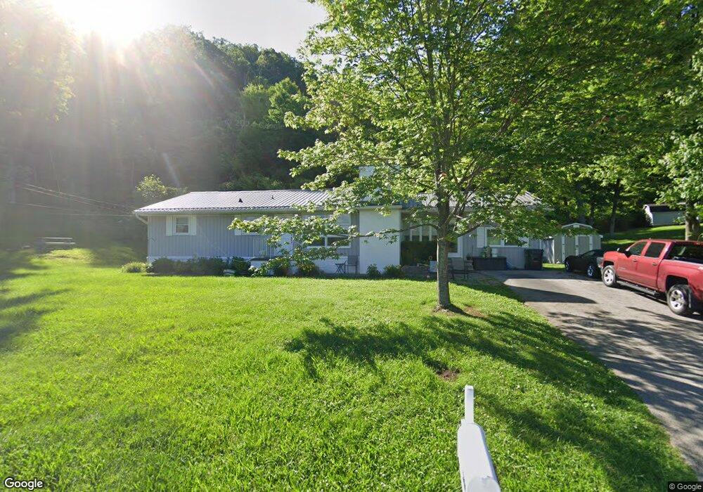
201 Mountain View Dr Bristol, TN 37620
Estimated Value: $293,000 - $358,000
4
Beds
3
Baths
2,324
Sq Ft
$140/Sq Ft
Est. Value
About This Home
This home is located at 201 Mountain View Dr, Bristol, TN 37620 and is currently estimated at $324,549, approximately $139 per square foot. 201 Mountain View Dr is a home located in Sullivan County with nearby schools including Avoca Elementary School, Vance Middle School, and Tennessee High School.
Ownership History
Date
Name
Owned For
Owner Type
Purchase Details
Closed on
Nov 15, 1999
Sold by
First Union National Bank
Bought by
Cheryl Seaman
Current Estimated Value
Purchase Details
Closed on
Aug 19, 1999
Purchase Details
Closed on
Oct 31, 1996
Sold by
Lee May Kenneth
Bought by
Anthony Shockley
Home Financials for this Owner
Home Financials are based on the most recent Mortgage that was taken out on this home.
Original Mortgage
$87,321
Interest Rate
8.02%
Purchase Details
Closed on
Dec 12, 1989
Create a Home Valuation Report for This Property
The Home Valuation Report is an in-depth analysis detailing your home's value as well as a comparison with similar homes in the area
Purchase History
| Date | Buyer | Sale Price | Title Company |
|---|---|---|---|
| Cheryl Seaman | $85,000 | -- | |
| -- | $88,700 | -- | |
| Anthony Shockley | $93,500 | -- | |
| -- | $51,000 | -- |
Source: Public Records
Mortgage History
| Date | Status | Borrower | Loan Amount |
|---|---|---|---|
| Previous Owner | -- | $87,321 |
Source: Public Records
Tax History
| Year | Tax Paid | Tax Assessment Tax Assessment Total Assessment is a certain percentage of the fair market value that is determined by local assessors to be the total taxable value of land and additions on the property. | Land | Improvement |
|---|---|---|---|---|
| 2025 | -- | $68,350 | $6,275 | $62,075 |
| 2024 | -- | $36,225 | $5,175 | $31,050 |
| 2023 | $1,592 | $36,225 | $5,175 | $31,050 |
| 2022 | $1,592 | $36,225 | $5,175 | $31,050 |
| 2021 | $1,591 | $36,225 | $5,175 | $31,050 |
| 2020 | $906 | $36,225 | $5,175 | $31,050 |
| 2019 | $1,668 | $35,250 | $5,175 | $30,075 |
| 2018 | $1,661 | $35,250 | $5,175 | $30,075 |
| 2017 | $1,661 | $35,250 | $5,175 | $30,075 |
| 2016 | $1,696 | $35,150 | $5,200 | $29,950 |
| 2014 | $1,602 | $35,162 | $0 | $0 |
Source: Public Records
Map
Nearby Homes
- 312 Sunnybrook Dr
- 105 Houston St
- 513 San Antonio Dr
- 200 Fairacres Dr
- 18 Ross St
- 3253 Avoca Rd
- 3257 Avoca Rd
- 555 Hickory Rd
- 100 Richmond Heights Rd
- 521 Hickory Rd
- 508 Hickory Rd
- 1026 Deer Harbour Rd
- 210 Hemlock Rd
- Tbd Volunteer Pkwy
- 1120 Barber Rd
- 2420 Volunteer Pkwy Unit 1
- 400 Martindale Rd
- 302 Martindale Rd
- 2118 King College Rd
- Tbd Barber Rd
- 205 Mountain View Dr
- 200 Mountain View Dr
- Lot 13 Mountain View Dr
- 535 Mountain View Dr
- 0 Mountain View Dr
- 403 Orchard Dr
- 204 Mountain View Dr
- 217 Mountain View Dr
- 216 Mountain View Dr
- 205 Santa fe Dr
- 401 Orchard Dr
- 224 Mountain View Rd
- 224 Mountain View Dr
- 125 Santa fe Dr
- 217 Santa fe Dr
- 200 Santa fe Dr
- 305 Santa fe Dr
- 317 Sunnybrook Dr Unit 1
- 117 Santa fe Dr
- 313 Orchard Dr
Your Personal Tour Guide
Ask me questions while you tour the home.