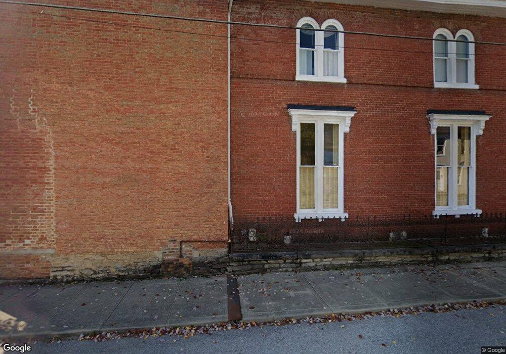
201 N 2nd St Ripley, OH 45167
Estimated Value: $307,801 - $477,000
6
Beds
3
Baths
4,312
Sq Ft
$92/Sq Ft
Est. Value
About This Home
This home is located at 201 N 2nd St, Ripley, OH 45167 and is currently estimated at $394,950, approximately $91 per square foot. 201 N 2nd St is a home located in Brown County with nearby schools including Ripley Union Lewis Huntington Elementary School, Ripley Union Lewis Huntington Middle School, and Ripley-Union-Lewis-Huntington High School.
Ownership History
Date
Name
Owned For
Owner Type
Purchase Details
Closed on
May 31, 2017
Sold by
Ross Linda A
Bought by
Bradshaw Brandon G
Current Estimated Value
Home Financials for this Owner
Home Financials are based on the most recent Mortgage that was taken out on this home.
Original Mortgage
$207,100
Outstanding Balance
$171,933
Interest Rate
3.95%
Mortgage Type
New Conventional
Estimated Equity
$223,017
Purchase Details
Closed on
Sep 21, 2007
Sold by
Kittles Patricia A and Schaefer Patricia A
Bought by
Ross Robert L and Ross Linda A
Create a Home Valuation Report for This Property
The Home Valuation Report is an in-depth analysis detailing your home's value as well as a comparison with similar homes in the area
Home Values in the Area
Average Home Value in this Area
Purchase History
| Date | Buyer | Sale Price | Title Company |
|---|---|---|---|
| Bradshaw Brandon G | $218,000 | American Homeland Title | |
| Ross Robert L | $190,000 | Attorney |
Source: Public Records
Mortgage History
| Date | Status | Borrower | Loan Amount |
|---|---|---|---|
| Open | Bradshaw Brandon G | $207,100 |
Source: Public Records
Tax History
| Year | Tax Paid | Tax Assessment Tax Assessment Total Assessment is a certain percentage of the fair market value that is determined by local assessors to be the total taxable value of land and additions on the property. | Land | Improvement |
|---|---|---|---|---|
| 2024 | $3,376 | $102,670 | $5,190 | $97,480 |
| 2023 | $3,371 | $84,050 | $4,210 | $79,840 |
| 2022 | $3,097 | $84,050 | $4,210 | $79,840 |
| 2021 | $3,069 | $84,050 | $4,210 | $79,840 |
| 2020 | $2,795 | $73,080 | $3,650 | $69,430 |
| 2019 | $2,777 | $73,080 | $3,650 | $69,430 |
| 2018 | $2,755 | $73,080 | $3,650 | $69,430 |
| 2017 | $1,582 | $50,670 | $4,020 | $46,650 |
| 2016 | $1,581 | $50,670 | $4,020 | $46,650 |
| 2015 | $1,497 | $50,670 | $4,020 | $46,650 |
| 2014 | $1,566 | $50,300 | $3,650 | $46,650 |
| 2013 | $1,457 | $50,300 | $3,650 | $46,650 |
Source: Public Records
Map
Nearby Homes
- 102 N 3rd St
- 45 Main St
- 220 Main St
- 4323 Old Us Rt 68
- 402 Catherine St
- 3402 Mary Ingles Hwy
- 4381 E Us Highway 52
- 65 Governor St
- 0 Flaugher Rd Unit 1870071
- Lot 0600 Shawnee Dr
- Lot 1200 Shawnee Dr
- Lot 0700 Shawnee Dr
- Lot 1000 Shawnee Dr
- Lot 0900 Shawnee Dr
- Lot 0800 Shawnee Dr
- 4667 U S 52
- 6962 US Rt 52
- 7075 Campbell Rd
- 0 Scoffield Rd Unit 1847641
- 7189 Campbell Rd
Your Personal Tour Guide
Ask me questions while you tour the home.