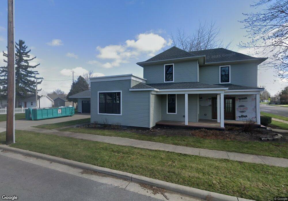
201 N Broad St Kalida, OH 45853
Estimated Value: $88,000 - $223,000
--
Bed
2
Baths
1,320
Sq Ft
$121/Sq Ft
Est. Value
About This Home
This home is located at 201 N Broad St, Kalida, OH 45853 and is currently estimated at $159,184, approximately $120 per square foot. 201 N Broad St is a home with nearby schools including Kalida Elementary School and Kalida High School.
Ownership History
Date
Name
Owned For
Owner Type
Purchase Details
Closed on
Feb 7, 2025
Sold by
Kortokrax Richard L
Bought by
Kortokrax Devin M and Kortokrax Olivia M
Current Estimated Value
Home Financials for this Owner
Home Financials are based on the most recent Mortgage that was taken out on this home.
Original Mortgage
$350,000
Outstanding Balance
$148,769
Interest Rate
6.91%
Mortgage Type
Construction
Estimated Equity
$10,415
Purchase Details
Closed on
Aug 22, 2010
Sold by
Estate Of Donna M Kortokrax
Bought by
Kortokrax Richard L
Create a Home Valuation Report for This Property
The Home Valuation Report is an in-depth analysis detailing your home's value as well as a comparison with similar homes in the area
Home Values in the Area
Average Home Value in this Area
Purchase History
| Date | Buyer | Sale Price | Title Company |
|---|---|---|---|
| Kortokrax Devin M | $90,000 | None Listed On Document | |
| Kortokrax Devin M | $90,000 | None Listed On Document | |
| Kortokrax Richard L | -- | None Available |
Source: Public Records
Mortgage History
| Date | Status | Borrower | Loan Amount |
|---|---|---|---|
| Open | Kortokrax Devin M | $350,000 | |
| Closed | Kortokrax Devin M | $350,000 |
Source: Public Records
Tax History Compared to Growth
Tax History
| Year | Tax Paid | Tax Assessment Tax Assessment Total Assessment is a certain percentage of the fair market value that is determined by local assessors to be the total taxable value of land and additions on the property. | Land | Improvement |
|---|---|---|---|---|
| 2024 | $1,292 | $54,340 | $3,900 | $50,440 |
| 2023 | $1,480 | $40,030 | $3,050 | $36,980 |
| 2022 | $1,140 | $40,030 | $3,049 | $36,981 |
| 2021 | $1,147 | $40,030 | $3,049 | $36,981 |
| 2020 | $1,144 | $30,790 | $2,730 | $28,060 |
| 2019 | $947 | $34,550 | $3,050 | $31,500 |
| 2018 | $924 | $34,550 | $3,050 | $31,500 |
| 2017 | $936 | $34,550 | $3,050 | $31,500 |
| 2016 | $792 | $30,790 | $2,730 | $28,060 |
| 2015 | $796 | $30,790 | $2,730 | $28,060 |
| 2014 | $786 | $30,790 | $2,730 | $28,060 |
| 2013 | $813 | $30,790 | $2,730 | $28,060 |
Source: Public Records
Map
Nearby Homes
- 106 Carnation St
- 15105 Road 15m
- 20501 U S 224
- 0 Sr 115 & Rd J Unit 6128830
- 0 Sr 115 & Rd J
- 12806 Road K
- 17736 Road 20p
- 202 S Main St
- 147 Elm St
- 148 S Water St
- 0 Heritage Cir Unit 6112034
- 0 Heritage Cir Unit 303239
- 717 & 717 1/2 & 721 E Third St
- 304 Oakview (Unit E) Dr
- 209 Willow Bend Dr
- 204 E Sugar St
- 715 N Perry St
- 416 N Taft Ave
- 402 S 5th St
- 320 Auglaize St