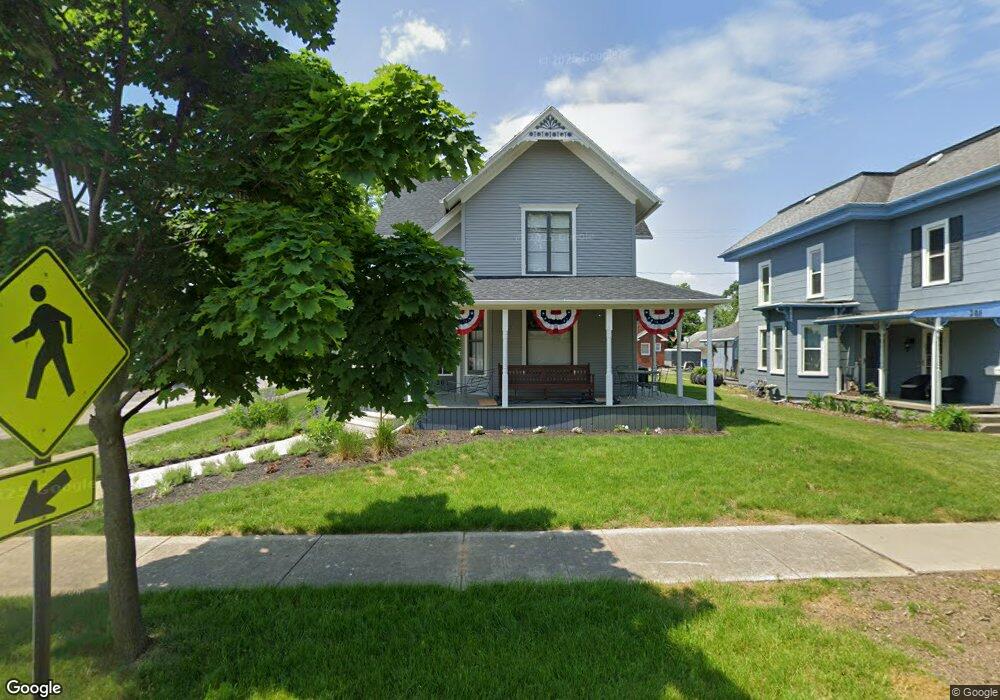
201 N Main St Swanton, OH 43558
Estimated Value: $230,000 - $287,000
7
Beds
3
Baths
3,430
Sq Ft
$78/Sq Ft
Est. Value
About This Home
This home is located at 201 N Main St, Swanton, OH 43558 and is currently estimated at $268,556, approximately $78 per square foot. 201 N Main St is a home located in Fulton County with nearby schools including Swanton High School, Swanton Middle School, and St. Richard School.
Ownership History
Date
Name
Owned For
Owner Type
Purchase Details
Closed on
Jun 22, 2021
Sold by
Krupa Marilyn J
Bought by
Church Amanda M
Current Estimated Value
Purchase Details
Closed on
Jun 10, 2021
Sold by
White Dorothy E
Bought by
Church Amanda M
Purchase Details
Closed on
Jan 1, 1990
Bought by
Fuller Edna M
Create a Home Valuation Report for This Property
The Home Valuation Report is an in-depth analysis detailing your home's value as well as a comparison with similar homes in the area
Home Values in the Area
Average Home Value in this Area
Purchase History
| Date | Buyer | Sale Price | Title Company |
|---|---|---|---|
| Church Amanda M | $15,100 | None Available | |
| Church Amanda M | $15,100 | None Available | |
| Church Amanda M | $15,100 | None Available | |
| Church Amanda M | $15,100 | None Available | |
| Fuller Edna M | -- | -- |
Source: Public Records
Tax History Compared to Growth
Tax History
| Year | Tax Paid | Tax Assessment Tax Assessment Total Assessment is a certain percentage of the fair market value that is determined by local assessors to be the total taxable value of land and additions on the property. | Land | Improvement |
|---|---|---|---|---|
| 2024 | $3,604 | $86,170 | $5,600 | $80,570 |
| 2023 | $3,628 | $86,170 | $5,600 | $80,570 |
| 2022 | $1,726 | $35,640 | $4,660 | $30,980 |
| 2021 | $1,825 | $35,640 | $4,660 | $30,980 |
| 2020 | $1,806 | $35,640 | $4,660 | $30,980 |
| 2019 | $1,798 | $31,400 | $4,660 | $26,740 |
| 2018 | $1,629 | $31,400 | $4,660 | $26,740 |
| 2017 | $1,607 | $31,400 | $4,660 | $26,740 |
| 2016 | $1,701 | $31,400 | $4,660 | $26,740 |
| 2015 | $1,618 | $31,400 | $4,660 | $26,740 |
| 2014 | $1,719 | $31,400 | $4,660 | $26,740 |
| 2013 | $1,667 | $30,070 | $4,270 | $25,800 |
Source: Public Records
Map
Nearby Homes
- 103 Cherry St
- 227 Kierra Ln
- 229 Woodland Ave
- 502 Brookside Dr
- 407 E Garfield Ave
- 133 Harrison Ave
- 510 S Main St
- 0 Waterwood Dr
- 7893 County Road 2
- 225 Kierra Ln
- 4303 S Berkey Southern Rd
- 13620 Brindley Rd
- 6854 County Road 3
- 9984 State Route 64
- 6042 County Road 1-1
- 12922 Airport Hwy
- 13560 Old State Line Rd
- 6330 County Road 4
- 0000 County Road 4
- 12257 Harriet Rd
- 203 N Main St
- 205 N Main St
- 0 Kierra Ln Lot 5 Unit 5083988
- 0 Kierra Lane Lot 24 Unit 5052529
- 0 Kierra Lane Lot 23
- 0 Kierra Lane Lot 14
- 0 Kierra Ln Unit 27 5053174
- 0 Kierra Ln Unit 22 5053176
- 0 Kierra Ln Unit 20 5053177
- 0 Kierra Ln Unit 28 5053170
- 0 Kierra Ln Unit 25 5053175
- 0 Kierra Ln Lot 8
- 0 Kierra Ln Unit 5053177
- 0 Kierra Ln Unit 5110119
- 0 Kierra Ln Unit 5110121
- 0 Kierra Ln Unit 5110122
- 0 Kierra Ln Unit 5110120
- 0 Kierra Ln Unit 5110118
- 0 Kierra Ln Unit 5110117
- 0 Kierra Ln Unit 5053175