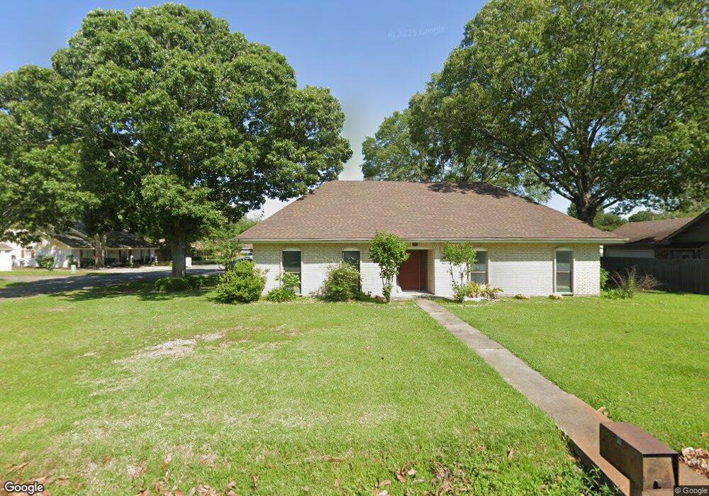
201 N Michot Rd Lafayette, LA 70508
Pilette NeighborhoodEstimated Value: $230,000 - $266,000
--
Bed
--
Bath
1,932
Sq Ft
$126/Sq Ft
Est. Value
About This Home
This home is located at 201 N Michot Rd, Lafayette, LA 70508 and is currently estimated at $242,490, approximately $125 per square foot. 201 N Michot Rd is a home located in Lafayette Parish with nearby schools including Corporal Michael Middlebrook Elementary School, Broussard Middle School, and O. Comeaux High School.
Ownership History
Date
Name
Owned For
Owner Type
Purchase Details
Closed on
Dec 8, 2021
Sold by
Jude Armand Heath and Craig Rebecca
Bought by
Robin Mary Celine and Robin Richard Rodney
Current Estimated Value
Home Financials for this Owner
Home Financials are based on the most recent Mortgage that was taken out on this home.
Original Mortgage
$160,000
Outstanding Balance
$137,111
Interest Rate
3.14%
Mortgage Type
New Conventional
Estimated Equity
$105,379
Create a Home Valuation Report for This Property
The Home Valuation Report is an in-depth analysis detailing your home's value as well as a comparison with similar homes in the area
Home Values in the Area
Average Home Value in this Area
Purchase History
| Date | Buyer | Sale Price | Title Company |
|---|---|---|---|
| Robin Mary Celine | $200,000 | None Listed On Document |
Source: Public Records
Mortgage History
| Date | Status | Borrower | Loan Amount |
|---|---|---|---|
| Open | Robin Mary Celine | $160,000 |
Source: Public Records
Tax History Compared to Growth
Tax History
| Year | Tax Paid | Tax Assessment Tax Assessment Total Assessment is a certain percentage of the fair market value that is determined by local assessors to be the total taxable value of land and additions on the property. | Land | Improvement |
|---|---|---|---|---|
| 2024 | $1,284 | $18,380 | $3,710 | $14,670 |
| 2023 | $1,284 | $17,783 | $3,710 | $14,073 |
| 2022 | $1,861 | $17,783 | $3,710 | $14,073 |
| 2021 | $1,867 | $17,783 | $3,710 | $14,073 |
| 2020 | $1,861 | $17,783 | $3,710 | $14,073 |
| 2019 | $848 | $17,783 | $3,710 | $14,073 |
| 2018 | $1,183 | $17,783 | $3,710 | $14,073 |
| 2017 | $1,182 | $17,783 | $2,473 | $15,310 |
| 2015 | $1,082 | $16,810 | $1,500 | $15,310 |
| 2013 | -- | $16,810 | $1,500 | $15,310 |
Source: Public Records
Map
Nearby Homes
- 101 Domas Dr
- 201 S Michot Rd
- 501 Yvette Marie Dr
- 607 Ember Grove Crossing
- 300 Amber Pond Ln
- 100 Huttingtower Ln
- 201 Barkhill Dr
- 100 Candlewood Dr
- 204 Fawn Crest Dr
- 207 Barkhill Dr
- 203 Ember Grove Crossing
- 305 Woodbridge Dr
- 120 Greenfarm Rd
- 201 Blue Cove Dr
- 206 Leaning Oak Dr
- 204 Leaning Oak Dr
- 307 Harvest Creek Ln
- 202 Leaning Oak Dr
- 100 Darbonne Rd
- 109 Blue Cove Dr
- 200 N Michot Rd
- 203 N Michot Rd
- 103 N Michot Rd
- 203 Domas Dr
- 102 N Michot Rd
- 202 Domas Dr
- 205 N Michot Rd
- 202 N Michot Rd
- 104 Domas Dr
- 205 Domas Dr
- 105 Domas Dr
- 707 Yvette Marie Dr
- 705 Yvette Marie Dr
- 100 N Michot Rd
- 102 Billy Lou Dr
- 204 Domas Dr
- 301 N Michot Rd
- 207 Domas Dr
- 102 Domas Dr
- 300 N Michot Rd