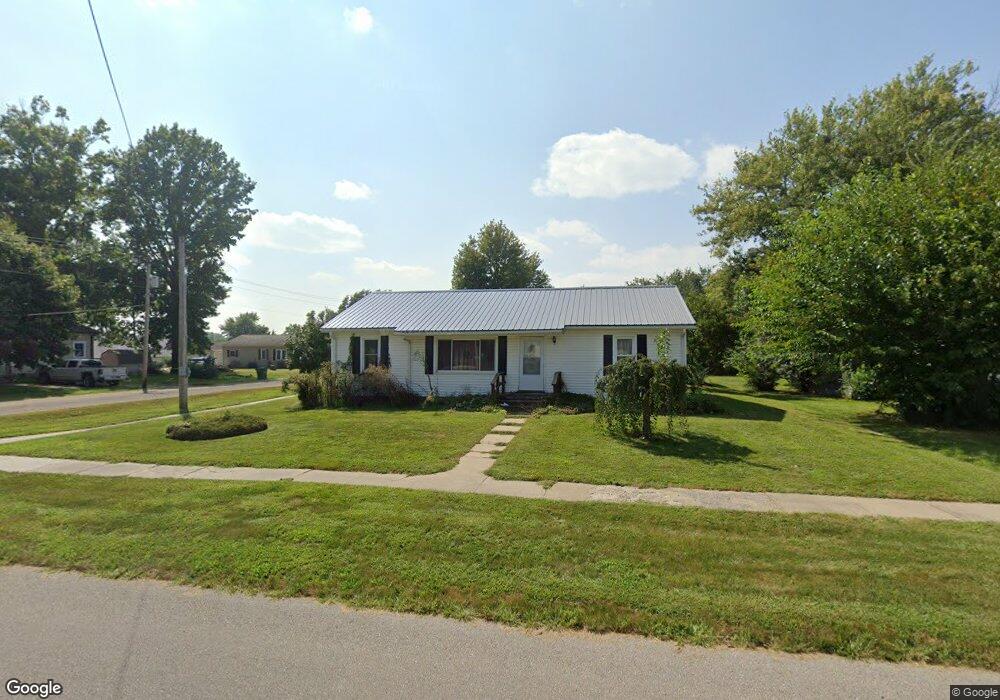
201 N Pine St Bloomfield, IA 52537
Estimated Value: $154,000 - $163,168
2
Beds
2
Baths
1,265
Sq Ft
$125/Sq Ft
Est. Value
About This Home
This home is located at 201 N Pine St, Bloomfield, IA 52537 and is currently estimated at $158,292, approximately $125 per square foot. 201 N Pine St is a home with nearby schools including Davis County Elementary School, Davis County Middle School, and Davis County Community High School.
Ownership History
Date
Name
Owned For
Owner Type
Purchase Details
Closed on
Jul 18, 2024
Sold by
Birchmier Carol
Bought by
Birchmier Kelly W
Current Estimated Value
Purchase Details
Closed on
Jul 27, 2006
Sold by
Johnson Betty J
Bought by
Birchmier Dennis and Birchmier Carol
Home Financials for this Owner
Home Financials are based on the most recent Mortgage that was taken out on this home.
Original Mortgage
$70,400
Interest Rate
6.5%
Mortgage Type
Adjustable Rate Mortgage/ARM
Create a Home Valuation Report for This Property
The Home Valuation Report is an in-depth analysis detailing your home's value as well as a comparison with similar homes in the area
Home Values in the Area
Average Home Value in this Area
Purchase History
| Date | Buyer | Sale Price | Title Company |
|---|---|---|---|
| Birchmier Kelly W | -- | None Listed On Document | |
| Birchmier Dennis | $88,000 | None Available |
Source: Public Records
Mortgage History
| Date | Status | Borrower | Loan Amount |
|---|---|---|---|
| Previous Owner | Birchmier Dennis | $70,400 |
Source: Public Records
Tax History
| Year | Tax Paid | Tax Assessment Tax Assessment Total Assessment is a certain percentage of the fair market value that is determined by local assessors to be the total taxable value of land and additions on the property. | Land | Improvement |
|---|---|---|---|---|
| 2025 | $2,356 | $142,290 | $11,250 | $131,040 |
| 2024 | $2,356 | $133,740 | $11,250 | $122,490 |
| 2023 | $2,708 | $133,740 | $11,250 | $122,490 |
| 2022 | $2,054 | $119,510 | $10,690 | $108,820 |
| 2021 | $2,054 | $94,630 | $10,690 | $83,940 |
| 2020 | $1,916 | $87,360 | $7,840 | $79,520 |
| 2019 | $2,110 | $87,360 | $7,840 | $79,520 |
| 2018 | $1,916 | $88,350 | $7,840 | $80,510 |
| 2017 | $1,934 | $88,350 | $7,840 | $80,510 |
| 2016 | $1,866 | $86,460 | $0 | $0 |
| 2015 | $1,866 | $87,910 | $0 | $0 |
| 2014 | $1,854 | $87,910 | $0 | $0 |
Source: Public Records
Map
Nearby Homes
- 108 N Bloomfield Ave
- 404 Elm St
- 603 W Walnut St
- 607 W Walnut St
- 404 S Railroad St
- 906 W Chestnut St
- 502 S West St
- NKA Lake Road Dr
- 302 N Madison St
- 402 S Columbia St
- 601 S Railroad St
- 412 N Madison St
- 505 Duffield St
- 416 N Madison St
- 607 N Columbia St
- 308 Karr Ave
- 402 E Franklin St
- 617 N Washington St
- 408 E Franklin St
- 201 Gregory Ln
- 606 W Locust St
- 203 N Pine St
- 200 N Buckeye St
- 205 N Pine St
- 111 N Pine St
- 204 N Buckeye St
- 605 W Locust St
- 508 W Locust St
- 207 N Pine St
- 109 N Pine St
- 204 N Pine St
- 110 N Buckeye St
- 607 W Poplar St
- 702 W Locust St
- 112 N Pine St
- 206 N Pine St
- 506 W Locust St
- 106 N Buckeye St
- 110 N Pine St
- 111 N Buckeye St
Your Personal Tour Guide
Ask me questions while you tour the home.