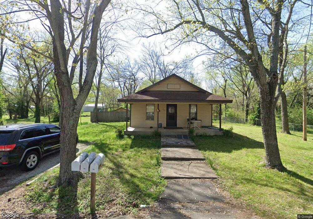
201 N Pollard Ave Fayetteville, AR 72701
Estimated Value: $130,000 - $263,000
--
Bed
--
Bath
--
Sq Ft
0.36
Acres
About This Home
This home is located at 201 N Pollard Ave, Fayetteville, AR 72701 and is currently estimated at $188,700. 201 N Pollard Ave is a home located in Washington County with nearby schools including Greenland Middle School, Greenland Elementary School, and Greenland High School.
Ownership History
Date
Name
Owned For
Owner Type
Purchase Details
Closed on
Feb 27, 2008
Sold by
Mahan Ailene and Baker Ailene
Bought by
Richards William M
Current Estimated Value
Home Financials for this Owner
Home Financials are based on the most recent Mortgage that was taken out on this home.
Original Mortgage
$80,000
Interest Rate
5.68%
Mortgage Type
Purchase Money Mortgage
Purchase Details
Closed on
Apr 27, 1995
Bought by
Mahan Ailene
Purchase Details
Closed on
Jan 1, 1985
Bought by
Mahan Charlie B
Create a Home Valuation Report for This Property
The Home Valuation Report is an in-depth analysis detailing your home's value as well as a comparison with similar homes in the area
Home Values in the Area
Average Home Value in this Area
Purchase History
| Date | Buyer | Sale Price | Title Company |
|---|---|---|---|
| Richards William M | $100,000 | Lenders Title Company | |
| Mahan Ailene | -- | -- | |
| Mahan Charlie B | -- | -- |
Source: Public Records
Mortgage History
| Date | Status | Borrower | Loan Amount |
|---|---|---|---|
| Closed | Richards William M | $80,000 |
Source: Public Records
Tax History Compared to Growth
Tax History
| Year | Tax Paid | Tax Assessment Tax Assessment Total Assessment is a certain percentage of the fair market value that is determined by local assessors to be the total taxable value of land and additions on the property. | Land | Improvement |
|---|---|---|---|---|
| 2025 | $560 | $14,650 | $11,620 | $3,030 |
| 2024 | $522 | $14,650 | $11,620 | $3,030 |
| 2023 | $486 | $14,650 | $11,620 | $3,030 |
| 2022 | $442 | $9,030 | $5,810 | $3,220 |
| 2021 | $442 | $9,030 | $5,810 | $3,220 |
| 2020 | $442 | $9,030 | $5,810 | $3,220 |
| 2019 | $483 | $9,870 | $6,250 | $3,620 |
| 2018 | $483 | $9,870 | $6,250 | $3,620 |
| 2017 | $478 | $9,870 | $6,250 | $3,620 |
| 2016 | $478 | $9,870 | $6,250 | $3,620 |
| 2015 | $478 | $9,870 | $6,250 | $3,620 |
| 2014 | $578 | $11,940 | $6,250 | $5,690 |
Source: Public Records
Map
Nearby Homes
- 424 W Tanner Dr
- 215/215B/219 S Peerson St
- 451 W Horn St
- 316 S Napier Ave
- 333 S Napier Ave
- 0 Path Trail Rd
- N Letitia Ave
- 0 W Carrol St
- 0 W Napier Dr Unit Tract 1 1262191
- 0 W Napier Dr Unit 1322099
- 0 W Napier Dr Unit Tract 4 1262201
- 823 N Lola Ln
- 475 N Cato Springs Rd
- TBD N Cato Springs Rd
- 1329 Homestead Ln
- 10360 N Highway 265
- 3255 S Coach Rd
- 660 & 664 W Whillock St
- TBD W Pear Ln
- 100 W Greenwood St
- 201 N Pollard Ave
- 292 W Yoes Ln
- 276 W Yoes Ln
- 0 Yoes Ln
- 18849 Yoes Ln
- 191 N Pollard St
- 191-201 Pollard
- 264 W Yoes Ln
- 334 W Tanner Dr
- 29 N Pollard Ave
- 340 W Tanner Dr
- 350 W Tanner Dr
- 291 W Yoes Ln
- 0 Yoes Place Lot 5
- 275 W Yoes Ln
- 250 W Yoes Ln
- 201 N Pollard St
- 352 W Tanner Dr
- 326 W Tanner Dr
- 263 W Yoes Ln