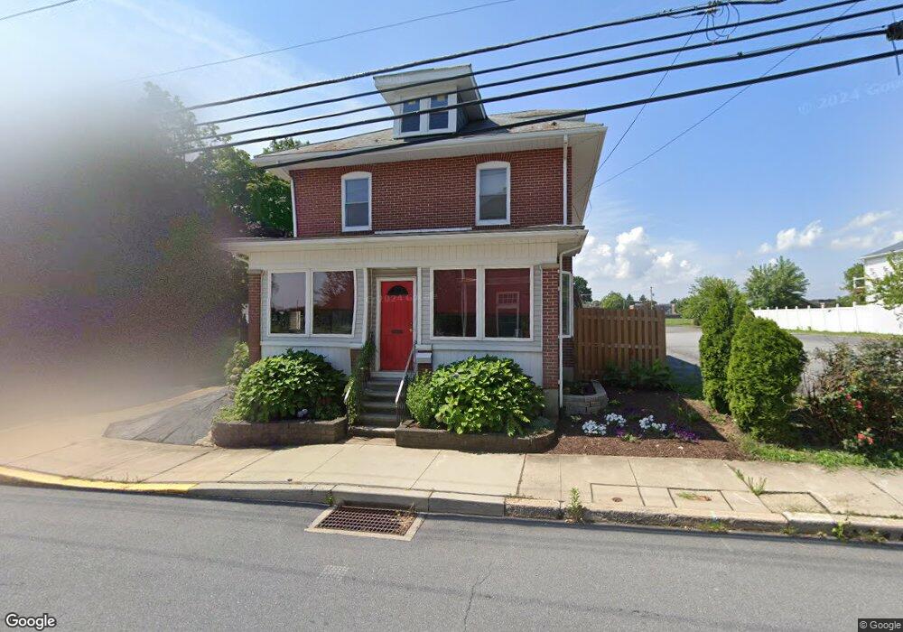
201 N Whiteoak St Kutztown, PA 19530
Estimated Value: $227,000 - $279,000
3
Beds
2
Baths
1,848
Sq Ft
$138/Sq Ft
Est. Value
About This Home
This home is located at 201 N Whiteoak St, Kutztown, PA 19530 and is currently estimated at $255,888, approximately $138 per square foot. 201 N Whiteoak St is a home located in Berks County with nearby schools including Kutztown Area Senior High School, Pleasant Hills Mennonite School, and LIGHTHOUSE ISLAND ACADEMY.
Ownership History
Date
Name
Owned For
Owner Type
Purchase Details
Closed on
Apr 24, 2002
Sold by
Bieber Carl R and Lamanna Jerome P
Bought by
Biscanti Barbara
Current Estimated Value
Purchase Details
Closed on
Feb 28, 2001
Sold by
Eschbach Robert A and Eschbach Eleanor F A
Bought by
Coe Beverly W
Home Financials for this Owner
Home Financials are based on the most recent Mortgage that was taken out on this home.
Original Mortgage
$97,186
Interest Rate
7%
Mortgage Type
FHA
Create a Home Valuation Report for This Property
The Home Valuation Report is an in-depth analysis detailing your home's value as well as a comparison with similar homes in the area
Home Values in the Area
Average Home Value in this Area
Purchase History
| Date | Buyer | Sale Price | Title Company |
|---|---|---|---|
| Biscanti Barbara | $10,000 | -- | |
| Coe Beverly W | $98,000 | -- |
Source: Public Records
Mortgage History
| Date | Status | Borrower | Loan Amount |
|---|---|---|---|
| Previous Owner | Coe Beverly W | $97,186 |
Source: Public Records
Tax History Compared to Growth
Tax History
| Year | Tax Paid | Tax Assessment Tax Assessment Total Assessment is a certain percentage of the fair market value that is determined by local assessors to be the total taxable value of land and additions on the property. | Land | Improvement |
|---|---|---|---|---|
| 2025 | $1,249 | $84,900 | $37,500 | $47,400 |
| 2024 | $3,719 | $84,900 | $37,500 | $47,400 |
| 2023 | $3,584 | $84,900 | $37,500 | $47,400 |
| 2022 | $3,584 | $84,900 | $37,500 | $47,400 |
| 2021 | $3,584 | $84,900 | $37,500 | $47,400 |
| 2020 | $3,584 | $84,900 | $37,500 | $47,400 |
| 2019 | $3,541 | $84,900 | $37,500 | $47,400 |
| 2018 | $3,541 | $84,900 | $37,500 | $47,400 |
| 2017 | $3,517 | $84,900 | $37,500 | $47,400 |
| 2016 | $954 | $84,900 | $37,500 | $47,400 |
| 2015 | $954 | $84,900 | $37,500 | $47,400 |
| 2014 | $954 | $84,900 | $37,500 | $47,400 |
Source: Public Records
Map
Nearby Homes
- 164 W Main St
- 350 College Blvd
- 113 W Main St
- 99 Noble St
- 10 E Main St
- 233 Noble St
- 504-512 E Main St
- 470 Highland Ave
- 471 Highland Ave
- 122 Portia Blvd
- 112 Portia Blvd
- 141 Portia Blvd
- 131 Portia Blvd
- 121 Portia Blvd
- 111 Portia Blvd
- 111 Kohler Rd
- 602 Seem Dr
- 97 S Kemp Rd
- 20 Miller Dr
- 0 College Blvd Unit PABK2022518
- 277 Fair St
- 211 N Whiteoak St
- 149 N Whiteoak St
- 275 Fair St
- 209 Church Ln
- 215 N Whiteoak St
- 219 Church Ln
- 219 N Whiteoak St
- 320 Fair St
- 223 N Whiteoak St
- 224 N Whiteoak St
- 309 W Walnut St
- 301 W Walnut St
- 319 W Walnut St
- 307 W Walnut St
- 321 W Walnut St
- 323 W Walnut St
- 229 N Whiteoak St
- 325 W Walnut St
- 225 Church Ln