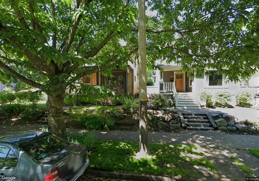
201 NE Fargo St Portland, OR 97212
Estimated Value: $660,130 - $760,000
4
Beds
2
Baths
1,671
Sq Ft
$420/Sq Ft
Est. Value
About This Home
This home is located at 201 NE Fargo St, Portland, OR 97212 and is currently estimated at $701,533, approximately $419 per square foot. 201 NE Fargo St is a home located in Multnomah County with nearby schools including Boise-Eliot Elementary School, Harriet Tubman Middle School, and Jefferson High School.
Ownership History
Date
Name
Owned For
Owner Type
Purchase Details
Closed on
Aug 25, 2007
Sold by
Zuttermeister David J
Bought by
Graff Brant R and Graff Joelle M
Current Estimated Value
Home Financials for this Owner
Home Financials are based on the most recent Mortgage that was taken out on this home.
Original Mortgage
$317,600
Outstanding Balance
$201,807
Interest Rate
6.73%
Mortgage Type
Purchase Money Mortgage
Estimated Equity
$499,726
Purchase Details
Closed on
May 21, 1998
Sold by
Clark Bruce H
Bought by
Zuttermeister David J
Home Financials for this Owner
Home Financials are based on the most recent Mortgage that was taken out on this home.
Original Mortgage
$117,200
Interest Rate
9.12%
Mortgage Type
Purchase Money Mortgage
Create a Home Valuation Report for This Property
The Home Valuation Report is an in-depth analysis detailing your home's value as well as a comparison with similar homes in the area
Home Values in the Area
Average Home Value in this Area
Purchase History
| Date | Buyer | Sale Price | Title Company |
|---|---|---|---|
| Graff Brant R | $397,000 | First American Title Insuran | |
| Zuttermeister David J | $146,500 | Ticor Title Insurance |
Source: Public Records
Mortgage History
| Date | Status | Borrower | Loan Amount |
|---|---|---|---|
| Open | Graff Brant R | $317,600 | |
| Previous Owner | Zuttermeister David J | $117,200 |
Source: Public Records
Tax History Compared to Growth
Tax History
| Year | Tax Paid | Tax Assessment Tax Assessment Total Assessment is a certain percentage of the fair market value that is determined by local assessors to be the total taxable value of land and additions on the property. | Land | Improvement |
|---|---|---|---|---|
| 2024 | $4,212 | $157,430 | -- | -- |
| 2023 | $4,050 | $152,850 | $0 | $0 |
| 2022 | $3,963 | $148,400 | $0 | $0 |
| 2021 | $3,896 | $144,080 | $0 | $0 |
| 2020 | $3,574 | $139,890 | $0 | $0 |
| 2019 | $3,442 | $135,820 | $0 | $0 |
| 2018 | $3,341 | $131,870 | $0 | $0 |
| 2017 | $3,202 | $128,030 | $0 | $0 |
| 2016 | $2,931 | $124,310 | $0 | $0 |
| 2015 | $2,854 | $120,690 | $0 | $0 |
| 2014 | $2,811 | $117,180 | $0 | $0 |
Source: Public Records
Map
Nearby Homes
- 3133 NE Rodney Ave
- 205 NE Stanton St
- 35 NE Morris St
- 78 NE Ivy St
- 2845 NE Martin Luther King Junior Blvd
- 325 NE Graham St Unit 8
- 533 NE Fargo St
- 0 NE Mlk and Fremont Blvd Unit 23325427
- 3550 NE Garfield Ave Unit 1
- 3552 NE Garfield Ave Unit 2
- 3554 NE Garfield Ave Unit 3
- 3558 NE Garfield Ave Unit 5
- 3562 NE Garfield Ave Unit 7
- 3564 NE Garfield Ave
- 12 NE Fremont St Unit 3W
- 12 NE Fremont St Unit 3E
- 3512 NE Grand Ave
- 236 NE Knott St
- 2741 NE 7th Ave
- 3032 NE 8th Ave
- 121 NE Fargo St
- 113 NE Fargo St
- 221 NE Fargo St
- 132 NE Cook St
- 210 NE Cook St
- 122 NE Cook St
- 109 NE Fargo St Unit B109
- 107 NE Fargo St Unit 107
- 3216 NE Rodney Ave
- 220 NE Cook St
- 124 NE Cook St
- 3226 NE Rodney Ave
- 229 NE Fargo St
- 116 NE Cook St
- 105 NE Fargo St Unit A105
- 132 NE Fargo St
- 210 NE Fargo St
- 126 NE Fargo St
- 112 NE Fargo St
- 220 NE Fargo St