

201 Norfolk St Cambridge, MA 02139
The Port NeighborhoodAbout This Home
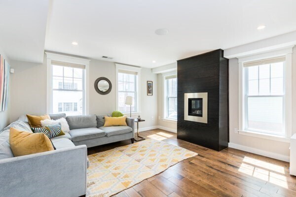
This luxurious, smart single-family home in Inman Square offers a unique blend of modern design and comfortable living. Recently renovated to perfection, this sun-filled, four-bedroom residence boasts thoughtful architectural detailing throughout, including a modern gas fireplace that creates a warm and inviting atmosphere. The gourmet kitchen is a chef's dream, featuring professional Thermador appliances, sleek stainless steel and granite countertops, custom cabinetry, and a convenient walk-in pantry.Beyond the interior, you'll find exceptional amenities, including in-unit laundry, a private outdoor space with a fenced yard, and the rare convenience of three dedicated parking spaces. This prime location is just steps away from the vibrant nightlife, diverse restaurants, unique shops, and charming cafes of Inman, Harvard, and Union Squares. We are an Equal Opportunity Housing Provider.409

Map
- 308 Broadway Unit 308
- 305 Broadway
- 114 Elm St
- 244 Norfolk St Unit 244
- 248 Norfolk St Unit 248
- 222 Columbia St Unit 2
- 51 Market St Unit 2
- 190 Prospect St Unit 8
- 31 Tremont St
- 196 Prospect St
- 161 Columbia St Unit 3
- 31 Market St Unit D
- 94 Hampshire St Unit B
- 30 Union St Unit 1
- 182 Harvard St Unit 3
- 294-302 Windsor St
- 100 Prospect St Unit 1
- 142 Amory St Unit Front
- 208 Windsor St
- 4 Saint Paul St
- 200 Norfolk St Unit 2
- 216 Norfolk St Unit 216
- 216 Norfolk St
- 221 Norfolk St
- 221 Norfolk St
- 18 Tremont St Unit 18 Tremont Street
- 16 Tremont St Unit 2A
- 18 Tremont St Unit 2
- 237 Norfolk St Unit 4
- 237 Norfolk St Unit 6
- 241 Norfolk St Unit 6
- 279 Broadway Unit 1
- 253 Norfolk St Unit 22
- 229 Harvard St
- 229 Harvard St
- 229 Harvard St
- 216 Prospect St
- 216 Prospect St
- 183 Prospect St Unit 3
- 222 Prospect St Unit 2B