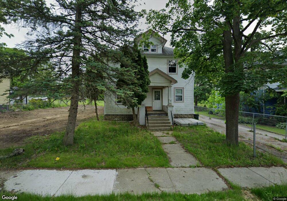
201 Odette St Flint, MI 48503
King Avenue Plus NeighborhoodEstimated Value: $10,000 - $107,000
4
Beds
2
Baths
1,851
Sq Ft
$32/Sq Ft
Est. Value
About This Home
This home is located at 201 Odette St, Flint, MI 48503 and is currently estimated at $58,745, approximately $31 per square foot. 201 Odette St is a home located in Genesee County with nearby schools including Brownell STEM Academy, Flint Cultural Center Academy, and WAY Academy of Flint.
Ownership History
Date
Name
Owned For
Owner Type
Purchase Details
Closed on
Dec 17, 2024
Sold by
Genesee County Land Bank Authority
Bought by
Perry-Walker Gloria Lashay-Jean
Current Estimated Value
Purchase Details
Closed on
Oct 9, 2020
Sold by
The Genessee County Land Bank Authority
Bought by
Perry Walker Gloria Lashay Jean
Purchase Details
Closed on
Dec 18, 2018
Sold by
Genesee County Treasurer
Bought by
Genesee County Land Bank Authority
Purchase Details
Closed on
Mar 8, 2004
Sold by
Chatmon Ester Lee
Bought by
Chatmon Robert E and Chatmon Ester Lee
Home Financials for this Owner
Home Financials are based on the most recent Mortgage that was taken out on this home.
Original Mortgage
$26,265
Interest Rate
5.78%
Mortgage Type
New Conventional
Create a Home Valuation Report for This Property
The Home Valuation Report is an in-depth analysis detailing your home's value as well as a comparison with similar homes in the area
Home Values in the Area
Average Home Value in this Area
Purchase History
| Date | Buyer | Sale Price | Title Company |
|---|---|---|---|
| Perry-Walker Gloria Lashay-Jean | $9,000 | None Listed On Document | |
| Perry Walker Gloria Lashay Jean | $9,000 | None Available | |
| Genesee County Land Bank Authority | -- | None Available | |
| Chatmon Robert E | -- | Centennial Title Insurance A |
Source: Public Records
Mortgage History
| Date | Status | Borrower | Loan Amount |
|---|---|---|---|
| Previous Owner | Chatmon Robert E | $26,265 | |
| Closed | Perry Walker Gloria Lashay Jean | $0 |
Source: Public Records
Tax History Compared to Growth
Tax History
| Year | Tax Paid | Tax Assessment Tax Assessment Total Assessment is a certain percentage of the fair market value that is determined by local assessors to be the total taxable value of land and additions on the property. | Land | Improvement |
|---|---|---|---|---|
| 2025 | $1,356 | $17,400 | $0 | $0 |
| 2024 | $1,251 | $17,100 | $0 | $0 |
| 2023 | $1,219 | $16,500 | $0 | $0 |
| 2022 | $0 | $14,400 | $0 | $0 |
| 2021 | $969 | $13,400 | $0 | $0 |
| 2020 | $0 | $0 | $0 | $0 |
| 2019 | $490 | $0 | $0 | $0 |
| 2018 | $474 | $5,700 | $0 | $0 |
| 2017 | $465 | $0 | $0 | $0 |
| 2016 | $490 | $0 | $0 | $0 |
| 2015 | -- | $0 | $0 | $0 |
| 2014 | -- | $0 | $0 | $0 |
| 2012 | -- | $7,200 | $0 | $0 |
Source: Public Records
Map
Nearby Homes
- 317 W Witherbee St
- 325 W Paterson St
- 235 Page St
- 1606 Garland St
- 115 W Baker St
- 506 Green St
- 1645 Seminole St
- 329 E Wood St
- 562 E Witherbee St
- 218 E Jackson Ave
- 2913
- 2913 Martin Luther King Ave
- 311 W Genesee St
- 409 W Genesee St
- 2245 Milbourne Ave
- 1909 Proctor Ave
- 1303 Root St
- 2718 N Chevrolet Ave
- 200 W Mcclellan St
- 2302 Mallery St