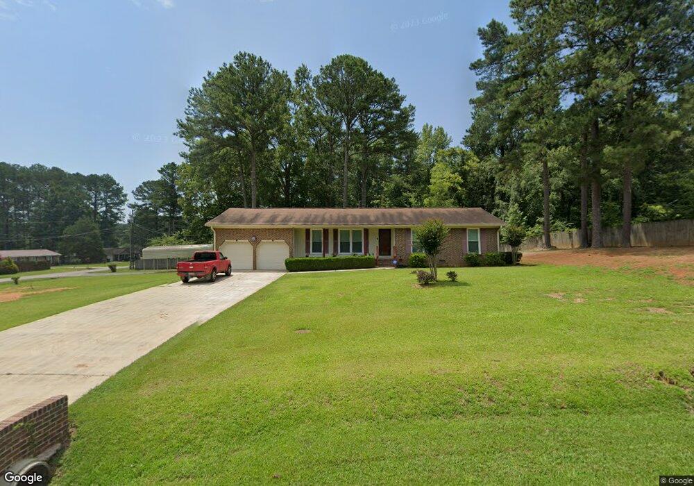
201 Oxmore Flint Rd SW Decatur, AL 35603
Flint City NeighborhoodEstimated Value: $198,000 - $236,000
--
Bed
1
Bath
1,490
Sq Ft
$145/Sq Ft
Est. Value
About This Home
This home is located at 201 Oxmore Flint Rd SW, Decatur, AL 35603 and is currently estimated at $215,864, approximately $144 per square foot. 201 Oxmore Flint Rd SW is a home located in Morgan County with nearby schools including Frances Nungester Elementary School, Brookhaven Middle School, and Horizon High School.
Ownership History
Date
Name
Owned For
Owner Type
Purchase Details
Closed on
Jan 17, 2006
Sold by
Johnson Harold and Johnson Linda F
Bought by
Kearse John Wesley
Current Estimated Value
Home Financials for this Owner
Home Financials are based on the most recent Mortgage that was taken out on this home.
Original Mortgage
$104,200
Outstanding Balance
$58,256
Interest Rate
6.18%
Mortgage Type
VA
Estimated Equity
$157,608
Create a Home Valuation Report for This Property
The Home Valuation Report is an in-depth analysis detailing your home's value as well as a comparison with similar homes in the area
Home Values in the Area
Average Home Value in this Area
Purchase History
| Date | Buyer | Sale Price | Title Company |
|---|---|---|---|
| Kearse John Wesley | $104,200 | None Available |
Source: Public Records
Mortgage History
| Date | Status | Borrower | Loan Amount |
|---|---|---|---|
| Open | Kearse John Wesley | $104,200 |
Source: Public Records
Tax History Compared to Growth
Tax History
| Year | Tax Paid | Tax Assessment Tax Assessment Total Assessment is a certain percentage of the fair market value that is determined by local assessors to be the total taxable value of land and additions on the property. | Land | Improvement |
|---|---|---|---|---|
| 2024 | -- | $12,630 | $1,410 | $11,220 |
| 2023 | $0 | $12,630 | $1,410 | $11,220 |
| 2022 | $525 | $12,630 | $1,410 | $11,220 |
| 2021 | $447 | $10,910 | $1,410 | $9,500 |
| 2020 | $447 | $20,410 | $1,410 | $19,000 |
| 2019 | $447 | $10,920 | $0 | $0 |
| 2015 | $476 | $11,560 | $0 | $0 |
| 2014 | $476 | $11,560 | $0 | $0 |
| 2013 | -- | $11,540 | $0 | $0 |
Source: Public Records
Map
Nearby Homes
- 0 Norris Mill Rd Unit 23367060
- 4711 Pineywood Dr SW
- 4407 Old Highway 31
- 220 Clear Creek Dr
- 4302 Central Pkwy SW
- 317 Austinville Flint Rd SW
- 4108 White River Rd SW
- 4113 White River Rd SW
- 4106 White River Rd SW
- 4112 White River Rd SW
- 310 Skykomish Rd
- 4116 White River SW
- Ridgeland Plan at Kenzie Meadows
- Somerville Plan at Kenzie Meadows
- Chelsey Plan at Kenzie Meadows
- Mitchell Plan at Kenzie Meadows
- Cooper Plan at Kenzie Meadows
- 4115 White River
- 415 Austinville Flint Rd SW
- 419 Austinville Flint Rd SW
- 4505 Margarete Dr SW
- 205 Oxmore Flint Rd SW
- 115 Oxmore Flint Rd SW
- 4507 Margarete Dr SW
- 204 Oxmore Flint Rd SW
- 4504 Margarete Dr SW
- 202 Oxmore Flint Rd SW
- 4509 Margarete Dr SW
- 113 Oxmore Flint Rd SW
- 206 Oxmore Flint Rd SW
- 4506 Margarete Dr SW
- 208 Oxmore Flint Rd SW
- 4511 Margarete Dr SW
- 209 Oxmore Flint Rd SW
- 120 Lucille Dr SW
- 111 Oxmore Flint Rd SW
- 4510 Margarete Dr SW
- 210 Oxmore Flint Rd SW
- 4513 Margarete Dr SW
- 118 Lucille Dr SW