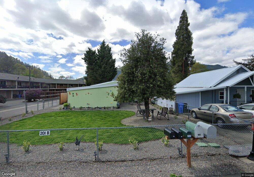
201 Park St Rogue River, OR 97537
Estimated Value: $248,000 - $370,000
2
Beds
2
Baths
789
Sq Ft
$384/Sq Ft
Est. Value
About This Home
This home is located at 201 Park St, Rogue River, OR 97537 and is currently estimated at $302,966, approximately $383 per square foot. 201 Park St is a home located in Jackson County with nearby schools including South Valley Academy, Rogue River Elementary School, and Rogue River Junior/Senior High School.
Ownership History
Date
Name
Owned For
Owner Type
Purchase Details
Closed on
Apr 22, 2009
Sold by
Stiehl Robert J
Bought by
Stiehl Robert J and Stiehl Theron W
Current Estimated Value
Purchase Details
Closed on
Oct 21, 2004
Sold by
Deong Carrie L and Deong Eugene D
Bought by
Sweat Floyd L
Home Financials for this Owner
Home Financials are based on the most recent Mortgage that was taken out on this home.
Original Mortgage
$314,800
Outstanding Balance
$155,591
Interest Rate
5.74%
Mortgage Type
Purchase Money Mortgage
Estimated Equity
$147,375
Purchase Details
Closed on
Sep 27, 2004
Sold by
Sweat Floyd
Bought by
Swing Clarence and Swing Laura
Home Financials for this Owner
Home Financials are based on the most recent Mortgage that was taken out on this home.
Original Mortgage
$314,800
Outstanding Balance
$155,591
Interest Rate
5.74%
Mortgage Type
Purchase Money Mortgage
Estimated Equity
$147,375
Create a Home Valuation Report for This Property
The Home Valuation Report is an in-depth analysis detailing your home's value as well as a comparison with similar homes in the area
Home Values in the Area
Average Home Value in this Area
Purchase History
| Date | Buyer | Sale Price | Title Company |
|---|---|---|---|
| Stiehl Robert J | -- | None Available | |
| Sweat Floyd L | $40,000 | Lawyers Title Ins | |
| Swing Clarence | $393,500 | Lawyers Title Ins |
Source: Public Records
Mortgage History
| Date | Status | Borrower | Loan Amount |
|---|---|---|---|
| Open | Swing Clarence | $314,800 |
Source: Public Records
Tax History Compared to Growth
Tax History
| Year | Tax Paid | Tax Assessment Tax Assessment Total Assessment is a certain percentage of the fair market value that is determined by local assessors to be the total taxable value of land and additions on the property. | Land | Improvement |
|---|---|---|---|---|
| 2025 | $1,549 | $108,460 | $54,510 | $53,950 |
| 2024 | $1,549 | $105,310 | $52,930 | $52,380 |
| 2023 | $320 | $21,180 | $51,390 | $21,180 |
| 2022 | $313 | $81,070 | $51,390 | $29,680 |
| 2021 | $120 | $78,710 | $49,900 | $28,810 |
| 2020 | $116 | $76,420 | $57,940 | $18,480 |
| 2019 | $108 | $72,040 | $54,620 | $17,420 |
| 2018 | $121 | $69,950 | $53,040 | $16,910 |
| 2017 | $118 | $69,950 | $53,040 | $16,910 |
| 2016 | $126 | $65,950 | $50,010 | $15,940 |
| 2015 | $967 | $65,950 | $50,010 | $15,940 |
| 2014 | $936 | $62,170 | $47,370 | $14,800 |
Source: Public Records
Map
Nearby Homes
- 207 Madrone St
- 202 Arbor St
- TL 1303 E Main St
- 111 Cedar St
- 419 E Main St
- 0 Oak St
- 5508 Rogue River Hwy
- 208 W Main St
- 5504 Rogue River Hwy
- 105 Brolin Ct
- 182 Wards Creek Rd
- 2661 Wards Creek Rd
- 299 Foothill Blvd
- 904 Broadway St Unit 503
- 405 Magerle Ln
- 5525 Red Tail Ln
- 5500 Red Tail Ln
- 300 Woodville Way
- 305 Woodville Way
- 5100 N River Rd