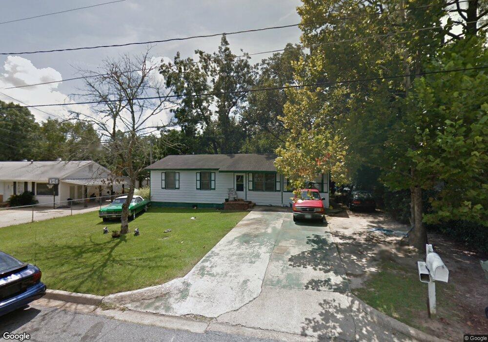
201 Patrol Dr Albany, GA 31705
Radium Springs NeighborhoodEstimated Value: $50,000 - $76,000
3
Beds
1
Bath
1,176
Sq Ft
$56/Sq Ft
Est. Value
About This Home
This home is located at 201 Patrol Dr, Albany, GA 31705 and is currently estimated at $65,418, approximately $55 per square foot. 201 Patrol Dr is a home located in Dougherty County with nearby schools including Morningside Elementary School, Southside Middle School, and Monroe High School.
Ownership History
Date
Name
Owned For
Owner Type
Purchase Details
Closed on
Mar 5, 2009
Sold by
Jones Justin
Bought by
Allison Investments Llc
Current Estimated Value
Purchase Details
Closed on
Jul 29, 2005
Sold by
Newell Properties
Bought by
Jones Justin
Purchase Details
Closed on
Apr 6, 2000
Sold by
Newell Roy D
Bought by
Newell Properties
Purchase Details
Closed on
Jul 6, 1999
Sold by
Faircloth Mortgage Inc
Bought by
Housing & Urban Dev
Purchase Details
Closed on
Apr 7, 1989
Sold by
Williams Barbara Y
Bought by
Faircloth Mark Etal
Create a Home Valuation Report for This Property
The Home Valuation Report is an in-depth analysis detailing your home's value as well as a comparison with similar homes in the area
Home Values in the Area
Average Home Value in this Area
Purchase History
| Date | Buyer | Sale Price | Title Company |
|---|---|---|---|
| Allison Investments Llc | $250,000 | -- | |
| Jones Justin | $105,900 | -- | |
| Newell Properties | $31,900 | -- | |
| Newell Roy D | $31,900 | -- | |
| Housing & Urban Dev | $42,100 | -- | |
| Regions Mortgage Inc | $42,100 | -- | |
| Faircloth Mark Etal | $40,500 | -- |
Source: Public Records
Tax History Compared to Growth
Tax History
| Year | Tax Paid | Tax Assessment Tax Assessment Total Assessment is a certain percentage of the fair market value that is determined by local assessors to be the total taxable value of land and additions on the property. | Land | Improvement |
|---|---|---|---|---|
| 2024 | $727 | $15,240 | $1,840 | $13,400 |
| 2023 | $710 | $15,240 | $1,840 | $13,400 |
| 2022 | $713 | $15,240 | $1,840 | $13,400 |
| 2021 | $661 | $15,240 | $1,840 | $13,400 |
| 2020 | $662 | $15,240 | $1,840 | $13,400 |
| 2019 | $665 | $15,240 | $1,840 | $13,400 |
| 2018 | $668 | $15,240 | $1,840 | $13,400 |
| 2017 | $622 | $15,240 | $1,840 | $13,400 |
| 2016 | $622 | $15,240 | $1,840 | $13,400 |
| 2015 | $624 | $15,240 | $1,840 | $13,400 |
| 2014 | $616 | $15,240 | $1,840 | $13,400 |
Source: Public Records
Map
Nearby Homes
- 211 Cannon Ave
- 403 Farkas Ln
- 113 Morningside Dr
- 111 Morningside Dr
- 1304 Mobile Ave
- 1102 Van Deman St
- 206 Raintree Dr
- 1013 Crawford Dr
- 1011 Crawford Dr
- 939 Crawford Dr
- 410 Redbud Rd
- 925 Mercedes St
- 916 Crawford Dr
- 454 Poinciana Ave
- 911 Mercedes St
- 502 Mitchell Ave
- 401 Mitchell Ave
- 2421 Cherry Laurel Ln
- 2220 S Jackson St
- 2601 S Jackson St