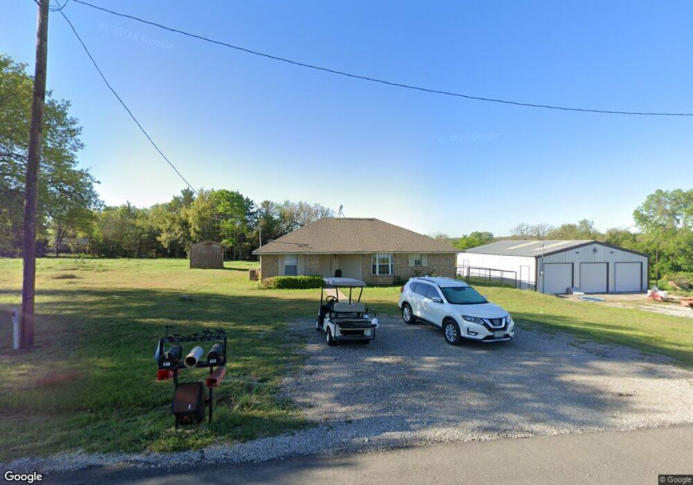
201 Peacock Dr Weatherford, TX 76085
Estimated Value: $307,555 - $611,000
--
Bed
--
Bath
2,045
Sq Ft
$235/Sq Ft
Est. Value
About This Home
This home is located at 201 Peacock Dr, Weatherford, TX 76085 and is currently estimated at $480,639, approximately $235 per square foot. 201 Peacock Dr is a home located in Parker County with nearby schools including Crockett Elementary School, Tison Middle School, and Weatherford High School.
Ownership History
Date
Name
Owned For
Owner Type
Purchase Details
Closed on
Jun 13, 2024
Sold by
Williams Robert and Williams Joni
Bought by
Pollard Judy Margaret and Fontenot Aaron
Current Estimated Value
Purchase Details
Closed on
Mar 25, 2022
Sold by
Craig Peacock A
Bought by
Williams Robert and Williams Joni
Home Financials for this Owner
Home Financials are based on the most recent Mortgage that was taken out on this home.
Original Mortgage
$647,200
Interest Rate
4.42%
Mortgage Type
New Conventional
Purchase Details
Closed on
Mar 24, 2022
Sold by
Craig Peacock A
Bought by
Williams Robert and Williams Joni
Home Financials for this Owner
Home Financials are based on the most recent Mortgage that was taken out on this home.
Original Mortgage
$647,200
Interest Rate
4.42%
Mortgage Type
New Conventional
Create a Home Valuation Report for This Property
The Home Valuation Report is an in-depth analysis detailing your home's value as well as a comparison with similar homes in the area
Home Values in the Area
Average Home Value in this Area
Purchase History
| Date | Buyer | Sale Price | Title Company |
|---|---|---|---|
| Pollard Judy Margaret | -- | Providence Title Company | |
| Williams Robert | -- | None Listed On Document | |
| Williams Robert | -- | None Listed On Document |
Source: Public Records
Mortgage History
| Date | Status | Borrower | Loan Amount |
|---|---|---|---|
| Previous Owner | Williams Robert | $647,200 | |
| Previous Owner | Williams Robert | $647,200 |
Source: Public Records
Tax History Compared to Growth
Tax History
| Year | Tax Paid | Tax Assessment Tax Assessment Total Assessment is a certain percentage of the fair market value that is determined by local assessors to be the total taxable value of land and additions on the property. | Land | Improvement |
|---|---|---|---|---|
| 2025 | $3,904 | $338,570 | $97,390 | $241,180 |
| 2024 | $3,904 | $239,670 | $42,770 | $196,900 |
| 2023 | $3,904 | $239,670 | $42,770 | $196,900 |
| 2022 | $3,701 | $232,520 | $29,880 | $202,640 |
| 2021 | $3,648 | $232,530 | $29,890 | $202,640 |
| 2020 | $3,332 | $173,330 | $21,690 | $151,640 |
| 2019 | $3,231 | $173,330 | $21,690 | $151,640 |
| 2018 | $2,953 | $135,760 | $15,670 | $120,090 |
| 2017 | $3,013 | $135,760 | $15,670 | $120,090 |
| 2016 | $2,920 | $131,540 | $15,670 | $115,870 |
| 2015 | $2,341 | $131,540 | $15,670 | $115,870 |
| 2014 | $2,068 | $112,490 | $15,110 | $97,380 |
Source: Public Records
Map
Nearby Homes
- 161 Cochran Rd
- 150 Ellis Spring Dr
- 209 Ellis Creek Dr
- 600 Joyce St
- Lot 118 Stonebridge Dr
- Lot 117 Stonebridge Dr
- 107 W Stagecoach Trail
- 368 Green Branch Rd
- 104 W Stagecoach Trail
- 1860 Trailwood Dr
- 2277 Tanglewood St
- 2358 Tanglewood St
- 737 Green Branch Rd
- 109 Odel Dr
- Haven Plan at Wossum Ranch
- 1300 Green Ridge Rd
- Vista Plan at Wossum Ranch
- 901 Green Branch Rd
- 1835 N Main St
- 1305 Green Ridge Rd
- 206 Peacock Dr
- 603 Price Ln
- 520 Price Ln
- 00 Price Ln
- 604 Price Ln
- 612 Price Ln
- 270 Price Ln
- 613 Price Ln
- 215 Price Ln Unit 29
- 215 Price Ln Unit 15
- 215 Price Ln Unit 11
- 215 Price Ln Unit 12
- 215 Price Ln Unit 1
- 215 Price Ln Unit 8
- 215 Price Ln Unit 10
- 215 Price Ln Unit 4
- 215 Price Ln
- 701 Price Ln
- 616 Price Ln
- 101 Gammill Dr