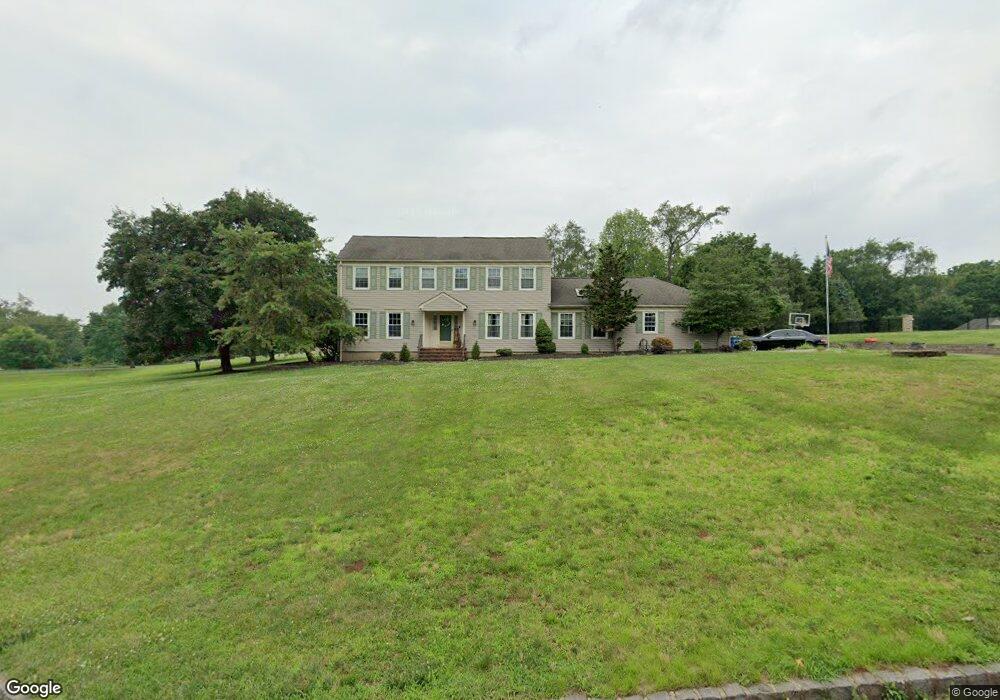
201 Post Rd Branchburg, NJ 08853
Branchburg Township NeighborhoodEstimated Value: $933,000
--
Bed
--
Bath
3,446
Sq Ft
$271/Sq Ft
Est. Value
About This Home
This home is located at 201 Post Rd, Branchburg, NJ 08853 and is currently estimated at $933,000, approximately $270 per square foot. 201 Post Rd is a home located in Somerset County with nearby schools including Whiton Elementary School, Stony Brook School, and Branchburg Central Middle School.
Ownership History
Date
Name
Owned For
Owner Type
Purchase Details
Closed on
Jun 15, 1998
Sold by
Degati Joe
Current Estimated Value
Home Financials for this Owner
Home Financials are based on the most recent Mortgage that was taken out on this home.
Original Mortgage
$231,000
Outstanding Balance
$45,691
Interest Rate
6.92%
Estimated Equity
$887,309
Purchase Details
Closed on
May 24, 1994
Sold by
Hodge Thomas
Bought by
Degati Joseph and Degati Valerie
Home Financials for this Owner
Home Financials are based on the most recent Mortgage that was taken out on this home.
Original Mortgage
$246,000
Interest Rate
8.74%
Purchase Details
Closed on
Aug 11, 1989
Sold by
Kozak Frederick J and Kozak Mary C
Bought by
Hodge Thomas M and Hodge Gila B
Purchase Details
Closed on
Nov 24, 1987
Sold by
Knopp Jeffrey A and Knopp Laura
Bought by
Kozak Frederick J and Kozak Mary C
Create a Home Valuation Report for This Property
The Home Valuation Report is an in-depth analysis detailing your home's value as well as a comparison with similar homes in the area
Home Values in the Area
Average Home Value in this Area
Purchase History
| Date | Buyer | Sale Price | Title Company |
|---|---|---|---|
| -- | $288,500 | -- | |
| Degati Joseph | $273,500 | -- | |
| Hodge Thomas M | $246,000 | -- | |
| Kozak Frederick J | $252,000 | -- |
Source: Public Records
Mortgage History
| Date | Status | Borrower | Loan Amount |
|---|---|---|---|
| Open | -- | $231,000 | |
| Previous Owner | Degati Joseph | $246,000 |
Source: Public Records
Tax History Compared to Growth
Tax History
| Year | Tax Paid | Tax Assessment Tax Assessment Total Assessment is a certain percentage of the fair market value that is determined by local assessors to be the total taxable value of land and additions on the property. | Land | Improvement |
|---|---|---|---|---|
| 2025 | $12,348 | $764,500 | $209,100 | $555,400 |
| 2024 | $12,348 | $684,500 | $209,100 | $475,400 |
| 2023 | $11,965 | $639,500 | $209,100 | $430,400 |
| 2022 | $11,903 | $604,500 | $209,100 | $395,400 |
| 2021 | $12,008 | $568,000 | $202,100 | $365,900 |
| 2020 | $11,851 | $553,000 | $202,100 | $350,900 |
| 2019 | $11,917 | $553,000 | $202,100 | $350,900 |
| 2018 | $11,821 | $547,000 | $202,100 | $344,900 |
| 2017 | $11,713 | $538,300 | $195,400 | $342,900 |
| 2016 | $11,570 | $528,300 | $195,400 | $332,900 |
| 2015 | $11,509 | $526,500 | $188,800 | $337,700 |
| 2014 | $11,204 | $518,700 | $179,300 | $339,400 |
Source: Public Records
Map
Nearby Homes
- 34 Lehigh Rd
- 91 Briar Way
- 407 Olive St
- 247 Summer Rd
- 752 Amwell Rd
- 816 Rt 202
- 200 Milkweed Ct Unit 200
- 21 Owl Ct Unit 21
- 718 Mill Ln
- 1053 Hillcrest Dr
- 205 Hockenbury Rd
- 838 Riverside Dr
- 6 Van Fleet Rd
- 581 Montgomery Rd
- 12 Forest Hill Dr
- 872 Amwell Rd
- 68 Clover Hill Rd
- 64 Murray Dr
- 126 Carriage Hill Way
- 5 Rea Ct
- 203 Post Rd
- 141 Fairview Dr
- 1 Gordon Place
- 137 Fairview Dr
- 143 Fairview Dr
- 204 Post Rd
- 140 Fairview Dr
- 144 Fairview Dr
- 2 Gordon Place
- 600 Hickory Hill Ln
- 209 Post Rd
- 100 Sturbridge Rd
- 208 Post Rd
- 3 Gordon Place
- 136 Fairview Dr
- 104 Sturbridge Rd
- 4 Gordon Place
- 135 Fairview Dr
- 32 Lehigh Rd
- 5 Gordon Place