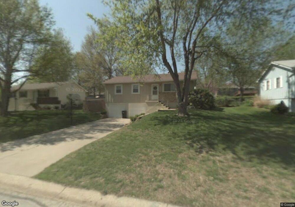
201 R Westminister Rd Blue Springs, MO 64014
Estimated Value: $196,000 - $232,000
3
Beds
2
Baths
1,184
Sq Ft
$180/Sq Ft
Est. Value
About This Home
This home is located at 201 R Westminister Rd, Blue Springs, MO 64014 and is currently estimated at $213,303, approximately $180 per square foot. 201 R Westminister Rd is a home located in Jackson County with nearby schools including William Bryant Elementary School, Moreland Ridge Middle School, and Blue Springs South High School.
Ownership History
Date
Name
Owned For
Owner Type
Purchase Details
Closed on
Apr 12, 2023
Sold by
Winston Real Estate Llc Le
Bought by
Stone Darryl Len
Current Estimated Value
Home Financials for this Owner
Home Financials are based on the most recent Mortgage that was taken out on this home.
Original Mortgage
$227,950
Outstanding Balance
$221,672
Interest Rate
6.65%
Mortgage Type
New Conventional
Estimated Equity
-$8,369
Purchase Details
Closed on
Sep 6, 2022
Sold by
Davis and Kimberly
Bought by
Winston Real Estate Llc
Home Financials for this Owner
Home Financials are based on the most recent Mortgage that was taken out on this home.
Original Mortgage
$175,000
Interest Rate
5.3%
Mortgage Type
Credit Line Revolving
Purchase Details
Closed on
Apr 21, 2016
Sold by
Pena Eliasar H and Moore Sharla N
Bought by
Davis Matthew
Purchase Details
Closed on
Apr 15, 2014
Sold by
Moore Sharla N and Pena Eliasar
Bought by
Moore Sharla N
Home Financials for this Owner
Home Financials are based on the most recent Mortgage that was taken out on this home.
Original Mortgage
$78,160
Interest Rate
4.36%
Mortgage Type
New Conventional
Purchase Details
Closed on
Jun 6, 2005
Sold by
Miller Jennifer and Miller Jennifer S
Bought by
Moore Sharla N
Home Financials for this Owner
Home Financials are based on the most recent Mortgage that was taken out on this home.
Original Mortgage
$90,200
Interest Rate
5.64%
Mortgage Type
Fannie Mae Freddie Mac
Purchase Details
Closed on
Mar 27, 2003
Sold by
Maske Frank W
Bought by
Wiesemann David and Wiesemann Sandra
Purchase Details
Closed on
Aug 5, 2000
Sold by
Maske Frank W and Maske Kimberly L
Bought by
Maske Frank W
Purchase Details
Closed on
Jul 25, 1996
Sold by
Hill Marc E and Hill Teresa Luanne
Bought by
Maske Frank W and Maske Kimberly L
Home Financials for this Owner
Home Financials are based on the most recent Mortgage that was taken out on this home.
Original Mortgage
$64,059
Interest Rate
8.41%
Mortgage Type
FHA
Create a Home Valuation Report for This Property
The Home Valuation Report is an in-depth analysis detailing your home's value as well as a comparison with similar homes in the area
Home Values in the Area
Average Home Value in this Area
Purchase History
| Date | Buyer | Sale Price | Title Company |
|---|---|---|---|
| Stone Darryl Len | -- | None Listed On Document | |
| Winston Real Estate Llc | -- | -- | |
| Davis Matthew | -- | First American Title | |
| Moore Sharla N | -- | Servicelink | |
| Moore Sharla N | -- | -- | |
| Wiesemann David | -- | Kansas City Title | |
| Maske Frank W | -- | -- | |
| Maske Frank W | -- | Old Republic Title Company |
Source: Public Records
Mortgage History
| Date | Status | Borrower | Loan Amount |
|---|---|---|---|
| Open | Stone Darryl Len | $227,950 | |
| Previous Owner | Winston Real Estate Llc | $175,000 | |
| Previous Owner | Moore Sharla N | $78,160 | |
| Previous Owner | Moore Sharla N | $90,200 | |
| Previous Owner | Maske Frank W | $64,059 |
Source: Public Records
Tax History Compared to Growth
Tax History
| Year | Tax Paid | Tax Assessment Tax Assessment Total Assessment is a certain percentage of the fair market value that is determined by local assessors to be the total taxable value of land and additions on the property. | Land | Improvement |
|---|---|---|---|---|
| 2025 | $2,308 | $23,870 | $6,253 | $17,617 |
| 2024 | $2,264 | $28,295 | $4,418 | $23,877 |
| 2023 | $2,264 | $28,295 | $4,264 | $24,031 |
| 2022 | $1,634 | $18,050 | $4,475 | $13,575 |
| 2021 | $1,633 | $18,050 | $4,475 | $13,575 |
| 2020 | $1,533 | $17,241 | $4,475 | $12,766 |
| 2019 | $1,482 | $17,241 | $4,475 | $12,766 |
| 2018 | $1,500 | $16,797 | $2,784 | $14,013 |
| 2017 | $1,459 | $16,797 | $2,784 | $14,013 |
| 2016 | $1,459 | $16,376 | $3,166 | $13,210 |
| 2014 | $1,435 | $16,055 | $3,104 | $12,951 |
Source: Public Records
Map
Nearby Homes
- 220 SE Kingscross Rd
- 1305 S Ward Pkwy
- 505 SE Gingerbread Ln
- 1616 SE 1st Street Terrace
- 1004 SE Gingerbread Ct
- 1628 SE 1st Street Terrace
- 1005 SE Alice St
- 1820 SW Keystone Dr
- 105 SW Windsor Ct
- 1917 SE Abbey St
- 613 SE Bugle Ct
- 1116 SE Sunnyside School Rd
- 1901 SW Gladstone Dr
- 4805 SW 6th St
- 4809 SW 6th St
- 417 SE Maxwell Dr
- 2115 S 7 Hwy
- 800 SE Cedrus Ln
- 2200 SE Pine Gate Cir
- 2601 SE 5th Street Ct
- 201 SE Westminister Rd
- 205 SE Westminister Rd
- 117 SE Westminister Rd
- 209 SE Westminister Rd
- 113 SE Westminister Rd
- 1501 SE Stratford St
- 200 SE Kingscross Rd
- 1500 SE Stratford St
- 116 SE Kingscross Rd
- 204 SE Kingscross Rd
- 112 SE Kingscross Rd
- 213 SE Westminister Rd
- 208 SE Kingscross Rd
- 109 SE Westminister Rd
- 204 SE Westminister Rd
- 1505 SE Stratford St
- 1504 SE Stratford St
- 1500 SE Abbey St
- 108 SE Kingscross Rd
- 212 SE Kingscross Rd