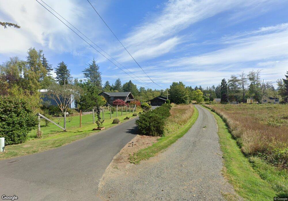
201 Railroad Ave Seaside, OR 97138
Woodland Park NeighborhoodEstimated Value: $764,000 - $891,000
3
Beds
2
Baths
2,537
Sq Ft
$318/Sq Ft
Est. Value
About This Home
This home is located at 201 Railroad Ave, Seaside, OR 97138 and is currently estimated at $806,229, approximately $317 per square foot. 201 Railroad Ave is a home located in Clatsop County with nearby schools including Seaside High School.
Ownership History
Date
Name
Owned For
Owner Type
Purchase Details
Closed on
Dec 18, 2012
Sold by
Baker Gretchen L
Bought by
Quckenbush Christopher J and Quckenbush Jill M
Current Estimated Value
Home Financials for this Owner
Home Financials are based on the most recent Mortgage that was taken out on this home.
Original Mortgage
$256,482
Outstanding Balance
$177,066
Interest Rate
3.37%
Mortgage Type
New Conventional
Estimated Equity
$629,163
Purchase Details
Closed on
Oct 5, 2009
Sold by
Baker Keith I
Bought by
Baker Gretchen L
Create a Home Valuation Report for This Property
The Home Valuation Report is an in-depth analysis detailing your home's value as well as a comparison with similar homes in the area
Home Values in the Area
Average Home Value in this Area
Purchase History
| Date | Buyer | Sale Price | Title Company |
|---|---|---|---|
| Quckenbush Christopher J | $265,000 | Ticor Title Ins Co | |
| Baker Gretchen L | -- | None Available |
Source: Public Records
Mortgage History
| Date | Status | Borrower | Loan Amount |
|---|---|---|---|
| Open | Quckenbush Christopher J | $256,482 |
Source: Public Records
Tax History Compared to Growth
Tax History
| Year | Tax Paid | Tax Assessment Tax Assessment Total Assessment is a certain percentage of the fair market value that is determined by local assessors to be the total taxable value of land and additions on the property. | Land | Improvement |
|---|---|---|---|---|
| 2025 | $4,924 | $450,841 | -- | -- |
| 2024 | $4,874 | $426,158 | -- | -- |
| 2023 | $4,738 | $413,746 | $0 | $0 |
| 2022 | $4,595 | $401,696 | $0 | $0 |
| 2021 | $4,691 | $389,997 | $0 | $0 |
| 2020 | $4,525 | $378,639 | $0 | $0 |
| 2019 | $4,409 | $367,611 | $0 | $0 |
| 2018 | $3,694 | $310,312 | $0 | $0 |
| 2017 | $3,597 | $301,274 | $0 | $0 |
| 2016 | $3,079 | $292,500 | $57,417 | $235,083 |
| 2015 | $2,943 | $283,981 | $55,745 | $228,236 |
| 2014 | $2,802 | $275,711 | $0 | $0 |
| 2013 | -- | $267,681 | $0 | $0 |
Source: Public Records
Map
Nearby Homes
- 3389 U S 101
- 3387-3389 U S 101
- 196 Dylan Ct
- 1265 D St
- 1324 Sea Ridge Ln
- 782 Woodland Ct
- 1065 Picture Place
- 1054 Picture Place
- 735 3rd St
- 2657 N Hwy 101 Unit 6
- 0 McCormick Garden Rd
- 0 Wellington Ave Unit 25-48
- 0 Wellington Ave Unit 1202
- 2624 Neawanna St
- 88161 McCormick Garden Rd
- 802 25th Ave
- 000 Neawanna St
- 0 Salminen Rd
- 1396 N Ocean Ave
- 101 13th St Unit 209
- 101 Railroad Ave
- 103 Railroad Ave
- 202 Railroad Ave
- 323 Railroad Ave
- 0 Railroad Ave
- 1513 Pacific Way
- 361 Railroad Ave
- 122 Railroad Ave
- 200 Railroad Ave
- 301 Park Ave
- 303 Hwy 101
- 1423 Pacific Way
- 303 U S 101
- 1677 Pacific Way
- 3379 Oregon Coast Hwy
- 3301 Hwy 101 N
- 3301 Highway 101 N
- 401 Railroad Ave
- 3281 Highway 101 N
- 3281 Hwy 101 N
