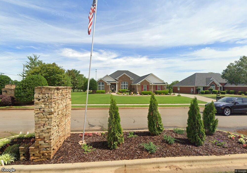
201 Rivershore Dr Huntsville, AL 35811
Ryland NeighborhoodEstimated Value: $424,000 - $485,397
--
Bed
--
Bath
2,850
Sq Ft
$161/Sq Ft
Est. Value
About This Home
This home is located at 201 Rivershore Dr, Huntsville, AL 35811 and is currently estimated at $460,099, approximately $161 per square foot. 201 Rivershore Dr is a home with nearby schools including Mt Carmel Elementary School, Riverton Intermediate School, and Buckhorn Middle School.
Ownership History
Date
Name
Owned For
Owner Type
Purchase Details
Closed on
Dec 28, 2010
Sold by
Huntsville Airport Self Storage Llc
Bought by
Lock Tight Inc
Current Estimated Value
Purchase Details
Closed on
Apr 26, 2007
Sold by
Sps Builders Inc
Bought by
Brown Marell T and Brown Barbara R
Home Financials for this Owner
Home Financials are based on the most recent Mortgage that was taken out on this home.
Original Mortgage
$219,920
Interest Rate
6.1%
Mortgage Type
New Conventional
Create a Home Valuation Report for This Property
The Home Valuation Report is an in-depth analysis detailing your home's value as well as a comparison with similar homes in the area
Home Values in the Area
Average Home Value in this Area
Purchase History
| Date | Buyer | Sale Price | Title Company |
|---|---|---|---|
| Lock Tight Inc | -- | -- | |
| Brown Marell T | -- | -- |
Source: Public Records
Mortgage History
| Date | Status | Borrower | Loan Amount |
|---|---|---|---|
| Previous Owner | Brown Marell T | $219,920 |
Source: Public Records
Tax History Compared to Growth
Tax History
| Year | Tax Paid | Tax Assessment Tax Assessment Total Assessment is a certain percentage of the fair market value that is determined by local assessors to be the total taxable value of land and additions on the property. | Land | Improvement |
|---|---|---|---|---|
| 2024 | $1,633 | $45,140 | $8,000 | $37,140 |
| 2023 | $1,576 | $42,160 | $8,000 | $34,160 |
| 2022 | $1,209 | $34,780 | $4,000 | $30,780 |
| 2021 | $1,088 | $31,460 | $4,000 | $27,460 |
| 2020 | $975 | $28,350 | $4,000 | $24,350 |
| 2019 | $934 | $27,240 | $4,000 | $23,240 |
| 2018 | $878 | $25,700 | $0 | $0 |
| 2017 | $854 | $25,040 | $0 | $0 |
| 2016 | $854 | $25,040 | $0 | $0 |
| 2015 | $854 | $25,040 | $0 | $0 |
| 2014 | $888 | $25,960 | $0 | $0 |
Source: Public Records
Map
Nearby Homes
- 309 Wanto Ln
- 121 Headen Ln
- 115 Ranna Dr
- 121 Ranna Dr
- 125 Ranna Dr
- 304 Wanto Ln
- 302 Wanto Ln
- The Shelburne Plan at Blue Ridge at Mount Carmel - Signature Series
- The Lincoln Plan at Blue Ridge at Mount Carmel - Signature Series
- The Jamestown Plan at Blue Ridge at Mount Carmel - Founders Series
- The Winston Plan at Blue Ridge at Mount Carmel - Signature Series
- The Raleigh Plan at Blue Ridge at Mount Carmel - Signature Series
- The Cambridge Plan at Blue Ridge at Mount Carmel - Signature Series
- The Savannah Plan at Blue Ridge at Mount Carmel - Signature Series
- The Potomac Plan at Blue Ridge at Mount Carmel - Founders Series
- The Lexington Plan at Blue Ridge at Mount Carmel - Founders Series
- The Bennington Plan at Blue Ridge at Mount Carmel - Signature Series
- The Manhattan Plan at Blue Ridge at Mount Carmel - Signature Series
- The Franklin Plan at Blue Ridge at Mount Carmel - Founders Series
- The Charleston Plan at Blue Ridge at Mount Carmel - Signature Series
- 203 Rivershore Dr
- 205 Rivershore Dr
- 200 Rivershore Dr
- 202 Rivershore Dr
- 204 Rivershore Dr
- 207 Rivershore Dr
- 781 Homer Nance Rd
- 209 Rivershore Dr
- 100 Pineda Dr
- 101 Pineda Dr
- 103 Pineda Dr
- 211 Rivershore Dr
- 106 Pineda Dr
- 113 Headen Ln
- 105 Pineda Dr
- 100 Sebastian Dr
- 213 Rivershore Dr
- 115 Headen Ln
- 103 Ranna Dr
- 108 Pineda Dr