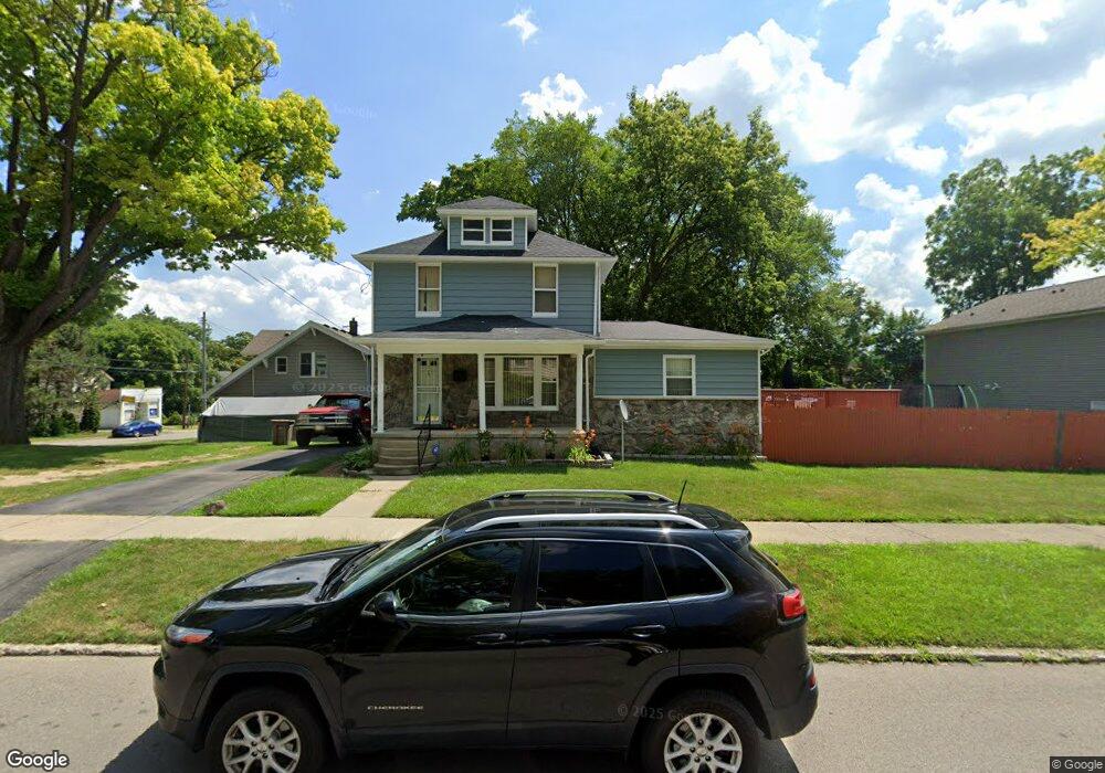
201 S Jessie St Pontiac, MI 48342
Estimated Value: $137,000 - $250,000
4
Beds
2
Baths
1,646
Sq Ft
$106/Sq Ft
Est. Value
About This Home
This home is located at 201 S Jessie St, Pontiac, MI 48342 and is currently estimated at $175,175, approximately $106 per square foot. 201 S Jessie St is a home located in Oakland County with nearby schools including Walt Whitman Elementary School, Pontiac Middle School, and Pontiac High School.
Ownership History
Date
Name
Owned For
Owner Type
Purchase Details
Closed on
Sep 24, 2020
Sold by
Brent Annie P
Bought by
Stewart Robert Cornelius and Stewart Robert Cornelius
Current Estimated Value
Home Financials for this Owner
Home Financials are based on the most recent Mortgage that was taken out on this home.
Original Mortgage
$69,000
Outstanding Balance
$61,260
Interest Rate
2.8%
Mortgage Type
New Conventional
Estimated Equity
$113,915
Purchase Details
Closed on
Aug 9, 2010
Sold by
Stewart Felicia K
Bought by
Stewart Robert Cornelius
Create a Home Valuation Report for This Property
The Home Valuation Report is an in-depth analysis detailing your home's value as well as a comparison with similar homes in the area
Home Values in the Area
Average Home Value in this Area
Purchase History
| Date | Buyer | Sale Price | Title Company |
|---|---|---|---|
| Stewart Robert Cornelius | -- | First American Title | |
| Stewart Robert Cornelius | -- | None Available |
Source: Public Records
Mortgage History
| Date | Status | Borrower | Loan Amount |
|---|---|---|---|
| Open | Stewart Robert Cornelius | $69,000 |
Source: Public Records
Tax History Compared to Growth
Tax History
| Year | Tax Paid | Tax Assessment Tax Assessment Total Assessment is a certain percentage of the fair market value that is determined by local assessors to be the total taxable value of land and additions on the property. | Land | Improvement |
|---|---|---|---|---|
| 2024 | $790 | $40,850 | $0 | $0 |
| 2023 | $753 | $35,650 | $0 | $0 |
| 2022 | $794 | $31,160 | $0 | $0 |
| 2021 | $771 | $27,750 | $0 | $0 |
| 2020 | $684 | $25,100 | $0 | $0 |
| 2019 | $745 | $22,010 | $0 | $0 |
| 2018 | $713 | $19,180 | $0 | $0 |
| 2017 | $678 | $18,620 | $0 | $0 |
| 2016 | $705 | $18,390 | $0 | $0 |
| 2015 | -- | $17,450 | $0 | $0 |
| 2014 | -- | $17,030 | $0 | $0 |
| 2011 | -- | $25,490 | $0 | $0 |
Source: Public Records
Map
Nearby Homes
- 328 Whittemore St
- 397 S Jessie St
- 000 Wall St
- 187 Wall St
- 176 S Francis Ave
- 389 Osmun St
- 18 S Shirley St
- 33 S Tasmania St
- 505 Auburn Ave
- 53 N Roselawn St
- 0 Woodward Ave
- 55 N Roselawn St
- 472 S Jessie St
- 57 N Roselawn St
- 511 E Pike St
- 59 Bellevue St
- 54 Bellevue St
- 70 N Roselawn St
- 28 S Marshall St
- 97 N Roselawn St
- 211 S Jessie St
- 310 Whittemore St
- 306 Whittemore St
- 314 Whittemore St
- 191 Willard St
- 221 S Jessie St
- 318 Whittemore St
- 290 Whittemore St
- 185 S Jessie St
- 210 S Jessie St
- 195 Willard St
- 171 Willard St
- 320 Whittemore St
- 199 Willard St
- 324 Whittemore St
- 280 Whittemore St
- 205 Willard St
- 165 Willard St
- 201 Willard St
- 291 Whittemore St