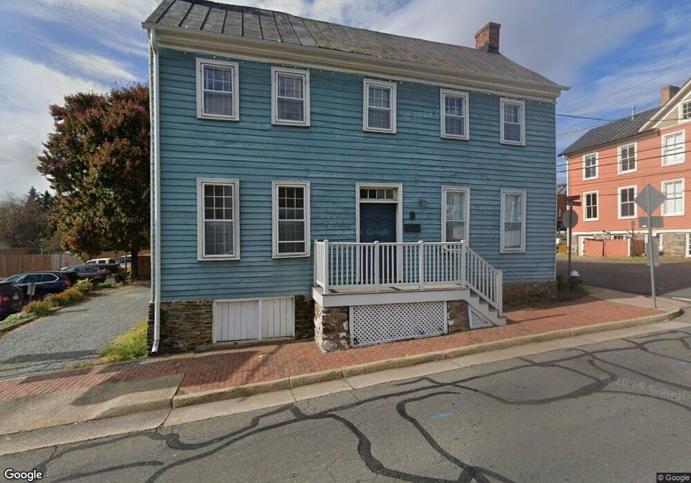
201 S King St Leesburg, VA 20175
Estimated Value: $642,597
--
Bed
--
Bath
3,136
Sq Ft
$205/Sq Ft
Est. Value
About This Home
This home is located at 201 S King St, Leesburg, VA 20175 and is currently priced at $642,597, approximately $204 per square foot. 201 S King St is a home located in Loudoun County with nearby schools including Frances Hazel Reid Elementary School, Smart's Mill Middle School, and Tuscarora High School.
Ownership History
Date
Name
Owned For
Owner Type
Purchase Details
Closed on
Aug 8, 2025
Sold by
Bffk Associates
Bought by
201 South King Street Llc
Current Estimated Value
Home Financials for this Owner
Home Financials are based on the most recent Mortgage that was taken out on this home.
Original Mortgage
$541,250
Outstanding Balance
$533,645
Interest Rate
6.77%
Mortgage Type
Seller Take Back
Estimated Equity
$108,952
Create a Home Valuation Report for This Property
The Home Valuation Report is an in-depth analysis detailing your home's value as well as a comparison with similar homes in the area
Home Values in the Area
Average Home Value in this Area
Purchase History
| Date | Buyer | Sale Price | Title Company |
|---|---|---|---|
| 201 South King Street Llc | $641,250 | Commonwealth Land Title |
Source: Public Records
Mortgage History
| Date | Status | Borrower | Loan Amount |
|---|---|---|---|
| Open | 201 South King Street Llc | $541,250 |
Source: Public Records
Tax History Compared to Growth
Tax History
| Year | Tax Paid | Tax Assessment Tax Assessment Total Assessment is a certain percentage of the fair market value that is determined by local assessors to be the total taxable value of land and additions on the property. | Land | Improvement |
|---|---|---|---|---|
| 2025 | $4,309 | $535,240 | $209,100 | $326,140 |
| 2024 | $4,517 | $522,200 | $209,100 | $313,100 |
| 2023 | $4,659 | $532,420 | $209,100 | $323,320 |
| 2022 | $4,547 | $510,940 | $209,100 | $301,840 |
| 2021 | $4,884 | $498,380 | $278,700 | $219,680 |
| 2020 | $5,246 | $506,860 | $278,700 | $228,160 |
| 2019 | $5,446 | $521,190 | $278,700 | $242,490 |
| 2018 | $6,194 | $570,850 | $278,700 | $292,150 |
| 2017 | $6,422 | $570,850 | $278,700 | $292,150 |
| 2016 | $6,536 | $570,850 | $0 | $0 |
| 2015 | $1,025 | $281,660 | $0 | $281,660 |
| 2014 | $1,036 | $287,440 | $0 | $287,440 |
Source: Public Records
Map
Nearby Homes
- 2 Stationmaster St SE Unit 301
- 2 Stationmaster St SE Unit 302
- 3 Stationmaster St SE Unit 402
- 3 Stationmaster St SE Unit 201
- 5 Stationmaster St SE Unit 202
- 414 Madison Ct SE
- 109 Belmont Dr SW
- 0 Loudoun St SW Unit VALO2106424
- 314 Rock Spring Dr SW
- 227 Dry Mill Rd SW
- 304 Lafayette Place SW
- 222 Wirt St NW
- 409 Wingate Place SW
- 332 Loudoun St SW
- 411 Bicksler Square SE
- 426 Ironsides Square SE
- 265 High Rail Terrace SE
- 239 Old Waterford Rd NW
- 276 Ariel Dr NE
- 293 Ariel Dr NE