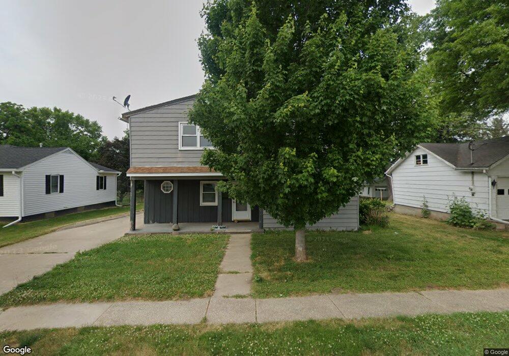
201 S Stewart St Geneseo, IL 61254
Estimated Value: $104,000 - $119,000
5
Beds
--
Bath
1,048
Sq Ft
$105/Sq Ft
Est. Value
About This Home
This home is located at 201 S Stewart St, Geneseo, IL 61254 and is currently estimated at $110,095, approximately $105 per square foot. 201 S Stewart St is a home located in Henry County with nearby schools including Geneseo High School and St. Malachy School.
Ownership History
Date
Name
Owned For
Owner Type
Purchase Details
Closed on
Jul 23, 2021
Sold by
Borkgren Rhonda
Bought by
Johnson Jason and Johnson Jason Brent
Current Estimated Value
Home Financials for this Owner
Home Financials are based on the most recent Mortgage that was taken out on this home.
Original Mortgage
$75,000
Outstanding Balance
$68,020
Interest Rate
2.87%
Mortgage Type
New Conventional
Estimated Equity
$42,075
Purchase Details
Closed on
Feb 21, 2012
Sold by
Mcginnis Fredrick Lamar
Bought by
Borkgren Rhonda and Pierson Heather
Create a Home Valuation Report for This Property
The Home Valuation Report is an in-depth analysis detailing your home's value as well as a comparison with similar homes in the area
Home Values in the Area
Average Home Value in this Area
Purchase History
| Date | Buyer | Sale Price | Title Company |
|---|---|---|---|
| Johnson Jason | $80,000 | None Available | |
| Borkgren Rhonda | -- | None Available |
Source: Public Records
Mortgage History
| Date | Status | Borrower | Loan Amount |
|---|---|---|---|
| Open | Johnson Jason | $75,000 |
Source: Public Records
Tax History Compared to Growth
Tax History
| Year | Tax Paid | Tax Assessment Tax Assessment Total Assessment is a certain percentage of the fair market value that is determined by local assessors to be the total taxable value of land and additions on the property. | Land | Improvement |
|---|---|---|---|---|
| 2024 | $2,588 | $31,838 | $6,075 | $25,763 |
| 2023 | $2,300 | $28,997 | $5,533 | $23,464 |
| 2022 | $2,190 | $26,949 | $5,142 | $21,807 |
| 2021 | $1,558 | $19,075 | $5,012 | $14,063 |
| 2020 | $1,551 | $19,252 | $5,058 | $14,194 |
| 2019 | $1,502 | $19,038 | $5,002 | $14,036 |
| 2018 | $1,425 | $17,995 | $4,728 | $13,267 |
| 2017 | $1,340 | $17,539 | $4,608 | $12,931 |
| 2016 | $1,399 | $17,094 | $4,491 | $12,603 |
| 2015 | $2,906 | $17,060 | $4,482 | $12,578 |
| 2013 | $2,906 | $16,741 | $4,398 | $12,343 |
Source: Public Records
Map
Nearby Homes
- 101 S Stewart St
- 335 S Stewart St
- 127 N Vail St
- 139 N Vail St
- 326 N Vail St
- 227 N State St
- 629 W Wells St
- 19025 Bluff Rd
- 513 W Elk St
- 608 S Oakwood Ave
- 522 N State St
- 317 E South St
- 228 E Locust St
- 417 E Orange St
- 513 E Pearl St
- 909 S Spring St
- 549 E Park St
- 336 E Ogden Ave
- 623 E Park St
- 407 N Chicago St
- 207 S Stewart St
- 135 S Stewart St
- 131 S Stewart St
- 211 S Stewart St
- 200 S Stewart St
- 523 W 2nd St
- 125 S Stewart St
- 217 S Stewart St
- 516 W 2nd St
- 221 S Stewart St
- 120 S Stewart St
- 517 W 2nd St
- 512 W 2nd St
- 225 S Stewart St
- 515 W 2nd St
- 525 W North St
- 112 S Stewart St
- 517 W North St
- 229 S Stewart St
- 511 W 2nd St