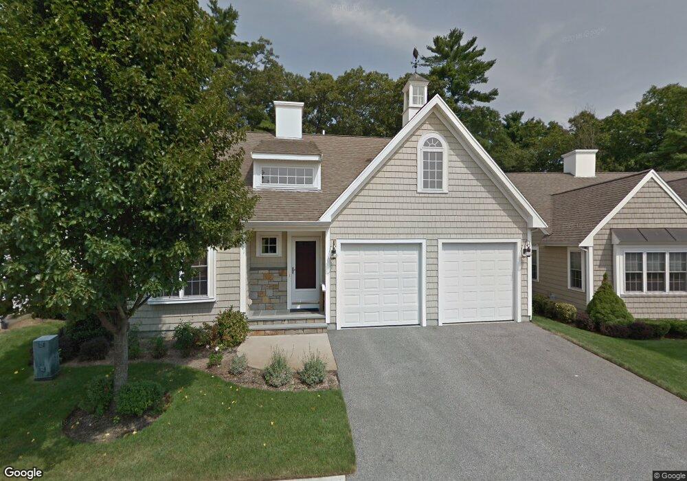
201 Sandtrap Cir South Weymouth, MA 02190
South Weymouth NeighborhoodEstimated Value: $910,000 - $1,052,000
2
Beds
3
Baths
2,300
Sq Ft
$435/Sq Ft
Est. Value
About This Home
This home is located at 201 Sandtrap Cir, South Weymouth, MA 02190 and is currently estimated at $999,638, approximately $434 per square foot. 201 Sandtrap Cir is a home located in Norfolk County with nearby schools including Thomas W. Hamilton Primary School, Abigail Adams Middle School, and Weymouth Middle School Chapman.
Ownership History
Date
Name
Owned For
Owner Type
Purchase Details
Closed on
Apr 27, 2017
Sold by
Lane Michael P and Lane Denise A
Bought by
Michael P Lane Lt
Current Estimated Value
Purchase Details
Closed on
May 20, 2016
Sold by
Coll Daniel J and Coll Judith
Bought by
Lane Michael P and Lane Denise A
Purchase Details
Closed on
May 28, 2013
Sold by
Norris Donald A and Norris Doris E
Bought by
Coll Daniel J and Coll Judith
Home Financials for this Owner
Home Financials are based on the most recent Mortgage that was taken out on this home.
Original Mortgage
$335,000
Interest Rate
3.45%
Mortgage Type
New Conventional
Purchase Details
Closed on
May 16, 2005
Sold by
Weathervane Dev Corp
Bought by
Norris Donald A and Norris Doris E
Home Financials for this Owner
Home Financials are based on the most recent Mortgage that was taken out on this home.
Original Mortgage
$75,000
Interest Rate
6.05%
Mortgage Type
Purchase Money Mortgage
Create a Home Valuation Report for This Property
The Home Valuation Report is an in-depth analysis detailing your home's value as well as a comparison with similar homes in the area
Home Values in the Area
Average Home Value in this Area
Purchase History
| Date | Buyer | Sale Price | Title Company |
|---|---|---|---|
| Michael P Lane Lt | -- | -- | |
| Lane Michael P | $589,900 | -- | |
| Coll Daniel J | $535,000 | -- | |
| Norris Donald A | $532,850 | -- |
Source: Public Records
Mortgage History
| Date | Status | Borrower | Loan Amount |
|---|---|---|---|
| Previous Owner | Coll Daniel J | $335,000 | |
| Previous Owner | Coll Daniel J | $75,000 | |
| Previous Owner | Norris Donald A | $75,000 |
Source: Public Records
Tax History Compared to Growth
Tax History
| Year | Tax Paid | Tax Assessment Tax Assessment Total Assessment is a certain percentage of the fair market value that is determined by local assessors to be the total taxable value of land and additions on the property. | Land | Improvement |
|---|---|---|---|---|
| 2025 | $9,595 | $950,000 | $0 | $950,000 |
| 2024 | $9,320 | $907,500 | $0 | $907,500 |
| 2023 | $8,170 | $781,800 | $0 | $781,800 |
| 2022 | $8,176 | $713,400 | $0 | $713,400 |
| 2021 | $8,015 | $682,700 | $0 | $682,700 |
| 2020 | $7,642 | $641,100 | $0 | $641,100 |
| 2019 | $7,442 | $614,000 | $0 | $614,000 |
| 2018 | $7,198 | $575,800 | $0 | $575,800 |
| 2017 | $7,066 | $551,600 | $0 | $551,600 |
| 2016 | $6,925 | $541,000 | $0 | $541,000 |
| 2015 | $6,665 | $516,700 | $0 | $516,700 |
| 2014 | $6,735 | $506,400 | $0 | $506,400 |
Source: Public Records
Map
Nearby Homes
- 18 Ben Hogan Landing Unit 18
- 17 Buchanan Ln
- 79 Tilden Rd
- 299 Union St
- 17 Sears Rd
- 26 Leahaven Rd
- 540 Union St
- 4 Edward Cody Ln
- 102 White St
- 25 Wales Ave
- 279 Pine St
- 446 Ralph Talbot St
- 197 White St
- 41 Oak St
- 5 Oak St
- 206 Pine St
- 45 Union St
- 261 Pleasant St Unit 5
- 82 Snowbird Ave
- 65 Webster St Unit 401
- 201 Sandtrap Cir Unit 201
- 205 Sandtrap Cir
- 205 Sandtrap Cir Unit 205
- 197 Sandtrap Cir
- 193 Sandtrap Cir
- 27 Mulligan Dr
- 207 Sandtrap Cir
- 204 Sandtrap Cir
- 196 Sandtrap Cir
- 23 Mulligan Dr
- 212 Sandtrap Cir
- 7 Mulligan Dr
- 187 Sandtrap Cir
- 17 Mulligan Dr
- 17 Mulligan Dr Unit 17
- 190 Sandtrap Cir
- 33 Mulligan Dr
- 181 Sandtrap Cir
- 186 Sandtrap Cir
- 186 Sandtrap Cir Unit 45