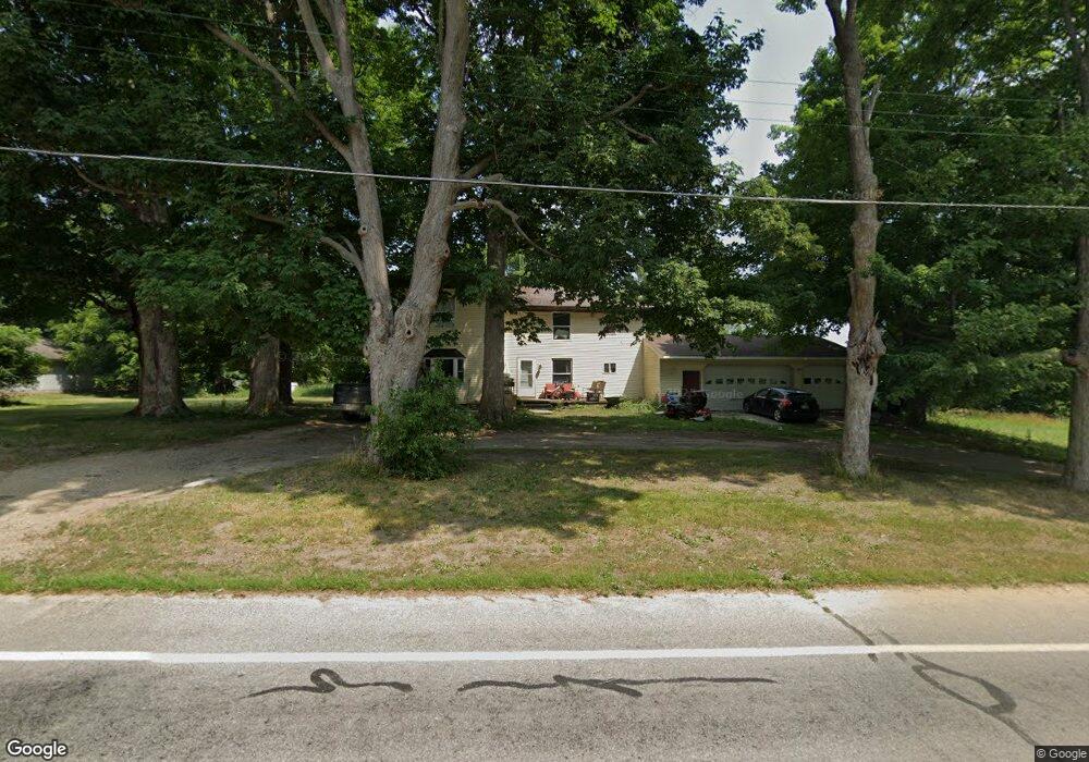
201 Smith St Crystal, MI 48818
Estimated Value: $191,000 - $244,000
4
Beds
2
Baths
2,266
Sq Ft
$93/Sq Ft
Est. Value
About This Home
This home is located at 201 Smith St, Crystal, MI 48818 and is currently estimated at $210,110, approximately $92 per square foot. 201 Smith St is a home located in Montcalm County with nearby schools including Carson City Elementary School, Carson City-Crystal Upper Elementary/Middle School, and Carson City-Crystal High School.
Ownership History
Date
Name
Owned For
Owner Type
Purchase Details
Closed on
Nov 19, 2018
Sold by
Huber Marie A
Bought by
Huber Marc A
Current Estimated Value
Purchase Details
Closed on
Oct 24, 2018
Sold by
Huber Heather M
Bought by
Huber Marc A
Purchase Details
Closed on
Jul 10, 2017
Sold by
Huber Marc A
Bought by
Huber Marc A and Huber Heather
Purchase Details
Closed on
Feb 8, 2010
Sold by
Federal Home Loan Mortgage Corporation
Bought by
Huber Marc A
Purchase Details
Closed on
Sep 10, 1996
Sold by
Cheseboro Troy and Cheseboro Rachel
Bought by
Cheseboro Troy and Cheseboro Rachel
Purchase Details
Closed on
Jun 23, 1994
Sold by
Brady John P and Brady Sharon K
Bought by
Cheseboro Troy and Cheseboro Rachel
Create a Home Valuation Report for This Property
The Home Valuation Report is an in-depth analysis detailing your home's value as well as a comparison with similar homes in the area
Purchase History
| Date | Buyer | Sale Price | Title Company |
|---|---|---|---|
| Huber Marc A | -- | -- | |
| Huber Marc A | -- | -- | |
| Huber Marc A | -- | None Available | |
| Huber Marc A | $27,000 | -- | |
| Cheseboro Troy | -- | -- | |
| Cheseboro Troy | $32,000 | -- |
Source: Public Records
Tax History
| Year | Tax Paid | Tax Assessment Tax Assessment Total Assessment is a certain percentage of the fair market value that is determined by local assessors to be the total taxable value of land and additions on the property. | Land | Improvement |
|---|---|---|---|---|
| 2025 | $1,618 | $86,100 | $0 | $0 |
| 2024 | $1,109 | $78,400 | $0 | $0 |
| 2023 | -- | $75,000 | $0 | $0 |
Source: Public Records
Map
Nearby Homes
- 305 E Lasalle St
- 802 Parker St
- 8652 E Colby Rd
- 8386 E Sidney Rd
- 2695 Ovid St
- 1283 S Waldron Rd
- 2100 Strait Tow Blvd
- 890 S Senator Rd
- 1050 Wicker Rd SE
- 4337 Holland Lake Rd
- 3545 S Roy Dr
- 4218 E Klees Rd
- Lot A Blackmer Rd
- 7518 S Crystal Rd
- 6758 S Mount Hope Rd
- 5019 S Townhall Rd
- 8093 S Bloomer St
- 115 N 2nd St
- 3990 N Ferris Rd
- 4685 Meadow View Dr
Your Personal Tour Guide
Ask me questions while you tour the home.