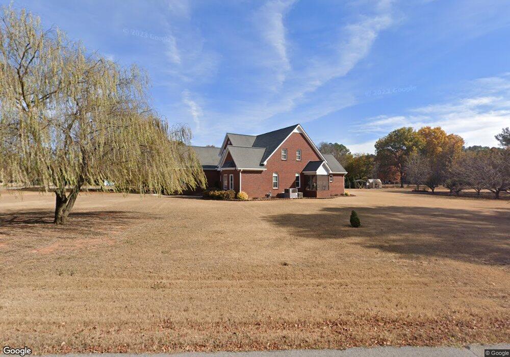
201 Springhill Rd NW Huntsville, AL 35806
Research Park NeighborhoodEstimated Value: $671,000 - $806,000
--
Bed
1
Bath
4,327
Sq Ft
$169/Sq Ft
Est. Value
About This Home
This home is located at 201 Springhill Rd NW, Huntsville, AL 35806 and is currently estimated at $729,858, approximately $168 per square foot. 201 Springhill Rd NW is a home with nearby schools including Monrovia Elementary School, Monrovia Middle School, and Sparkman High School.
Ownership History
Date
Name
Owned For
Owner Type
Purchase Details
Closed on
Jul 28, 2005
Sold by
Frazier Albert Bruno and Frazier Henry Buchanan
Bought by
Beighley Kay L and Wise Mark O
Current Estimated Value
Home Financials for this Owner
Home Financials are based on the most recent Mortgage that was taken out on this home.
Original Mortgage
$182,500
Interest Rate
5.59%
Mortgage Type
New Conventional
Create a Home Valuation Report for This Property
The Home Valuation Report is an in-depth analysis detailing your home's value as well as a comparison with similar homes in the area
Home Values in the Area
Average Home Value in this Area
Purchase History
| Date | Buyer | Sale Price | Title Company |
|---|---|---|---|
| Beighley Kay L | $300,000 | None Available |
Source: Public Records
Mortgage History
| Date | Status | Borrower | Loan Amount |
|---|---|---|---|
| Closed | Beighley Kay L | $182,500 |
Source: Public Records
Tax History Compared to Growth
Tax History
| Year | Tax Paid | Tax Assessment Tax Assessment Total Assessment is a certain percentage of the fair market value that is determined by local assessors to be the total taxable value of land and additions on the property. | Land | Improvement |
|---|---|---|---|---|
| 2024 | $2,193 | $62,140 | $9,000 | $53,140 |
| 2023 | $2,193 | $62,140 | $9,000 | $53,140 |
| 2022 | $1,943 | $55,300 | $9,000 | $46,300 |
| 2021 | $1,819 | $51,900 | $9,000 | $42,900 |
| 2020 | $1,803 | $51,390 | $8,500 | $42,890 |
| 2019 | $1,803 | $51,390 | $8,500 | $42,890 |
| 2018 | $1,779 | $50,760 | $0 | $0 |
| 2017 | $1,779 | $50,760 | $0 | $0 |
| 2016 | $1,779 | $50,760 | $0 | $0 |
| 2015 | $1,779 | $50,760 | $0 | $0 |
| 2014 | $1,708 | $48,800 | $0 | $0 |
Source: Public Records
Map
Nearby Homes
- 0 County Road 118
- 146 Springhill Rd NW
- 1224 Smooth Stone Trail
- 6426 Dunnavant Place NW
- 1272 Smooth Stone Trail
- 1273 Smooth Stone Trail
- 1219 Smooth Stone Trail
- 1214 Smooth Stone Trail
- 6414 Dunnavant Place NW
- 6404 Lenox Hill Way
- 6422 Lenox Hill Way
- 6453 Lincoln Park Place NW
- 6426 Lenox Hill Way
- 6417 Lenox Hill Way
- 6423 Lenox Hill Way
- 6425 Lenox Hill Way
- 6429 Lenox Hill Way
- 6408 Midtowne Ln NW
- 1311 Towne Creek Place NW
- 1152 Towne Creek Place NW
- 100 Shawnee Dr NW
- 108 Country Rd NW
- 101 Shawnee Dr NW
- 222 Springhill Rd NW
- 128 Country Rd NW
- 149 Country Rd NW
- 162 Springhill Rd NW
- 161 Springhill Rd NW
- 148 Country Rd NW
- 102 Shawnee Dr NW
- 161 Country Rd NW
- 234 Springhill Rd NW
- 160 Country Rd NW
- 255 Springhill Rd NW
- 179 Country Rd NW
- 6647 Highway 72 W
- 262 Springhill Rd NW
- 172 Country Rd NW
- 106 Shawnee Dr NW
- 319 Springhill Rd NW