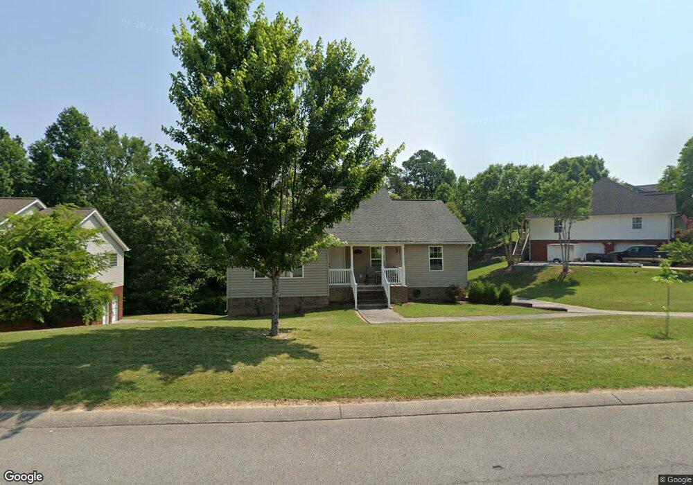
201 Stanford Dr Flintstone, GA 30725
High Point NeighborhoodEstimated Value: $308,000 - $385,000
3
Beds
2
Baths
1,376
Sq Ft
$240/Sq Ft
Est. Value
About This Home
This home is located at 201 Stanford Dr, Flintstone, GA 30725 and is currently estimated at $330,468, approximately $240 per square foot. 201 Stanford Dr is a home located in Walker County with nearby schools including Chattanooga Valley Elementary School, Chattanooga Valley Middle School, and Ridgeland High School.
Ownership History
Date
Name
Owned For
Owner Type
Purchase Details
Closed on
Mar 31, 2006
Sold by
Not Provided
Bought by
Allison Joan L and Allison David G
Current Estimated Value
Home Financials for this Owner
Home Financials are based on the most recent Mortgage that was taken out on this home.
Original Mortgage
$114,320
Outstanding Balance
$65,087
Interest Rate
6.2%
Mortgage Type
New Conventional
Estimated Equity
$265,381
Purchase Details
Closed on
Jun 11, 2004
Sold by
Baker & Summers Construction
Bought by
Walker Ronald F
Purchase Details
Closed on
Feb 14, 2003
Bought by
Baker & Summers Construction
Create a Home Valuation Report for This Property
The Home Valuation Report is an in-depth analysis detailing your home's value as well as a comparison with similar homes in the area
Home Values in the Area
Average Home Value in this Area
Purchase History
| Date | Buyer | Sale Price | Title Company |
|---|---|---|---|
| Allison Joan L | $142,900 | -- | |
| Walker Ronald F | $20,000 | -- | |
| Baker & Summers Construction | $456,000 | -- |
Source: Public Records
Mortgage History
| Date | Status | Borrower | Loan Amount |
|---|---|---|---|
| Open | Allison Joan L | $114,320 | |
| Closed | Allison Joan L | $14,290 |
Source: Public Records
Tax History Compared to Growth
Tax History
| Year | Tax Paid | Tax Assessment Tax Assessment Total Assessment is a certain percentage of the fair market value that is determined by local assessors to be the total taxable value of land and additions on the property. | Land | Improvement |
|---|---|---|---|---|
| 2024 | $2,498 | $112,458 | $16,000 | $96,458 |
| 2023 | $2,434 | $107,188 | $16,000 | $91,188 |
| 2022 | $2,304 | $93,350 | $16,000 | $77,350 |
| 2021 | $1,983 | $72,016 | $10,000 | $62,016 |
| 2020 | $1,757 | $60,996 | $10,000 | $50,996 |
| 2019 | $1,788 | $60,996 | $10,000 | $50,996 |
| 2018 | $1,614 | $60,996 | $10,000 | $50,996 |
| 2017 | $1,712 | $52,849 | $4,000 | $48,849 |
| 2016 | $1,374 | $52,849 | $4,000 | $48,849 |
| 2015 | $1,530 | $55,732 | $4,800 | $50,932 |
| 2014 | $1,421 | $55,732 | $4,800 | $50,932 |
| 2013 | -- | $55,732 | $4,800 | $50,932 |
Source: Public Records
Map
Nearby Homes
- 433 Stanford Dr
- 0 Roundtree Ct Unit 1514898
- 0 Roundtree Ct Unit RTC2914889
- 144 N Victor Dr
- 3509 N Highway N 341
- 301 Hidden Oaks Dr
- 3269 N Highway 341
- 1080 Harp Switch Rd
- 2751 N Highway 341
- 12 Mark Cir
- 757 W Schmitt Rd
- 221 Highland Dr
- 426 Simmons Tawzer Rd
- 201 Laurelwood Cir
- 16 Japonica St
- 58 Japonica St
- 404 W Schmitt Rd
- 413 Harp Switch Rd
- 244 Haven Hill
- 309 W Schmitt Rd
- 225 Stanford Dr
- 177 Stanford Dr
- 0 Stanford Dr Unit 1023350
- 0 Stanford Dr Unit 1024482
- 0 Stanford Dr Unit LT 13 1023350
- 0 Stanford Dr Unit 113 1024482
- 0 Stanford Dr Unit 1013614
- 186 Stanford Dr
- 220 Stanford Dr
- 204 Stanford Dr
- 161 Stanford Dr
- 164 Stanford Dr
- 9 Zackry Trace
- 252 Stanford Dr
- 39 Zackry Trace
- 85 Zackry Trace
- 57 Zackry Trace
- 143 Stanford Dr
- 142 Stanford Dr
- 268 Stanford Dr