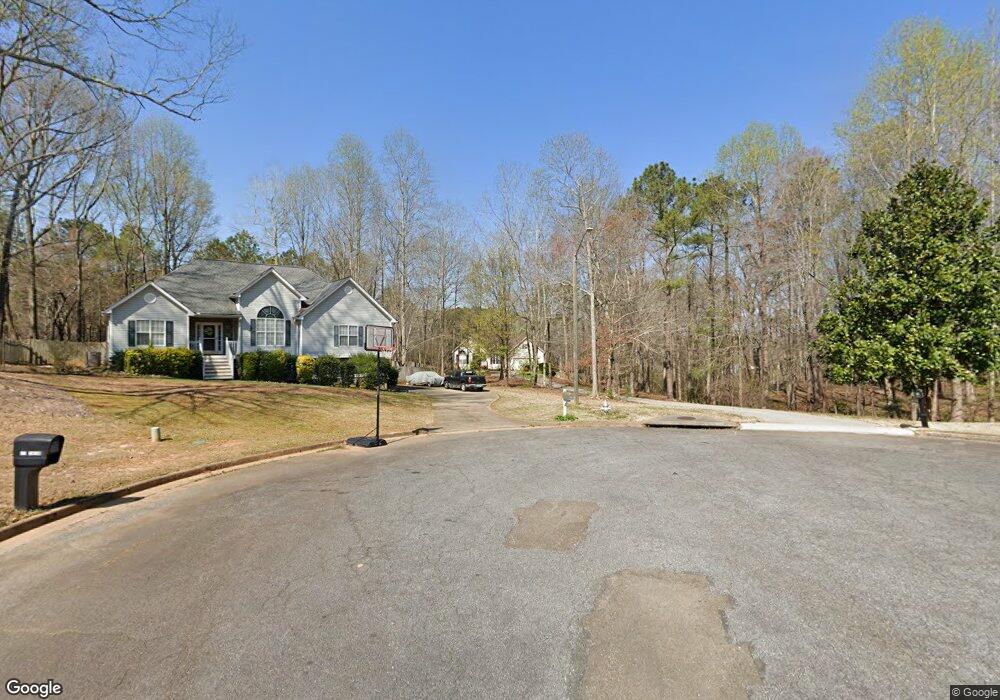
201 Sundown Dr Acworth, GA 30102
Oak Grove NeighborhoodEstimated Value: $440,000 - $531,542
3
Beds
2
Baths
3,632
Sq Ft
$134/Sq Ft
Est. Value
About This Home
This home is located at 201 Sundown Dr, Acworth, GA 30102 and is currently estimated at $485,771, approximately $133 per square foot. 201 Sundown Dr is a home located in Cherokee County with nearby schools including Oak Grove Elementary School, E. T. Booth Middle School, and Etowah High School.
Ownership History
Date
Name
Owned For
Owner Type
Purchase Details
Closed on
Apr 7, 2017
Sold by
Oquinn Dwight W
Bought by
Cook Christie T and Cook Charles Gary
Current Estimated Value
Purchase Details
Closed on
Dec 8, 2005
Sold by
Baxter James A and Baxter Hillary K
Bought by
Oquinn Dwight W and Oquinn Shelene M
Home Financials for this Owner
Home Financials are based on the most recent Mortgage that was taken out on this home.
Original Mortgage
$227,156
Interest Rate
6.28%
Mortgage Type
VA
Purchase Details
Closed on
Jun 24, 1999
Sold by
Lance Builders Inc
Bought by
Baxter James A and Baxter Hillary K
Home Financials for this Owner
Home Financials are based on the most recent Mortgage that was taken out on this home.
Original Mortgage
$144,550
Interest Rate
7.27%
Mortgage Type
New Conventional
Create a Home Valuation Report for This Property
The Home Valuation Report is an in-depth analysis detailing your home's value as well as a comparison with similar homes in the area
Home Values in the Area
Average Home Value in this Area
Purchase History
| Date | Buyer | Sale Price | Title Company |
|---|---|---|---|
| Cook Christie T | $247,000 | -- | |
| Oquinn Dwight W | $219,900 | -- | |
| Baxter James A | $152,200 | -- |
Source: Public Records
Mortgage History
| Date | Status | Borrower | Loan Amount |
|---|---|---|---|
| Previous Owner | Oquinn Dwight W | $227,156 | |
| Previous Owner | Baxter James A | $144,550 |
Source: Public Records
Tax History
| Year | Tax Paid | Tax Assessment Tax Assessment Total Assessment is a certain percentage of the fair market value that is determined by local assessors to be the total taxable value of land and additions on the property. | Land | Improvement |
|---|---|---|---|---|
| 2025 | $1,169 | $186,160 | $38,400 | $147,760 |
| 2024 | $1,130 | $179,520 | $38,400 | $141,120 |
| 2023 | $1,010 | $185,480 | $36,000 | $149,480 |
| 2022 | $1,076 | $148,200 | $27,000 | $121,200 |
| 2021 | $1,113 | $135,880 | $27,000 | $108,880 |
| 2020 | $1,058 | $120,880 | $27,000 | $93,880 |
| 2019 | $3,451 | $121,440 | $27,000 | $94,440 |
| 2018 | $2,855 | $99,880 | $18,000 | $81,880 |
| 2017 | $804 | $224,500 | $18,000 | $71,800 |
| 2016 | $794 | $212,800 | $15,000 | $70,120 |
| 2015 | $743 | $193,900 | $15,000 | $62,560 |
| 2014 | $719 | $186,700 | $15,000 | $59,680 |
Source: Public Records
Map
Nearby Homes
- 2707 Westridge Ct Unit 5
- 6280 New Mill Trail Unit 3
- 6222 Westridge Trace
- 6002 Little Ridge Rd
- Abney Plan at Enclave at Little Ridge
- Dunning Plan at Enclave at Little Ridge
- 6010 Little Ridge Rd
- 6018 Little Ridge Rd
- 3286 Elwin Ragsdale Way
- 6147 Little Ridge Rd
- 6147 Little Ridge Rd Unit LOT 2
- 6155 (LOT #1) Little Ridge Rd Unit LOT 1
- 6137 (LOT #3) Little Ridge Rd Unit LOT 3
- 131 Centennial Ridge Dr
- 132 Centennial Ridge Dr
- 0 Highway 92 Unit 5623819
- 0 Highway 92 Unit 8844996
- 0 Highway 92 Unit 182 10271736
- 517 Rendezvous Rd
- 5160 E Holiday Ct SE
- 200 Sundown Dr
- 6260 New Mill Trail
- 2747 New Mill Place Unit 5
- 6258 New Mill Trail Unit 5
- 203 Sundown Dr
- 101 Sundown Way
- 100 Sundown Way
- 202 Sundown Dr
- 6256 New Mill Trail
- 6262 New Mill Trail Unit 5
- 6296 James Dupree Ln
- 6296 James Dupree Ln
- 205 Sundown Dr
- 2213 Westridge Ct
- 2748 New Mill Place
- 103 Sundown Way
- 102 Sundown Way
- 6264 New Mill Trail Unit 5
- 6263 New Mill Trail
- 6259 New Mill Trail
Your Personal Tour Guide
Ask me questions while you tour the home.