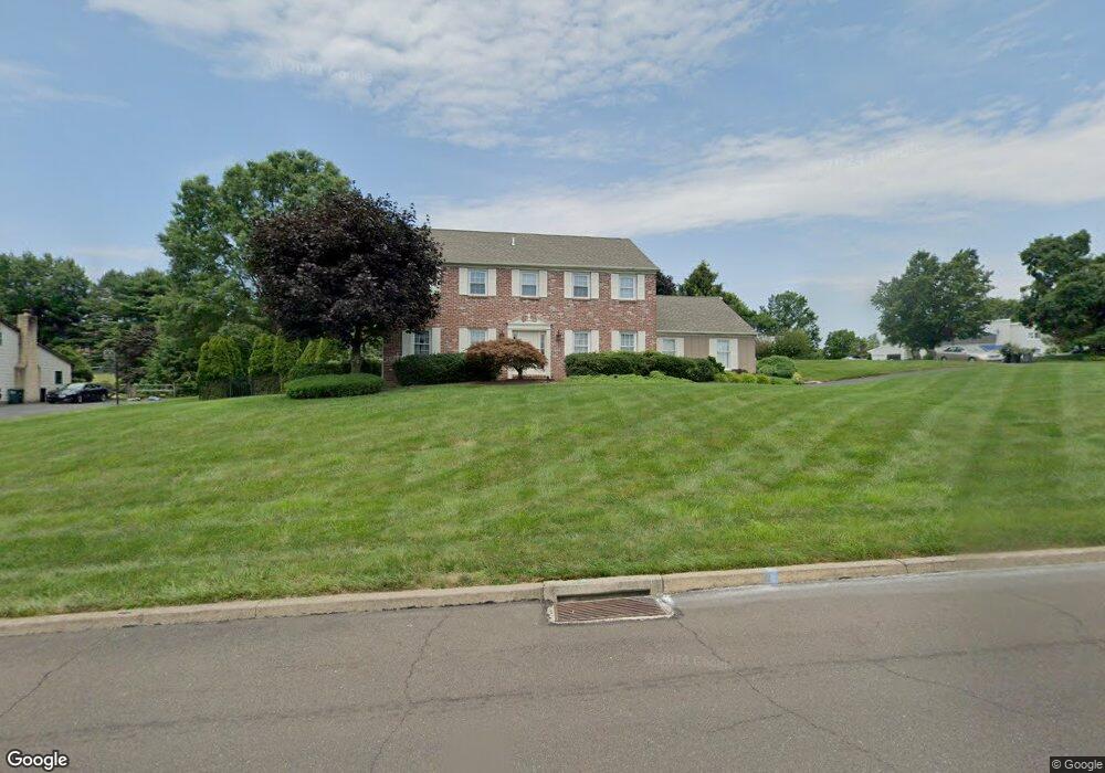
201 Vermeer Dr Feasterville Trevose, PA 19053
Estimated Value: $808,078 - $934,000
4
Beds
3
Baths
3,286
Sq Ft
$264/Sq Ft
Est. Value
About This Home
This home is located at 201 Vermeer Dr, Feasterville Trevose, PA 19053 and is currently estimated at $867,770, approximately $264 per square foot. 201 Vermeer Dr is a home located in Bucks County with nearby schools including Hillcrest El School, Holland Middle School, and Council Rock High School - South.
Ownership History
Date
Name
Owned For
Owner Type
Purchase Details
Closed on
May 25, 2022
Sold by
John Walsh
Bought by
Rennie Colleen and Williams Matthew
Current Estimated Value
Home Financials for this Owner
Home Financials are based on the most recent Mortgage that was taken out on this home.
Original Mortgage
$540,000
Interest Rate
5.09%
Mortgage Type
New Conventional
Purchase Details
Closed on
Mar 19, 2018
Sold by
Walsh John P and Walsh Barbara A
Bought by
Walsh John Patrick and Walsh Barbara Anne
Home Financials for this Owner
Home Financials are based on the most recent Mortgage that was taken out on this home.
Original Mortgage
$300,000
Interest Rate
3.75%
Mortgage Type
Adjustable Rate Mortgage/ARM
Purchase Details
Closed on
Jan 6, 1984
Sold by
Holland Ent Inc
Bought by
Walsh John P and Walsh Barbara A
Create a Home Valuation Report for This Property
The Home Valuation Report is an in-depth analysis detailing your home's value as well as a comparison with similar homes in the area
Home Values in the Area
Average Home Value in this Area
Purchase History
| Date | Buyer | Sale Price | Title Company |
|---|---|---|---|
| Rennie Colleen | $675,000 | None Listed On Document | |
| Walsh John Patrick | -- | Cross Keys Abstract | |
| Walsh John P | $108,400 | -- |
Source: Public Records
Mortgage History
| Date | Status | Borrower | Loan Amount |
|---|---|---|---|
| Previous Owner | Rennie Colleen | $540,000 | |
| Previous Owner | Walsh John Patrick | $300,000 |
Source: Public Records
Tax History Compared to Growth
Tax History
| Year | Tax Paid | Tax Assessment Tax Assessment Total Assessment is a certain percentage of the fair market value that is determined by local assessors to be the total taxable value of land and additions on the property. | Land | Improvement |
|---|---|---|---|---|
| 2025 | $10,886 | $56,520 | $14,520 | $42,000 |
| 2024 | $10,886 | $56,520 | $14,520 | $42,000 |
| 2023 | $10,260 | $56,520 | $14,520 | $42,000 |
| 2022 | $10,166 | $56,520 | $14,520 | $42,000 |
| 2021 | $9,844 | $56,520 | $14,520 | $42,000 |
| 2020 | $9,623 | $56,520 | $14,520 | $42,000 |
| 2019 | $9,211 | $56,520 | $14,520 | $42,000 |
| 2018 | $9,047 | $56,520 | $14,520 | $42,000 |
| 2017 | $8,698 | $56,520 | $14,520 | $42,000 |
| 2016 | $8,698 | $56,520 | $14,520 | $42,000 |
| 2015 | -- | $56,520 | $14,520 | $42,000 |
| 2014 | -- | $56,520 | $14,520 | $42,000 |
Source: Public Records
Map
Nearby Homes
- 147 Watergate Dr
- 52 Dalton Way
- 1021 W Maple Ave
- 15 Dover Place
- 166 N Hawthorne Ave
- 13 Golf Club Dr
- 27 Rocking Horse Way
- 1210 Brownsville Rd
- 60 Signal Hill Rd
- 413 N Pine St
- 501 Heritage Place Unit 1
- 15 Heritage Dr Unit 8
- 29 Langhorne Ave
- 137 Coach Rd
- 409 N Pine St
- 257 Wisteria Ave
- 2604 Beacon Hill Dr Unit 2
- 281 E Village Rd
- 308 W Richardson Ave
- 6 Rolling Hills Dr