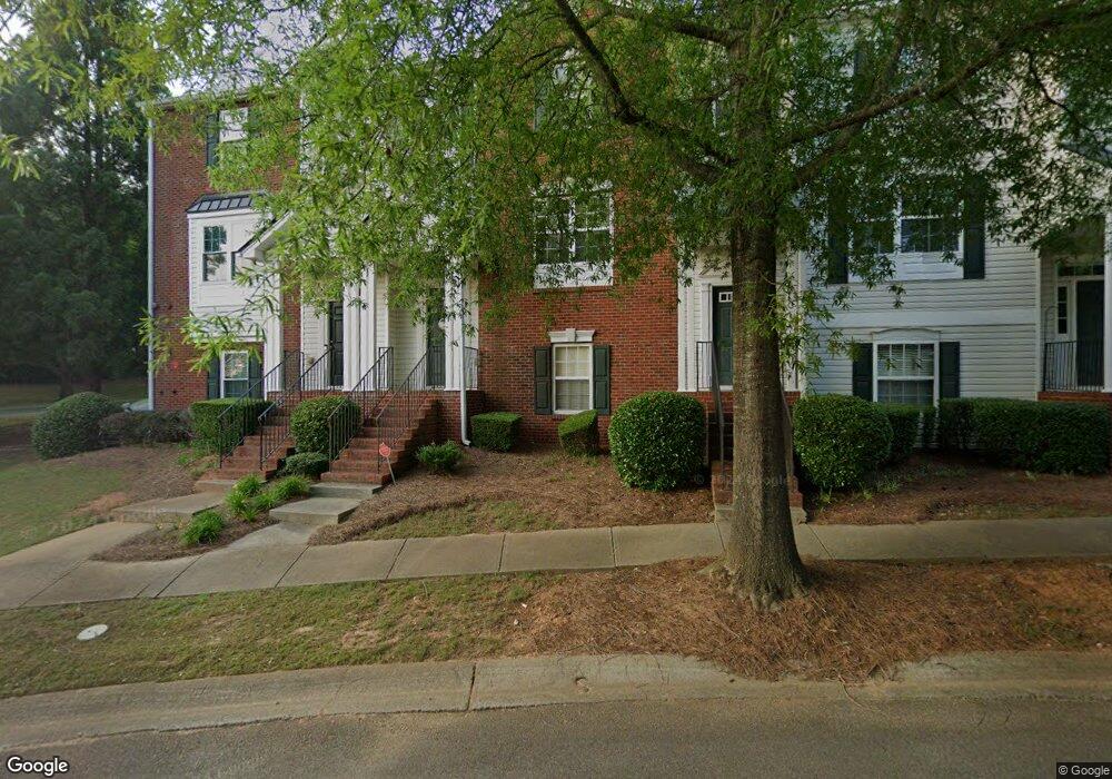
201 Village Square Dr Unit 1940 Woodstock, GA 30188
Estimated Value: $358,000 - $368,357
3
Beds
3
Baths
1,908
Sq Ft
$190/Sq Ft
Est. Value
About This Home
This home is located at 201 Village Square Dr Unit 1940, Woodstock, GA 30188 and is currently estimated at $363,179, approximately $190 per square foot. 201 Village Square Dr Unit 1940 is a home located in Cherokee County with nearby schools including Little River Elementary, Mill Creek Middle School, and River Ridge High School.
Ownership History
Date
Name
Owned For
Owner Type
Purchase Details
Closed on
Jul 14, 2025
Sold by
Brown Stephen F
Bought by
Brown Family Trust Dated July 14 2025 and Brown Stephen Francis Tr
Current Estimated Value
Purchase Details
Closed on
Sep 14, 2006
Sold by
Fisher Jennifer M
Bought by
Brown Stephen F
Home Financials for this Owner
Home Financials are based on the most recent Mortgage that was taken out on this home.
Original Mortgage
$32,500
Interest Rate
6.48%
Mortgage Type
Stand Alone Refi Refinance Of Original Loan
Purchase Details
Closed on
Apr 24, 2003
Sold by
Colony Homes Llc
Bought by
Fisher Jennifer M
Home Financials for this Owner
Home Financials are based on the most recent Mortgage that was taken out on this home.
Original Mortgage
$163,800
Interest Rate
5.86%
Mortgage Type
New Conventional
Create a Home Valuation Report for This Property
The Home Valuation Report is an in-depth analysis detailing your home's value as well as a comparison with similar homes in the area
Home Values in the Area
Average Home Value in this Area
Purchase History
| Date | Buyer | Sale Price | Title Company |
|---|---|---|---|
| Brown Family Trust Dated July 14 2025 | -- | -- | |
| Brown Stephen F | $162,500 | -- | |
| Fisher Jennifer M | $167,000 | -- |
Source: Public Records
Mortgage History
| Date | Status | Borrower | Loan Amount |
|---|---|---|---|
| Previous Owner | Brown Stephen F | $32,500 | |
| Previous Owner | Fisher Jennifer M | $163,800 |
Source: Public Records
Tax History Compared to Growth
Tax History
| Year | Tax Paid | Tax Assessment Tax Assessment Total Assessment is a certain percentage of the fair market value that is determined by local assessors to be the total taxable value of land and additions on the property. | Land | Improvement |
|---|---|---|---|---|
| 2024 | $3,108 | $140,000 | $28,800 | $111,200 |
| 2023 | $270 | $131,640 | $27,200 | $104,440 |
| 2022 | $2,056 | $99,040 | $18,000 | $81,040 |
| 2021 | $2,058 | $90,840 | $18,000 | $72,840 |
| 2020 | $2,380 | $81,280 | $12,000 | $69,280 |
| 2019 | $1,735 | $74,400 | $12,000 | $62,400 |
| 2018 | $1,651 | $69,760 | $12,000 | $57,760 |
| 2017 | $1,504 | $154,600 | $12,000 | $49,840 |
| 2016 | $1,331 | $135,800 | $8,400 | $45,920 |
| 2015 | $1,322 | $133,800 | $8,400 | $45,120 |
| 2014 | $1,350 | $136,200 | $10,400 | $44,080 |
Source: Public Records
Map
Nearby Homes
- 231 Village Square Dr
- 240 Village Square Dr
- 132 Cornerstone Place
- 120 Cornerstone Place
- 140 Apple Valley Dr
- 109 Weatherstone Dr
- 230 Apple Branch Dr
- 180 Regent Place
- 205 Deerchase Dr
- 503 Azalea Ct
- 202 Roseman Way
- 115 Marlow Dr
- 126 Normandy Dr
- 939 Bendleton Dr
- 317 Lakestone Landing
- 141 Bevington Ln
- 217 Roseman Way
- 207 Village Square Dr Unit 1910
- 0 Village Trace Unit 8555636
- 0 Village Trace Unit 7106816
- 0 Village Trace Unit 7030838
- 0 Village Trace Unit 8420676
- 0 Village Trace Unit 8818953
- 0 Village Trace Unit 8471194
- 0 Village Trace Unit 8434608
- 0 Village Trace Unit 7378243
- 0 Village Trace Unit 8954950
- 0 Village Trace Unit 8971054
- 0 Village Trace Unit 8758323
- 0 Village Trace Unit 8780113
- 0 Village Trace Unit 8868204
- 0 Village Trace Unit 8939026
- 0 Village Trace Unit 3082902
- 0 Village Trace Unit 3267664
- 0 Village Trace Unit 7147665
- 0 Village Trace Unit 7189167
- 0 Village Trace Unit 7259448