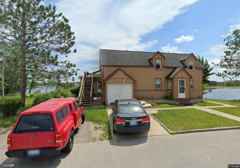
201 W Dwight St Oscoda, MI 48750
Estimated Value: $232,000 - $296,219
--
Bed
--
Bath
1,511
Sq Ft
$174/Sq Ft
Est. Value
About This Home
This home is located at 201 W Dwight St, Oscoda, MI 48750 and is currently estimated at $263,055, approximately $174 per square foot. 201 W Dwight St is a home located in Iosco County with nearby schools including Richardson Elementary School and Oscoda Area High School.
Ownership History
Date
Name
Owned For
Owner Type
Purchase Details
Closed on
Jun 23, 2025
Sold by
Rose Marie Kathleen Macdonald Trust and Macdonald Patrick Stephen
Bought by
Boers Thomas J and Boers Virginia L
Current Estimated Value
Home Financials for this Owner
Home Financials are based on the most recent Mortgage that was taken out on this home.
Original Mortgage
$254,118
Outstanding Balance
$253,459
Interest Rate
6.76%
Mortgage Type
VA
Estimated Equity
$9,596
Purchase Details
Closed on
Jun 12, 2025
Sold by
Macdonald Mary Kathleen and Macdonald Chad Stephen
Bought by
Rose Marie Kathleen Macdonald Trust and Macdonald
Home Financials for this Owner
Home Financials are based on the most recent Mortgage that was taken out on this home.
Original Mortgage
$254,118
Outstanding Balance
$253,459
Interest Rate
6.76%
Mortgage Type
VA
Estimated Equity
$9,596
Create a Home Valuation Report for This Property
The Home Valuation Report is an in-depth analysis detailing your home's value as well as a comparison with similar homes in the area
Home Values in the Area
Average Home Value in this Area
Purchase History
| Date | Buyer | Sale Price | Title Company |
|---|---|---|---|
| Boers Thomas J | $246,000 | None Listed On Document | |
| Rose Marie Kathleen Macdonald Trust | -- | None Listed On Document |
Source: Public Records
Mortgage History
| Date | Status | Borrower | Loan Amount |
|---|---|---|---|
| Open | Boers Thomas J | $254,118 |
Source: Public Records
Tax History Compared to Growth
Tax History
| Year | Tax Paid | Tax Assessment Tax Assessment Total Assessment is a certain percentage of the fair market value that is determined by local assessors to be the total taxable value of land and additions on the property. | Land | Improvement |
|---|---|---|---|---|
| 2025 | $3,374 | $144,300 | $144,300 | $0 |
| 2024 | $3,090 | $121,500 | $0 | $0 |
| 2023 | $2,160 | $93,100 | $93,100 | $0 |
| 2022 | $2,891 | $74,300 | $74,300 | $0 |
| 2021 | $2,796 | $69,500 | $69,500 | $0 |
| 2020 | $2,721 | $63,800 | $63,800 | $0 |
| 2019 | $2,686 | $75,000 | $75,000 | $0 |
| 2018 | $2,628 | $74,900 | $74,900 | $0 |
| 2017 | $2,427 | $78,400 | $78,400 | $0 |
| 2016 | $2,367 | $78,400 | $0 | $0 |
| 2015 | -- | $75,100 | $0 | $0 |
| 2014 | -- | $66,400 | $0 | $0 |
| 2013 | -- | $65,400 | $0 | $0 |
Source: Public Records
Map
Nearby Homes
- 205 E Water Ave Unit 16
- 112 1st St N
- 411 Ottawa Dr
- 430 S State St
- 879 S State St
- 891 S State St
- #26 Appletree Trail
- 241 Smith St
- #49 Appletree Trail
- #21 Meadow Ln
- #46 Vaughan Trail
- #48 Vaughan Trail
- #3 Vaughan Trail
- #20 Vaughan Trail
- VL Vaughan Trail
- #18 Vaughan Trail
- #1 Vaughan Trail
- #16 Vaughan Trail
- #17 Vaughan Trail
- #47 Vaughan Trail
- 201 W Dwight St
- 119 W Dwight Ave
- 119 & 201 W Dwight Ave Unit 1-9
- 119 & 201 W Dwight Ave
- 119 W Dwight St
- 119 W Dwight St
- 208 W Dwight St
- 106 Pearl St N
- 212 W Dwight St
- 117 W River Rd
- 00 E Park Ave
- 100 Pearl St N
- 209 W River Rd
- 119 W Dwight St
- 218 W Dwight St
- 213 W River Rd
- 111 Superior St N
- 300 W Dwight St
- 238 S State St
- 109 Pearl St N