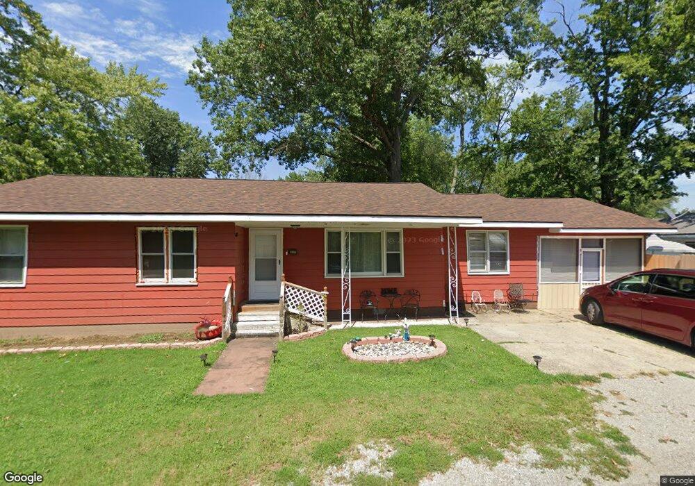
201 W Harrison St Carrier Mills, IL 62917
Estimated Value: $51,000 - $71,000
--
Bed
--
Bath
--
Sq Ft
--
Built
About This Home
This home is located at 201 W Harrison St, Carrier Mills, IL 62917 and is currently estimated at $61,009. 201 W Harrison St is a home with nearby schools including Carrier Mills-Stonefort Elementary School and Carrier Mills-Stonefort High School.
Ownership History
Date
Name
Owned For
Owner Type
Purchase Details
Closed on
Feb 24, 2022
Sold by
P & N Properties Inc
Bought by
Trevino Mirna and Lopez Juan Carlos
Current Estimated Value
Purchase Details
Closed on
Apr 20, 2021
Sold by
County Of Saline
Bought by
P & N Properties Inc
Home Financials for this Owner
Home Financials are based on the most recent Mortgage that was taken out on this home.
Original Mortgage
$8,600
Interest Rate
3.05%
Mortgage Type
Land Contract Argmt. Of Sale
Purchase Details
Closed on
Apr 15, 2021
Sold by
P & N Properties Inc
Bought by
Lopez Juan Carlos and De Gomez Mirna
Home Financials for this Owner
Home Financials are based on the most recent Mortgage that was taken out on this home.
Original Mortgage
$8,600
Interest Rate
3.05%
Mortgage Type
Land Contract Argmt. Of Sale
Create a Home Valuation Report for This Property
The Home Valuation Report is an in-depth analysis detailing your home's value as well as a comparison with similar homes in the area
Home Values in the Area
Average Home Value in this Area
Purchase History
| Date | Buyer | Sale Price | Title Company |
|---|---|---|---|
| Trevino Mirna | -- | None Listed On Document | |
| P & N Properties Inc | -- | None Available | |
| Lopez Juan Carlos | $8,600 | None Available |
Source: Public Records
Mortgage History
| Date | Status | Borrower | Loan Amount |
|---|---|---|---|
| Previous Owner | Lopez Juan Carlos | $8,600 |
Source: Public Records
Tax History Compared to Growth
Tax History
| Year | Tax Paid | Tax Assessment Tax Assessment Total Assessment is a certain percentage of the fair market value that is determined by local assessors to be the total taxable value of land and additions on the property. | Land | Improvement |
|---|---|---|---|---|
| 2023 | $1,083 | $17,339 | $2,256 | $15,083 |
| 2022 | $989 | $16,126 | $2,098 | $14,028 |
| 2021 | $884 | $14,659 | $1,907 | $12,752 |
| 2020 | $814 | $14,220 | $1,850 | $12,370 |
| 2019 | $833 | $14,220 | $1,850 | $12,370 |
| 2018 | $851 | $14,220 | $1,850 | $12,370 |
| 2017 | $869 | $14,220 | $1,850 | $12,370 |
| 2016 | $8 | $14,220 | $1,850 | $12,370 |
| 2015 | -- | $14,220 | $1,850 | $12,370 |
| 2014 | $1,463 | $14,220 | $1,850 | $12,370 |
| 2013 | $1,463 | $23,230 | $1,850 | $21,380 |
| 2012 | $1,463 | $23,230 | $1,850 | $21,380 |
Source: Public Records
Map
Nearby Homes
- 603 N Main St
- 437 N Thompson St
- 205 W Washington St
- 315 W Furlong St
- 720 N Mill St
- 518 Fife St
- 736 N Mill St
- 104 Deborann Dr
- 109 Delanor Dr
- 1501 Duncan Rd
- 1501 Duncan Rd
- 0 Frond Rd Unit Lot WP001
- 002 Robinson Hill Rd
- 000 Robinson Hill Rd
- 001 Robinson Hill Rd
- 0 Rock Hole Rd
- 315 Lighthouse Rd
- 7034 Parks Ln
- 3590 Tuller Rd
- 615 Liberty Rd