Estimated Value: $37,000 - $133,000
2
Beds
1
Bath
1,008
Sq Ft
$83/Sq Ft
Est. Value
About This Home
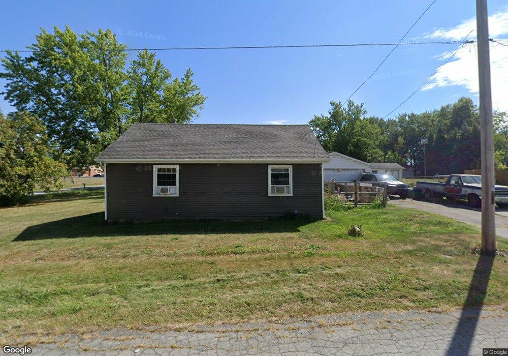
This home is located at 201 W Michigan Ave, Lima, OH 45801 and is currently estimated at $83,969, approximately $83 per square foot. 201 W Michigan Ave is a home located in Allen County with nearby schools including Independence Elementary School, Lima North Middle School, and Lima West Middle School.
Ownership History
Date
Name
Owned For
Owner Type
Purchase Details
Closed on
Aug 11, 2025
Sold by
Shearer Tracy
Bought by
Green Bethanee Nicole
Current Estimated Value
Purchase Details
Closed on
Feb 14, 2024
Sold by
Green Bethanee Nicole
Bought by
Green Bethanee Nicole and Shearer Tracy
Home Financials for this Owner
Home Financials are based on the most recent Mortgage that was taken out on this home.
Original Mortgage
$73,700
Interest Rate
6.69%
Mortgage Type
New Conventional
Purchase Details
Closed on
Sep 4, 2009
Sold by
Green Erik Keith
Bought by
Green Bethanee Nicole
Purchase Details
Closed on
Oct 30, 1985
Bought by
Green Alicia
Create a Home Valuation Report for This Property
The Home Valuation Report is an in-depth analysis detailing your home's value as well as a comparison with similar homes in the area
Home Values in the Area
Average Home Value in this Area
Purchase History
| Date | Buyer | Sale Price | Title Company |
|---|---|---|---|
| Green Bethanee Nicole | $38,000 | None Listed On Document | |
| Green Bethanee Nicole | -- | None Listed On Document | |
| Green Bethanee Nicole | -- | Attorney | |
| Green Alicia | $6,000 | -- |
Source: Public Records
Mortgage History
| Date | Status | Borrower | Loan Amount |
|---|---|---|---|
| Previous Owner | Green Bethanee Nicole | $73,700 |
Source: Public Records
Tax History Compared to Growth
Tax History
| Year | Tax Paid | Tax Assessment Tax Assessment Total Assessment is a certain percentage of the fair market value that is determined by local assessors to be the total taxable value of land and additions on the property. | Land | Improvement |
|---|---|---|---|---|
| 2024 | $1,004 | $26,570 | $6,230 | $20,340 |
| 2023 | $865 | $19,540 | $4,590 | $14,950 |
| 2022 | $862 | $19,540 | $4,590 | $14,950 |
| 2021 | $913 | $19,540 | $4,590 | $14,950 |
| 2020 | $782 | $14,640 | $4,450 | $10,190 |
| 2019 | $782 | $14,640 | $4,450 | $10,190 |
| 2018 | $779 | $14,640 | $4,450 | $10,190 |
| 2017 | $785 | $14,640 | $4,450 | $10,190 |
| 2016 | $793 | $14,640 | $4,450 | $10,190 |
| 2015 | $889 | $14,640 | $4,450 | $10,190 |
| 2014 | $889 | $16,450 | $4,270 | $12,180 |
| 2013 | $866 | $16,450 | $4,270 | $12,180 |
Source: Public Records
Map
Nearby Homes
- 1200 N Main St
- 340 W Robb Ave
- 128 E Lane Ave
- 400 W Northern Ave
- 610 W Robb Ave
- 608 W O'Connor Ave
- 105 Watt Ave
- 939 N West St
- 1776 Virginia Ave
- 2104 Virginia Ave
- 700 Lewis Blvd
- 765 W O'Connor Ave
- 711 Taylor Ave
- 123 Flanders Ave
- 222 W Grand Ave
- 1116 Belvidere Ave
- 849 Runyan Ave
- 416 Hazel Ave
- 735 N Main St
- 616 N Elizabeth St
- 1477 N Elizabeth St
- 215 W Michigan Ave
- 1445 N Elizabeth St
- 214 W Michigan Ave
- 212 W Michigan Ave
- 218 W Michigan Ave
- 220 W Michigan Ave
- 1415 N Elizabeth St
- 192 W Michigan Ave
- 1507 N Elizabeth St
- 1266 N West St
- 178 W Michigan Ave
- 1258 N West St
- 1260 N West St
- 174 W Michigan Ave
- 1252 N West St
- 1569 N Elizabeth St
- 1540 N Elizabeth St