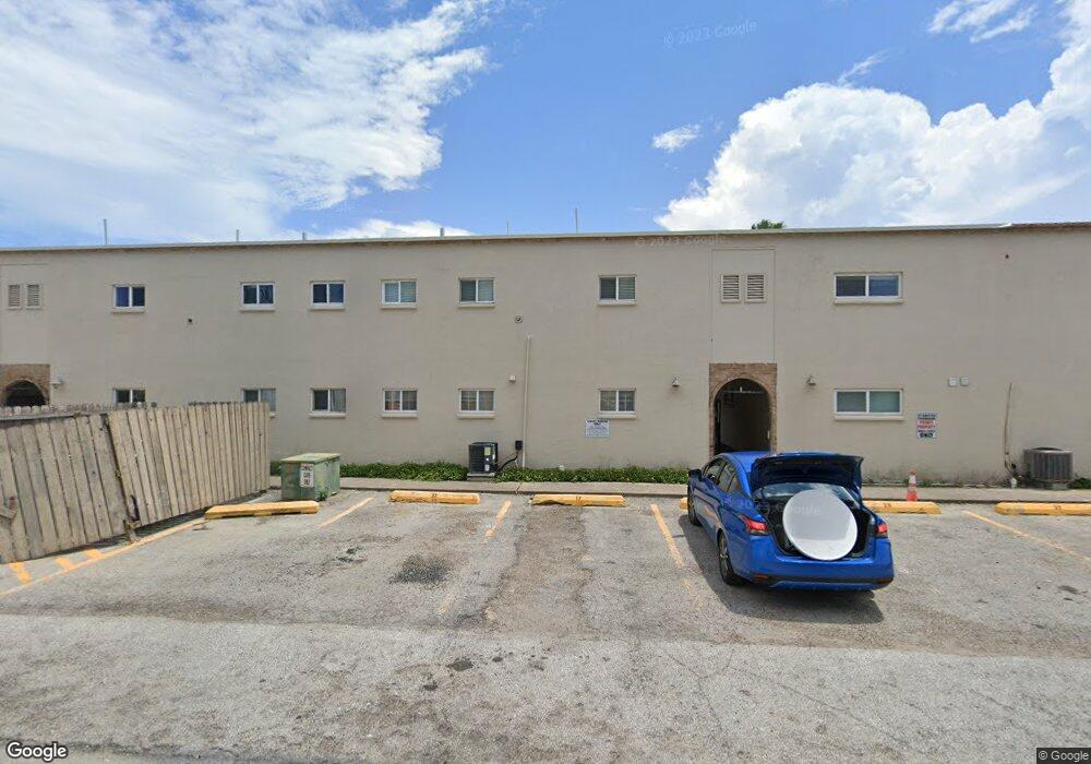
201 W Polaris Dr Unit 26 South Padre Island, TX 78597
Estimated Value: $165,495 - $244,000
--
Bed
--
Bath
520
Sq Ft
$423/Sq Ft
Est. Value
About This Home
This home is located at 201 W Polaris Dr Unit 26, South Padre Island, TX 78597 and is currently estimated at $220,124, approximately $423 per square foot. 201 W Polaris Dr Unit 26 is a home located in Cameron County with nearby schools including Garriga Elementary School, Derry Elementary School, and Port Isabel Junior High School.
Ownership History
Date
Name
Owned For
Owner Type
Purchase Details
Closed on
Feb 10, 2017
Sold by
Matz Alisa A
Bought by
Rafa Rental Llc
Current Estimated Value
Purchase Details
Closed on
Apr 23, 2014
Sold by
Karrick Robert A and Robert A Karrick Revocable Tru
Bought by
Matz Alisa A
Purchase Details
Closed on
Oct 23, 2009
Sold by
Karrick Robert A
Bought by
Karrick Robert A and Revocable Trust Agreement Of Robert A Ka
Purchase Details
Closed on
May 16, 2003
Sold by
Buchholz Dennis L and Buchholz Juanita L
Bought by
Calip Selbino and Fahrenkrug Leslie
Home Financials for this Owner
Home Financials are based on the most recent Mortgage that was taken out on this home.
Original Mortgage
$66,000
Interest Rate
5.77%
Mortgage Type
Purchase Money Mortgage
Create a Home Valuation Report for This Property
The Home Valuation Report is an in-depth analysis detailing your home's value as well as a comparison with similar homes in the area
Home Values in the Area
Average Home Value in this Area
Purchase History
| Date | Buyer | Sale Price | Title Company |
|---|---|---|---|
| Rafa Rental Llc | -- | None Available | |
| Matz Alisa A | -- | Sierra Title | |
| Karrick Robert A | -- | None Available | |
| Calip Selbino | -- | Dba Cameron County Title Co |
Source: Public Records
Mortgage History
| Date | Status | Borrower | Loan Amount |
|---|---|---|---|
| Previous Owner | Calip Selbino | $66,000 |
Source: Public Records
Tax History Compared to Growth
Tax History
| Year | Tax Paid | Tax Assessment Tax Assessment Total Assessment is a certain percentage of the fair market value that is determined by local assessors to be the total taxable value of land and additions on the property. | Land | Improvement |
|---|---|---|---|---|
| 2025 | $2,141 | $111,517 | $49,999 | $61,518 |
| 2024 | $2,141 | $131,150 | $49,999 | $81,151 |
| 2023 | $2,227 | $129,900 | $48,749 | $81,151 |
| 2022 | $1,737 | $91,657 | $40,938 | $50,719 |
| 2021 | $1,589 | $79,017 | $28,298 | $50,719 |
| 2020 | $1,600 | $79,017 | $28,298 | $50,719 |
| 2019 | $1,632 | $79,017 | $28,298 | $50,719 |
| 2018 | $1,631 | $79,017 | $28,298 | $50,719 |
| 2017 | $1,618 | $79,017 | $28,298 | $50,719 |
| 2016 | $1,618 | $79,017 | $28,298 | $50,719 |
| 2015 | $1,610 | $79,835 | $28,298 | $51,537 |
Source: Public Records
Map
Nearby Homes
- 5100 Laguna Blvd Unit 3
- 5100 Padre Blvd Unit 4,5,6
- 104 W Georgia Ruth Dr Unit 10
- 5200 Padre Blvd Unit 1-3
- 4901 Laguna Blvd Unit 407
- 4901 Laguna Blvd Unit 305
- 4901 Laguna Blvd Unit 304
- 4901 Laguna Blvd
- 106 W Capricorn Dr Unit B
- 5309 Padre Blvd Unit 6
- 103 E Verna Jean Dr
- LOT 4A W Carolyn Dr
- 104 E Verna Jean Dr Unit 201
- 104 E Verna Jean Dr Unit 102
- 103 E Georgia Ruth Dr Unit 2D
- 130-132 E Aries Dr Unit 19-20
- 200 W Constellation Dr Unit S401
- 200 W Constellation Dr Unit S402
- 200 W Constellation Dr Unit 203
- 102 E Capricorn Dr Unit A3
- 201 W Polaris Dr Unit 25
- 201 W Polaris Dr Unit 28
- 201 W Polaris Dr Unit 27
- 201 W Polaris Dr Unit 24
- 201 W Polaris Dr Unit 23
- 201 W Polaris Dr Unit 31
- 201 W Polaris Dr Unit 30
- 201 W Polaris Dr Unit 29
- 201 W Polaris Dr Unit 22
- 201 W Polaris Dr Unit 21
- 201 W Polaris Dr Unit 33
- 201 W Polaris Dr Unit 19
- 201 W Polaris Dr Unit 18
- 201 W Polaris Dr Unit 34
- 201 W Polaris Dr Unit 17
- 201 W Polaris Dr Unit 16
- 201 W Polaris Dr Unit 37
- 201 W Polaris Dr Unit 36
- 201 W Polaris Dr Unit 14
- 201 W Polaris Dr Unit 15