Estimated Value: $272,000 - $405,000
5
Beds
4
Baths
3,144
Sq Ft
$110/Sq Ft
Est. Value
About This Home
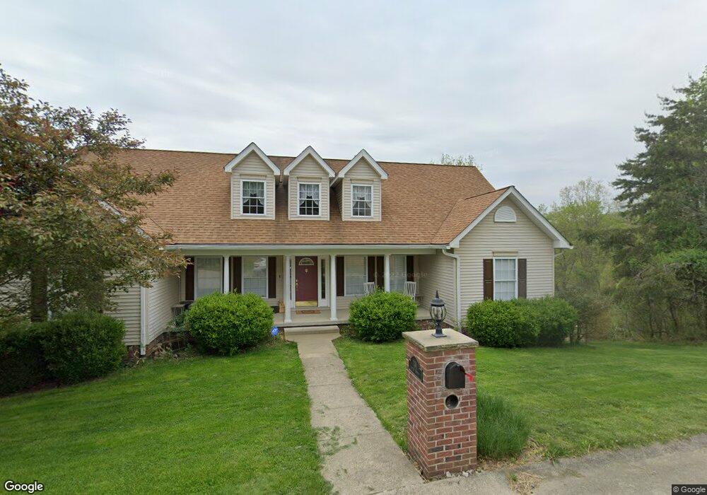
This home is located at 201 Walnut St, Nitro, WV 25143 and is currently estimated at $344,810, approximately $109 per square foot. 201 Walnut St is a home with nearby schools including Cross Lanes Christian School.
Ownership History
Date
Name
Owned For
Owner Type
Purchase Details
Closed on
Dec 27, 2017
Sold by
Davis Julie
Bought by
Adkins Betty J
Current Estimated Value
Home Financials for this Owner
Home Financials are based on the most recent Mortgage that was taken out on this home.
Original Mortgage
$255,550
Outstanding Balance
$213,913
Interest Rate
3.9%
Mortgage Type
New Conventional
Estimated Equity
$130,897
Purchase Details
Closed on
Sep 5, 2007
Sold by
Hale Ted and Hale Marietta
Bought by
Davis Rodney P and Davis Julie
Home Financials for this Owner
Home Financials are based on the most recent Mortgage that was taken out on this home.
Original Mortgage
$162,000
Interest Rate
6.7%
Create a Home Valuation Report for This Property
The Home Valuation Report is an in-depth analysis detailing your home's value as well as a comparison with similar homes in the area
Home Values in the Area
Average Home Value in this Area
Purchase History
| Date | Buyer | Sale Price | Title Company |
|---|---|---|---|
| Adkins Betty J | $269,000 | None Available | |
| Davis Rodney P | $259,000 | -- |
Source: Public Records
Mortgage History
| Date | Status | Borrower | Loan Amount |
|---|---|---|---|
| Open | Adkins Betty J | $255,550 | |
| Previous Owner | Davis Rodney P | $162,000 |
Source: Public Records
Tax History
| Year | Tax Paid | Tax Assessment Tax Assessment Total Assessment is a certain percentage of the fair market value that is determined by local assessors to be the total taxable value of land and additions on the property. | Land | Improvement |
|---|---|---|---|---|
| 2025 | $2,612 | $164,700 | $16,140 | $148,560 |
| 2024 | $2,612 | $153,480 | $16,140 | $137,340 |
| 2023 | $2,225 | $148,980 | $16,140 | $132,840 |
| 2022 | $2,279 | $148,920 | $18,360 | $130,560 |
| 2021 | $2,419 | $157,140 | $18,360 | $138,780 |
| 2020 | $2,389 | $155,220 | $18,360 | $136,860 |
| 2019 | $2,414 | $154,980 | $18,240 | $136,740 |
| 2018 | $2,372 | $153,360 | $18,240 | $135,120 |
| 2017 | $2,319 | $149,700 | $18,240 | $131,460 |
| 2016 | $2,297 | $148,080 | $24,300 | $123,780 |
| 2015 | $1,894 | $131,400 | $25,320 | $106,080 |
| 2014 | $1,894 | $122,280 | $15,060 | $107,220 |
Source: Public Records
Map
Nearby Homes
- 216 Carriage Way
- 715 Woodland Dr
- 104 Woodland Dr
- 105 Holley Dr
- 105 Brookhaven Cir
- 177 Clark Dr
- 612 Cross Lanes Dr
- 1386 Charleston Rd
- 236 Easter Rd
- 3981 39th St E
- 103 Bailes Dr
- 5320 Glow Dr
- 0 Evergreen Cir
- 0 Stephen Way
- 2 Brick Cir
- 910 Cross Lanes Dr
- 827 Dairy Rd
- 5206 Hammons Dr
- 5201 Hammons Dr
- 111 Oakland Dr
Your Personal Tour Guide
Ask me questions while you tour the home.