Estimated Value: $621,454 - $720,000
5
Beds
4
Baths
3,920
Sq Ft
$171/Sq Ft
Est. Value
About This Home
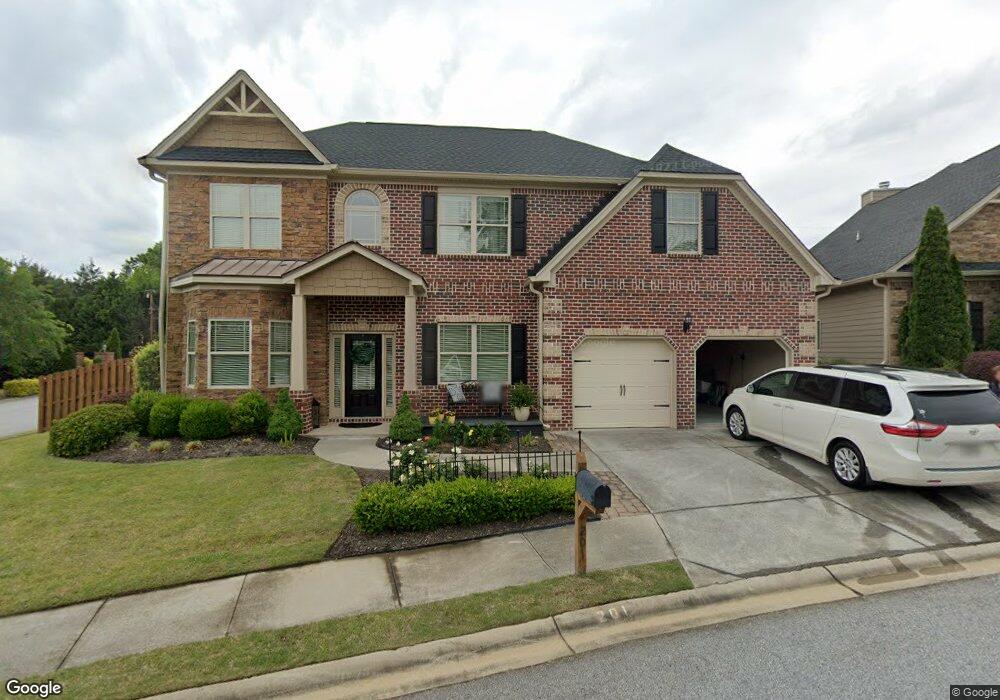
This home is located at 201 Wando Way, Greer, SC 29650 and is currently estimated at $670,114, approximately $170 per square foot. 201 Wando Way is a home located in Greenville County with nearby schools including Brushy Creek Elementary School, Northwood Middle School, and Eastside High School.
Ownership History
Date
Name
Owned For
Owner Type
Purchase Details
Closed on
Aug 16, 2016
Sold by
Hunt Catherine E and Hunt Daniel C
Bought by
Cass Paul T and Cass Deetra L
Current Estimated Value
Home Financials for this Owner
Home Financials are based on the most recent Mortgage that was taken out on this home.
Original Mortgage
$125,000
Outstanding Balance
$99,509
Interest Rate
3.41%
Mortgage Type
New Conventional
Estimated Equity
$570,605
Purchase Details
Closed on
Aug 21, 2012
Sold by
S C Pillon Homes Inc
Bought by
Hunt Catherine E and Hunt Daniel C
Home Financials for this Owner
Home Financials are based on the most recent Mortgage that was taken out on this home.
Original Mortgage
$315,838
Interest Rate
3.55%
Mortgage Type
New Conventional
Create a Home Valuation Report for This Property
The Home Valuation Report is an in-depth analysis detailing your home's value as well as a comparison with similar homes in the area
Home Values in the Area
Average Home Value in this Area
Purchase History
| Date | Buyer | Sale Price | Title Company |
|---|---|---|---|
| Cass Paul T | $355,000 | None Available | |
| Hunt Catherine E | $333,056 | -- |
Source: Public Records
Mortgage History
| Date | Status | Borrower | Loan Amount |
|---|---|---|---|
| Open | Cass Paul T | $125,000 | |
| Previous Owner | Hunt Catherine E | $315,838 |
Source: Public Records
Tax History Compared to Growth
Tax History
| Year | Tax Paid | Tax Assessment Tax Assessment Total Assessment is a certain percentage of the fair market value that is determined by local assessors to be the total taxable value of land and additions on the property. | Land | Improvement |
|---|---|---|---|---|
| 2024 | $1,990 | $13,770 | $2,180 | $11,590 |
| 2023 | $1,871 | $13,770 | $2,180 | $11,590 |
| 2022 | $1,728 | $13,770 | $2,180 | $11,590 |
| 2021 | $1,729 | $13,770 | $2,180 | $11,590 |
| 2020 | $1,704 | $12,930 | $2,020 | $10,910 |
| 2019 | $1,670 | $12,930 | $2,020 | $10,910 |
| 2018 | $1,790 | $12,930 | $2,020 | $10,910 |
| 2017 | $2,080 | $12,930 | $2,020 | $10,910 |
| 2016 | $1,986 | $323,230 | $50,500 | $272,730 |
| 2015 | $1,952 | $323,230 | $50,500 | $272,730 |
| 2014 | $1,718 | $284,300 | $45,000 | $239,300 |
Source: Public Records
Map
Nearby Homes
- 109 Comstock Ct
- 137 Hammett Pond Ct
- 147 Tanager Cir
- 117 Shady Creek Ct
- 158 Grinders Cir Unit 158
- 212 N Antigo Ct
- 325 Skylark Cir
- 108 Berrywood Ct
- 307 Barry Dr
- 96 W Hackney Rd
- 7 Crosswinds Way
- 111 Dartmoor Dr
- 115 Dartmoor Dr
- 103 Berrywood Ct
- 15 Crosswinds Way
- 105 Middle Brook Rd
- 36 Riley Hill Ct
- 100 Breeds Hill Way
- 16 Overcup Ct
- 1841 Hudson Rd
- 209 Wando Way
- 2 Downey Hill Ln
- 6 Downey Hill Ln
- 100 Downey Hill Ln
- 100 Downey Hill Ln
- 221 Wando Way
- 216 Lytle St
- 214 Lytle St
- 108 Downey Hill Ln
- 218 Lytle St
- 227 Wando Way
- 112 Downey Hill Ln
- 230 Wando Way
- 112 Downey Hill Ln
- 212 Lytle St
- 220 Lytle St
- 101 Spartan Ct
- 236 Wando Way
- 1409 Old Spartanburg Rd
- 116 Downey Hill Ln