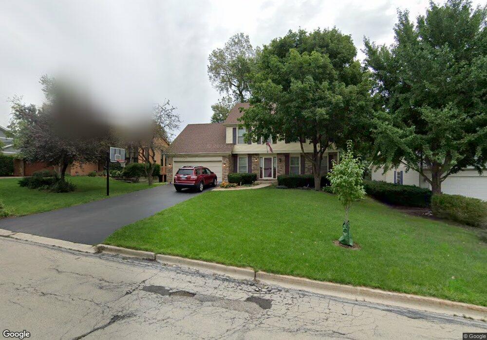
201 White Oak Dr Wheaton, IL 60187
West Wheaton NeighborhoodEstimated Value: $578,000 - $677,000
4
Beds
3
Baths
2,346
Sq Ft
$263/Sq Ft
Est. Value
About This Home
This home is located at 201 White Oak Dr, Wheaton, IL 60187 and is currently estimated at $616,332, approximately $262 per square foot. 201 White Oak Dr is a home located in DuPage County with nearby schools including Clarence E Culver School, Emerson Elementary School, and Monroe Middle School.
Ownership History
Date
Name
Owned For
Owner Type
Purchase Details
Closed on
Jun 18, 2002
Sold by
Boi Martin T and Boi Roseann E
Bought by
Blatner Peter J and Blatner Angela L
Current Estimated Value
Home Financials for this Owner
Home Financials are based on the most recent Mortgage that was taken out on this home.
Original Mortgage
$261,600
Outstanding Balance
$111,079
Interest Rate
6.87%
Estimated Equity
$505,253
Create a Home Valuation Report for This Property
The Home Valuation Report is an in-depth analysis detailing your home's value as well as a comparison with similar homes in the area
Home Values in the Area
Average Home Value in this Area
Purchase History
| Date | Buyer | Sale Price | Title Company |
|---|---|---|---|
| Blatner Peter J | $327,000 | -- |
Source: Public Records
Mortgage History
| Date | Status | Borrower | Loan Amount |
|---|---|---|---|
| Open | Blatner Peter J | $261,600 | |
| Closed | Blatner Peter J | $32,700 |
Source: Public Records
Tax History Compared to Growth
Tax History
| Year | Tax Paid | Tax Assessment Tax Assessment Total Assessment is a certain percentage of the fair market value that is determined by local assessors to be the total taxable value of land and additions on the property. | Land | Improvement |
|---|---|---|---|---|
| 2024 | $10,251 | $167,045 | $30,072 | $136,973 |
| 2023 | $9,850 | $153,760 | $27,680 | $126,080 |
| 2022 | $9,648 | $145,310 | $26,160 | $119,150 |
| 2021 | $9,616 | $141,860 | $25,540 | $116,320 |
| 2020 | $9,586 | $140,540 | $25,300 | $115,240 |
| 2019 | $9,366 | $136,830 | $24,630 | $112,200 |
| 2018 | $9,231 | $133,450 | $23,210 | $110,240 |
| 2017 | $9,093 | $128,520 | $22,350 | $106,170 |
| 2016 | $8,972 | $123,390 | $21,460 | $101,930 |
| 2015 | $8,903 | $117,710 | $20,470 | $97,240 |
| 2014 | $8,160 | $106,640 | $16,690 | $89,950 |
| 2013 | $7,950 | $106,960 | $16,740 | $90,220 |
Source: Public Records
Map
Nearby Homes
- 119 N Dorchester Ave
- 1321 W Liberty Dr
- 200 N Erie St
- 615 Polo Dr
- 505 S Knollwood Dr
- 0S015 Cottonwood Dr
- 0N042 Nepil Ave
- 1489 Woodcutter Ln Unit A
- 1785 Grosvenor Cir Unit A
- 2059 W Roosevelt Rd
- 26W278 Harrison Ave
- 620 Crest St
- 904 Dartmouth Dr
- 1222 Champion Forest Ct
- 906 W Roosevelt Rd
- 0S064 Calvin Ct
- 100 N Gary Ave Unit 304
- 536 W Evergreen St
- 1970 Wexford Cir
- 418 W Franklin St
- 135 White Oak Dr
- 205 White Oak Dr
- 130 N Pierce Ave
- 202 N Pierce Ave
- 131 White Oak Dr
- 209 White Oak Dr
- 206 N Pierce Ave
- 126 N Pierce Ave
- 1725 Maple Leaf Ct
- 122 N Pierce Ave
- 210 N Pierce Ave
- 206 White Oak Dr
- 127 White Oak Dr
- 130 White Oak Dr
- 118 N Pierce Ave
- 213 White Oak Dr
- 1745 Maple Leaf Ct
- 210 White Oak Dr
- 114 N Pierce Ave
- 126 White Oak Dr