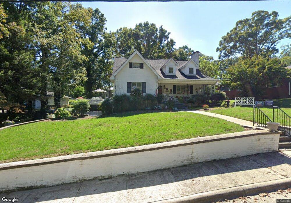
201 Wrenn Ave Mount Airy, NC 27030
Estimated Value: $289,000 - $330,000
3
Beds
2
Baths
2,111
Sq Ft
$146/Sq Ft
Est. Value
About This Home
This home is located at 201 Wrenn Ave, Mount Airy, NC 27030 and is currently estimated at $308,036, approximately $145 per square foot. 201 Wrenn Ave is a home located in Surry County with nearby schools including Bruce H. Tharrington Elementary School, Mount Airy Middle School, and Mount Airy High School.
Ownership History
Date
Name
Owned For
Owner Type
Purchase Details
Closed on
May 29, 2024
Sold by
Sanders Sandra Inman and Sanders John J
Bought by
Keck Robert C
Current Estimated Value
Home Financials for this Owner
Home Financials are based on the most recent Mortgage that was taken out on this home.
Original Mortgage
$240,000
Outstanding Balance
$226,706
Interest Rate
6.39%
Mortgage Type
New Conventional
Estimated Equity
$81,330
Purchase Details
Closed on
Dec 1, 1994
Purchase Details
Closed on
Jan 1, 1985
Create a Home Valuation Report for This Property
The Home Valuation Report is an in-depth analysis detailing your home's value as well as a comparison with similar homes in the area
Home Values in the Area
Average Home Value in this Area
Purchase History
| Date | Buyer | Sale Price | Title Company |
|---|---|---|---|
| Keck Robert C | $300,000 | None Listed On Document | |
| -- | -- | -- | |
| -- | -- | -- | |
| -- | $65,000 | -- |
Source: Public Records
Mortgage History
| Date | Status | Borrower | Loan Amount |
|---|---|---|---|
| Open | Keck Robert C | $240,000 |
Source: Public Records
Tax History Compared to Growth
Tax History
| Year | Tax Paid | Tax Assessment Tax Assessment Total Assessment is a certain percentage of the fair market value that is determined by local assessors to be the total taxable value of land and additions on the property. | Land | Improvement |
|---|---|---|---|---|
| 2025 | $1,812 | $294,190 | $31,500 | $262,690 |
| 2024 | $1,114 | $238,490 | $31,500 | $206,990 |
| 2023 | $195 | $161,700 | $31,500 | $130,200 |
| 2022 | $1,096 | $161,700 | $31,500 | $130,200 |
| 2021 | $1,114 | $161,700 | $31,500 | $130,200 |
| 2020 | $1,149 | $159,560 | $31,500 | $128,060 |
| 2019 | $1,146 | $159,560 | $31,500 | $128,060 |
| 2018 | $1,128 | $159,560 | $0 | $0 |
| 2017 | $1,143 | $159,560 | $0 | $0 |
| 2016 | $1,127 | $159,560 | $0 | $0 |
| 2013 | -- | $156,940 | $0 | $0 |
Source: Public Records
Map
Nearby Homes
- 109 Grace St
- 316 Linville Rd
- 1709 N Main St Unit A-1
- 1709 N Main St
- 344 Linville Rd
- 1694 Woodbury Ln
- 234 Hylton St
- 0 Woodruff St
- 311 E Lebanon St
- 1816 Gwyn St
- 1020 Frank St
- 607 Riverside Dr
- 2029 N Main St
- 1769 Inglebrook Trail
- TBD River Walk Rd
- 921 N South St
- 712 Greenhill Rd
- 150 Witt St
- 00 Carroll St
- 648 Knollwood Dr
- 1355 5 Oaks Trail
- 205 Wrenn Ave
- 104 Grace St
- 209 Wrenn Ave
- 124 Wrenn Ave
- 202 Wrenn Ave
- 108 Grace St
- 206 Wrenn Ave
- 213 Wrenn Ave
- 1510 Five Oaks Trail
- 1339 N Main St
- 1509 Five Oaks Trail
- 210 Wrenn Ave
- 105 Grace St
- 217 Wrenn Ave
- 1514 Five Oaks Trail
- 112 Grace St
- 1325 N Main St
- 214 Wrenn Ave
- 200 Robin Rd