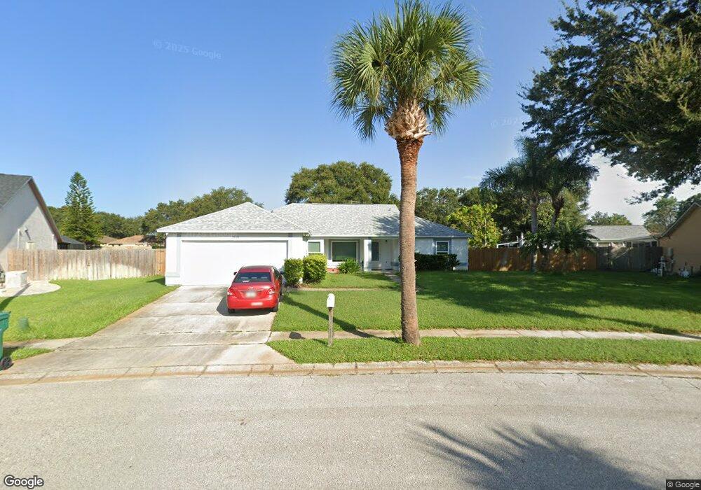
2010 Adirondack Cir Melbourne, FL 32935
Estimated Value: $346,360 - $405,000
3
Beds
2
Baths
1,628
Sq Ft
$229/Sq Ft
Est. Value
About This Home
This home is located at 2010 Adirondack Cir, Melbourne, FL 32935 and is currently estimated at $373,340, approximately $229 per square foot. 2010 Adirondack Cir is a home located in Brevard County with nearby schools including Croton Elementary School, Lyndon B. Johnson Middle School, and Eau Gallie High School.
Ownership History
Date
Name
Owned For
Owner Type
Purchase Details
Closed on
Aug 7, 2023
Sold by
Silis John
Bought by
John P Silis Revocable Trust and Silis
Current Estimated Value
Purchase Details
Closed on
Dec 4, 2019
Sold by
Silas John and Silis John
Bought by
Silis John
Purchase Details
Closed on
Nov 1, 2016
Bought by
Silas John
Purchase Details
Closed on
Feb 13, 2013
Sold by
Silis Eugene and Eugene Silis Living Trust
Bought by
Silis Eugene and Silas John P
Purchase Details
Closed on
Sep 30, 2005
Sold by
Silis Eugenie
Bought by
Silis Eugenie and Eugenie Silis Living Trust
Purchase Details
Closed on
Dec 17, 1999
Sold by
Silis Eugenie and Siles Eugenie
Bought by
Silis Eugenie
Purchase Details
Closed on
Jun 22, 1995
Sold by
Moreno Kimberly M
Bought by
Moreno Jorge E
Create a Home Valuation Report for This Property
The Home Valuation Report is an in-depth analysis detailing your home's value as well as a comparison with similar homes in the area
Home Values in the Area
Average Home Value in this Area
Purchase History
| Date | Buyer | Sale Price | Title Company |
|---|---|---|---|
| John P Silis Revocable Trust | $100 | None Listed On Document | |
| Silis John | -- | None Available | |
| Silas John | -- | -- | |
| Silis Eugene | $8,400 | Attorney | |
| Silis Eugenie | -- | -- | |
| Silis Eugenie | -- | -- | |
| Siles Eugenie | $98,000 | -- | |
| Moreno Jorge E | -- | -- |
Source: Public Records
Tax History Compared to Growth
Tax History
| Year | Tax Paid | Tax Assessment Tax Assessment Total Assessment is a certain percentage of the fair market value that is determined by local assessors to be the total taxable value of land and additions on the property. | Land | Improvement |
|---|---|---|---|---|
| 2025 | $2,230 | $186,830 | -- | -- |
| 2024 | $2,322 | $181,570 | -- | -- |
| 2023 | $2,322 | $176,290 | $0 | $0 |
| 2022 | $2,153 | $171,160 | $0 | $0 |
| 2021 | $2,162 | $166,180 | $0 | $0 |
| 2020 | $2,313 | $163,890 | $0 | $0 |
| 2019 | $2,327 | $160,210 | $0 | $0 |
| 2018 | $2,319 | $157,230 | $0 | $0 |
| 2017 | $2,320 | $154,000 | $40,000 | $114,000 |
| 2016 | $1,240 | $96,760 | $35,000 | $61,760 |
| 2015 | $1,262 | $96,090 | $28,000 | $68,090 |
| 2014 | $1,241 | $95,330 | $28,000 | $67,330 |
Source: Public Records
Map
Nearby Homes
- 1979 Blue Ridge Ave
- 2322 Appalachian Dr
- 2255 Royal Poinciana Blvd
- 2345 Royal Poinciana Blvd
- 2542 Appalachian Dr
- 505 Linda Ln
- 2210 Grand Teton Blvd
- 2249 Flower Tree Cir
- 2182 Appalachian Dr
- 2441 Wolf Creek Dr
- 0000 Unknown Rd
- 2309 Myla Ln
- 2279 Myla Ln
- 1940 Dawn Dr
- 168 Ulster Ct
- 294 Berkshire Ln
- 216 Preston Ln
- 111 Bristol Ln Unit 111
- 103 Bristol Ln Unit 103
- 203 Bristol Ln Unit 203
- 2015 Blue Ridge Ave
- 2012 Adirondack Cir
- 2019 Blue Ridge Ave
- 2011 Blue Ridge Ave
- 2023 Blue Ridge Ave
- 2004 Adirondack Cir
- 2013 Adirondack Cir
- 2009 Adirondack Cir
- 2018 Blue Ridge Ave
- 2017 Adirondack Cir
- 2020 Adirondack Cir
- 2027 Blue Ridge Ave
- 1999 Lansing St
- 1992 Lansing St
- 2000 Adirondack Cir
- 2026 Blue Ridge Ave
- 2021 Adirondack Cir
- 2005 Adirondack Cir
- 2031 Blue Ridge Ave
- 2024 Adirondack Cir