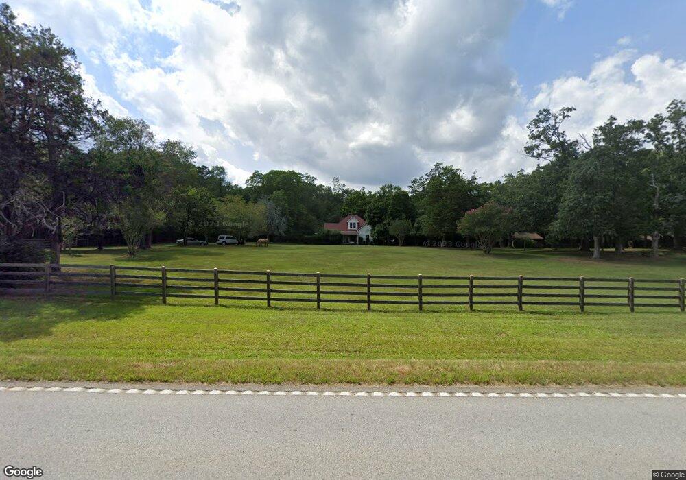
2010 Anderson Hwy Elberton, GA 30635
Estimated Value: $281,000 - $411,000
3
Beds
2
Baths
2,071
Sq Ft
$153/Sq Ft
Est. Value
About This Home
This home is located at 2010 Anderson Hwy, Elberton, GA 30635 and is currently estimated at $317,140, approximately $153 per square foot. 2010 Anderson Hwy is a home located in Elbert County with nearby schools including Elbert County Primary School, Elbert County Elementary School, and Elbert County Middle School.
Ownership History
Date
Name
Owned For
Owner Type
Purchase Details
Closed on
Apr 19, 2016
Sold by
Lester David D
Bought by
Miller Larry W
Current Estimated Value
Home Financials for this Owner
Home Financials are based on the most recent Mortgage that was taken out on this home.
Original Mortgage
$112,000
Outstanding Balance
$89,065
Interest Rate
3.71%
Estimated Equity
$228,075
Purchase Details
Closed on
Mar 8, 2002
Sold by
Adams Clyde T Executor
Bought by
Lester Shelly E and Lester David D
Create a Home Valuation Report for This Property
The Home Valuation Report is an in-depth analysis detailing your home's value as well as a comparison with similar homes in the area
Home Values in the Area
Average Home Value in this Area
Purchase History
| Date | Buyer | Sale Price | Title Company |
|---|---|---|---|
| Miller Larry W | $140,000 | -- | |
| Lester Shelly E | $40,200 | -- |
Source: Public Records
Mortgage History
| Date | Status | Borrower | Loan Amount |
|---|---|---|---|
| Open | Miller Larry W | $112,000 |
Source: Public Records
Tax History Compared to Growth
Tax History
| Year | Tax Paid | Tax Assessment Tax Assessment Total Assessment is a certain percentage of the fair market value that is determined by local assessors to be the total taxable value of land and additions on the property. | Land | Improvement |
|---|---|---|---|---|
| 2024 | $1,930 | $85,808 | $13,853 | $71,955 |
| 2023 | $1,930 | $85,808 | $13,853 | $71,955 |
| 2022 | $1,268 | $58,140 | $8,247 | $49,893 |
| 2021 | $1,270 | $58,140 | $8,247 | $49,893 |
| 2020 | $1,108 | $46,070 | $6,597 | $39,473 |
| 2019 | $1,146 | $46,070 | $6,597 | $39,473 |
| 2018 | $1,176 | $46,070 | $6,597 | $39,473 |
| 2017 | $1,055 | $39,274 | $6,597 | $32,677 |
| 2016 | $1,094 | $39,274 | $6,597 | $32,677 |
| 2015 | -- | $39,274 | $6,597 | $32,677 |
| 2014 | -- | $39,274 | $6,597 | $32,677 |
| 2013 | -- | $39,274 | $6,597 | $32,677 |
Source: Public Records
Map
Nearby Homes
- 2023 Stephens Rd
- 1136 Flagstone Rd
- 0 Allen Logan Rd Unit 22671131
- 0 Harmony Rd Unit 18771344
- 2154 Far-A-way Rd
- 0 Far-A-way Rd
- 0 Far-A-way Rd Unit 1026251
- 2166 Far A Way Rd
- 0 Paul Motes Rd Unit 10631596
- 2109 Brewers Mill Rd
- 1912 Ruckersville
- 1160 Plantation Rd
- 1 Powerhouse Dr
- 0 Henry Moon Dr Unit 10452056
- 15 Emmaus Dr
- 5 Emmaus Dr
- 2 Emmaus Dr
- 20 Emmaus Dr
- 14 Emmaus Dr
- 21 Emmaus Dr
- 2198 Harmony Rd
- 2055 Harmony Rd
- 1965 Anderson Hwy
- 2079 Harmony Rd
- 2044 Raymond Anderson Rd
- 2097 Anderson Hwy
- 2440 Harmony Rd
- 1939 Anderson Hwy
- 2100 Anderson Hwy
- 2098 Harmony Rd
- 0 Marion Rd Unit 8322307
- 2063 Raymond Anderson Rd
- 375 Broad St S
- 2138 Pauline Daniels Rd
- 2101 Anderson Hwy
- 1915 Anderson Hwy
- 0 Bennett Rd Unit 8387104
- 00000000 Rehoboth Rd
- 2087 Raymond Anderson Rd
- 2109 Harmony Rd