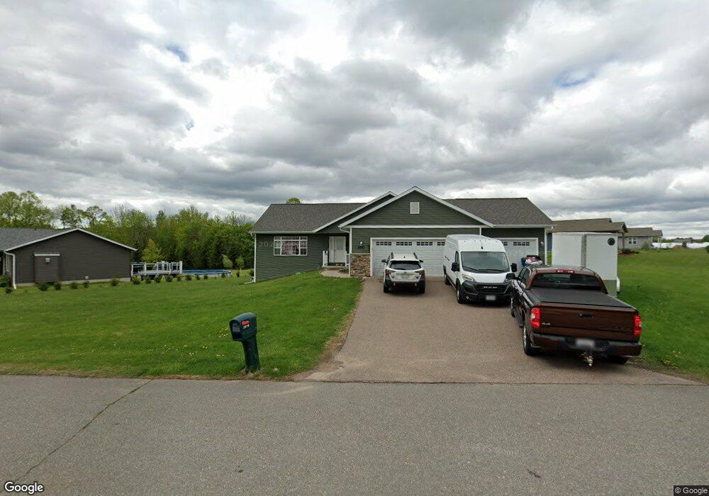
2010 Branon Cir Wausau, WI 54401
Estimated Value: $373,000 - $443,000
--
Bed
--
Bath
17,311
Sq Ft
$23/Sq Ft
Est. Value
About This Home
This home is located at 2010 Branon Cir, Wausau, WI 54401 and is currently estimated at $396,445, approximately $22 per square foot. 2010 Branon Cir is a home located in Marathon County with nearby schools including Maine Elementary School, John Muir Middle School, and West High School.
Ownership History
Date
Name
Owned For
Owner Type
Purchase Details
Closed on
Oct 31, 2018
Sold by
Hoida Dean
Bought by
Yang Ka Tou and Vang Mai Yang
Current Estimated Value
Home Financials for this Owner
Home Financials are based on the most recent Mortgage that was taken out on this home.
Original Mortgage
$191,920
Outstanding Balance
$168,061
Interest Rate
4.6%
Mortgage Type
New Conventional
Estimated Equity
$228,384
Purchase Details
Closed on
Nov 6, 2017
Sold by
Lonsdorf Dolores M
Bought by
Hoida Dean
Home Financials for this Owner
Home Financials are based on the most recent Mortgage that was taken out on this home.
Original Mortgage
$20,000
Interest Rate
3.85%
Mortgage Type
Future Advance Clause Open End Mortgage
Purchase Details
Closed on
Aug 16, 2012
Sold by
Lonsdorf Dolores M
Bought by
Lonsdorf Dolores M and Dolores M Lonsdorf Survivors Trust
Create a Home Valuation Report for This Property
The Home Valuation Report is an in-depth analysis detailing your home's value as well as a comparison with similar homes in the area
Home Values in the Area
Average Home Value in this Area
Purchase History
| Date | Buyer | Sale Price | Title Company |
|---|---|---|---|
| Yang Ka Tou | $239,900 | Midwest Title | |
| Hoida Dean | $25,900 | None Available | |
| Lonsdorf Dolores M | -- | None Available |
Source: Public Records
Mortgage History
| Date | Status | Borrower | Loan Amount |
|---|---|---|---|
| Open | Yang Ka Tou | $191,920 | |
| Previous Owner | Hoida Dean | $20,000 |
Source: Public Records
Tax History Compared to Growth
Tax History
| Year | Tax Paid | Tax Assessment Tax Assessment Total Assessment is a certain percentage of the fair market value that is determined by local assessors to be the total taxable value of land and additions on the property. | Land | Improvement |
|---|---|---|---|---|
| 2024 | $5,775 | $313,000 | $46,200 | $266,800 |
| 2023 | $6,183 | $244,300 | $39,100 | $205,200 |
| 2022 | $6,182 | $244,300 | $39,100 | $205,200 |
| 2021 | $5,982 | $244,300 | $39,100 | $205,200 |
| 2020 | $6,065 | $244,300 | $39,100 | $205,200 |
| 2019 | $6,272 | $235,600 | $30,600 | $205,000 |
| 2018 | $1,318 | $52,500 | $30,600 | $21,900 |
| 2017 | $667 | $26,000 | $26,000 | $0 |
| 2016 | $649 | $26,000 | $26,000 | $0 |
| 2015 | $665 | $26,000 | $26,000 | $0 |
| 2014 | $769 | $31,600 | $31,600 | $0 |
Source: Public Records
Map
Nearby Homes
- 2315 Boot Ln
- 1508 Merrill Ave Unit 213
- 1508 Merrill Ave Unit 311
- 1505 Graham St
- 1800 Desert Dr
- 1305 Eden Dr
- 2305 Beecher Ave
- 1509 N 1st Ave
- 1533 Cherry St
- 802 N 9th Ave
- 1537 Lenard St
- 706 N 9th Ave
- 108 W Strowbridge St
- 614 N 10th Ave
- 810 N 6th Ave
- 501 N 12th Ave
- 1111 Pine St
- 515 N 8th Ave
- 817 N 2nd Ave
- 328 N 11th Ave
- 2010 Brandon Cir
- 2006 Brandon Cir
- Lot #3 Boot Ln
- Lot #2 Boot Ln
- Lot #1 Boot Ln
- Lot # 3 Boot Ln
- Lot#2 Boot Ln
- lot # 1 Boot Ln
- 2305 Boot Ln
- 2002 Brandon Cir
- 2300 Boot Ln
- 2309 Boot Ln
- 2007 Brandon Cir
- 2315 Boot Ln Unit Lot 5
- 1910 Brandon Cir
- 2313 Boot Ln
- 2003 Brandon Cir
- 2308 Boot Ln
- 1911 Brandon Cir
- 1906 Brandon Cir