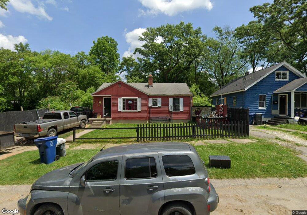
2010 Burns St Flint, MI 48506
Eastside NeighborhoodEstimated Value: $25,000 - $46,000
3
Beds
1
Bath
910
Sq Ft
$42/Sq Ft
Est. Value
About This Home
This home is located at 2010 Burns St, Flint, MI 48506 and is currently estimated at $37,909, approximately $41 per square foot. 2010 Burns St is a home located in Genesee County with nearby schools including Potter School, Flint Cultural Center Academy, and WAY Academy of Flint.
Ownership History
Date
Name
Owned For
Owner Type
Purchase Details
Closed on
Mar 16, 2022
Sold by
Genesee County Land Bank Authority
Bought by
Morse Johnny Dean and Jones Jennifer Ann
Current Estimated Value
Purchase Details
Closed on
Apr 3, 2019
Sold by
The Genesee County Land Bank Authority
Bought by
Morse Johnny Dean and Jones Jennifer Ann
Purchase Details
Closed on
Jan 3, 2018
Sold by
Mission Of Hope
Bought by
Mattews Alran
Purchase Details
Closed on
May 29, 2014
Sold by
Road To Damascus Inc
Bought by
Mission Of Hope Universal Life Church
Purchase Details
Closed on
Aug 9, 2004
Sold by
The William J Parker Trust
Bought by
Nelson Marilyn
Purchase Details
Closed on
Jun 16, 2000
Sold by
Nelson Marilyn
Bought by
Nelson Robert and Nelson Marilyn
Create a Home Valuation Report for This Property
The Home Valuation Report is an in-depth analysis detailing your home's value as well as a comparison with similar homes in the area
Home Values in the Area
Average Home Value in this Area
Purchase History
| Date | Buyer | Sale Price | Title Company |
|---|---|---|---|
| Morse Johnny Dean | $5,000 | None Listed On Document | |
| Morse Johnny Dean | $5,000 | None Available | |
| Mattews Alran | $500 | Cislo Title Co | |
| Mission Of Hope Universal Life Church | -- | None Available | |
| Nelson Marilyn | $34,000 | -- | |
| Nelson Robert | -- | Centennial Title & Abstract |
Source: Public Records
Mortgage History
| Date | Status | Borrower | Loan Amount |
|---|---|---|---|
| Closed | Morse Johnny Dean | $0 |
Source: Public Records
Tax History
| Year | Tax Paid | Tax Assessment Tax Assessment Total Assessment is a certain percentage of the fair market value that is determined by local assessors to be the total taxable value of land and additions on the property. | Land | Improvement |
|---|---|---|---|---|
| 2025 | $769 | $14,700 | $0 | $0 |
| 2024 | $704 | $13,700 | $0 | $0 |
| 2023 | $696 | $12,000 | $0 | $0 |
| 2022 | $0 | $9,700 | $0 | $0 |
| 2021 | $719 | $9,200 | $0 | $0 |
| 2020 | $656 | $8,200 | $0 | $0 |
| 2019 | $656 | $0 | $0 | $0 |
| 2018 | $649 | $6,600 | $0 | $0 |
| 2017 | $957 | $0 | $0 | $0 |
| 2016 | $656 | $0 | $0 | $0 |
| 2015 | -- | $0 | $0 | $0 |
| 2014 | -- | $0 | $0 | $0 |
| 2012 | -- | $8,600 | $0 | $0 |
Source: Public Records
Map
Nearby Homes
- 2426 Broadway Blvd
- 1622 Arlington Ave
- 1510 N Vernon Ave
- 2321 Levern St
- 2601 Illinois Ave
- 2211 Torrance St
- 1805 Bennett Ave
- 2415 Pennsylvania Ave
- 2506 Arlington Ave
- 2426 Hoff St
- 2301 Missouri Ave
- 1318 Cronk Ave
- 2610 Pennsylvania Ave
- 1734 Missouri Ave
- 1721 New York Ave
- 2217 Maryland Ave
- 1609 Ohio Ave
- 1216 Minnesota Ave
- 2605 Nebraska Ave
- 1529 Broadway Blvd
- 2004 Burns St
- 2022 Burns St
- 2009 N Lynch St
- 1926 Burns St
- 2013 N Lynch St
- 2310 Broadway Blvd
- 2024 Burns St
- 2021 N Lynch St
- 1922 Burns St
- 1929 N Lynch St
- 2009 Burns St
- 2013 Burns St
- 2017 Burns St
- 2005 Burns St
- 1918 Burns St
- 1923 Burns St
- 1914 Burns St
- 2210 Broadway Blvd
- 1915 N Lynch St
- 1932 N Lynch St
Your Personal Tour Guide
Ask me questions while you tour the home.