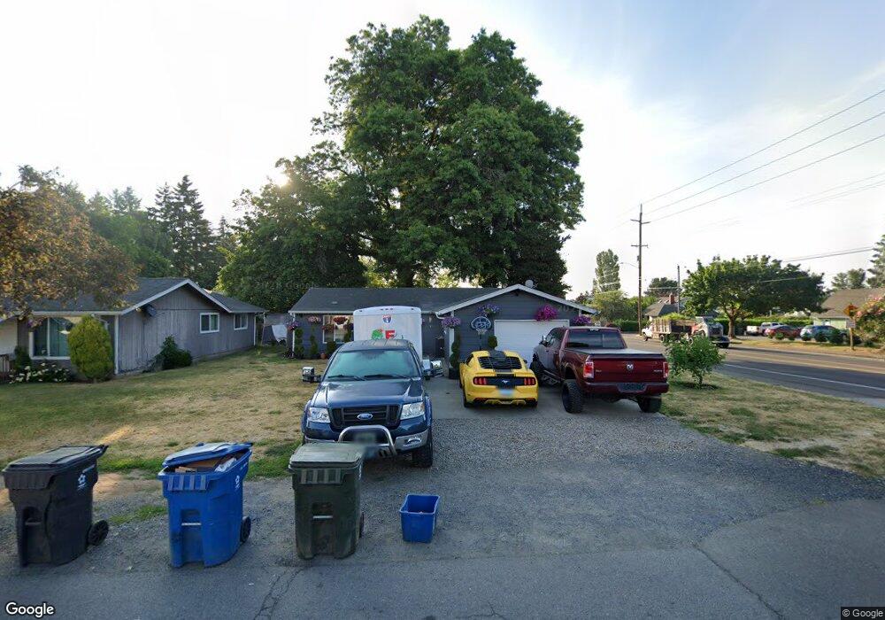
2010 Byram St NE Salem, OR 97301
Lansing NeighborhoodEstimated Value: $257,000 - $366,000
2
Beds
1
Bath
1,008
Sq Ft
$325/Sq Ft
Est. Value
About This Home
This home is located at 2010 Byram St NE, Salem, OR 97301 and is currently estimated at $327,404, approximately $324 per square foot. 2010 Byram St NE is a home located in Marion County with nearby schools including Washington Elementary School, Waldo Middle School, and North Salem High School.
Ownership History
Date
Name
Owned For
Owner Type
Purchase Details
Closed on
Mar 3, 2025
Sold by
Perez Eloy A and Perez Olivia
Bought by
Ramos Leslie O Perez
Current Estimated Value
Purchase Details
Closed on
Nov 17, 2015
Sold by
Wells Fargo Bank Na
Bought by
Perez Eloy A and Perez Olivia
Purchase Details
Closed on
Jul 14, 2015
Sold by
Scales Shaun
Bought by
Wells Fargo Bank Na
Purchase Details
Closed on
Sep 11, 2008
Sold by
Fischer Ronald E and Fischer Debbie Ann
Bought by
Scales Shaun
Home Financials for this Owner
Home Financials are based on the most recent Mortgage that was taken out on this home.
Original Mortgage
$154,095
Interest Rate
6.5%
Mortgage Type
FHA
Create a Home Valuation Report for This Property
The Home Valuation Report is an in-depth analysis detailing your home's value as well as a comparison with similar homes in the area
Home Values in the Area
Average Home Value in this Area
Purchase History
| Date | Buyer | Sale Price | Title Company |
|---|---|---|---|
| Ramos Leslie O Perez | $270,000 | None Listed On Document | |
| Perez Eloy A | $87,500 | Nextitle | |
| Wells Fargo Bank Na | $106,820 | None Available | |
| Scales Shaun | $156,900 | Ticor Title |
Source: Public Records
Mortgage History
| Date | Status | Borrower | Loan Amount |
|---|---|---|---|
| Previous Owner | Scales Shaun | $154,095 |
Source: Public Records
Tax History Compared to Growth
Tax History
| Year | Tax Paid | Tax Assessment Tax Assessment Total Assessment is a certain percentage of the fair market value that is determined by local assessors to be the total taxable value of land and additions on the property. | Land | Improvement |
|---|---|---|---|---|
| 2024 | $2,755 | $140,320 | -- | -- |
| 2023 | $2,674 | $136,240 | $0 | $0 |
| 2022 | $2,521 | $132,280 | $0 | $0 |
| 2021 | $2,449 | $128,430 | $0 | $0 |
| 2020 | $2,451 | $124,690 | $0 | $0 |
| 2019 | $2,294 | $121,060 | $0 | $0 |
| 2018 | $2,335 | $0 | $0 | $0 |
| 2017 | $2,107 | $0 | $0 | $0 |
| 2016 | $2,007 | $0 | $0 | $0 |
| 2015 | $2,023 | $0 | $0 | $0 |
| 2014 | $1,957 | $0 | $0 | $0 |
Source: Public Records
Map
Nearby Homes
- 3346 Sunnyview Rd NE
- 2189 34th Ave NE
- 2274 32nd Ave NE
- 2325 Hawthorne Ave NE
- 2280 Evergreen Ave NE
- 2914 Florence Ave NE
- 3257 Ladd Ave NE
- 2806 Livingston (-2808) St NE
- 2990 Chester Ave NE
- 3016 Starr Ct NE
- 1567 Park Ave NE
- 1925 24th St NE
- 2980 Ellis Ave NE
- 1350 30th Ave NE
- 3103 Tess Ave NE
- 1530 25th St NE
- 2895 Fisher Rd NE
- 3152 Tess Ave NE
- 3552 Anchor Ct NE
- 4149 Market St NE
- 2020 Byram St NE
- 2030 Byram St NE
- 2005 Byram St NE
- 2015 Debbie Way NE
- 2040 Byram St NE
- 2025 Byram St NE
- 2025 Debbie Way NE
- 3292 Sunnyview Rd NE
- 3342 Sunnyview Rd NE
- 2055 Byram St NE
- 3253 Sunnyview Rd NE
- 3320 Brenna Ave NE
- 2055 Debbie Way NE
- 3262 Sunnyview Rd NE
- 2035 Debbie Way NE
- 3294 Sunnyview Rd NE Unit 3332
- 2050 Debbie Way NE Unit 2060
- 3350 Brenna Ave NE
- 2045 Debbie Way NE Unit 2055
- 3290 Brenna Ave NE